Map of North Kansas City city

Map of North Kansas City

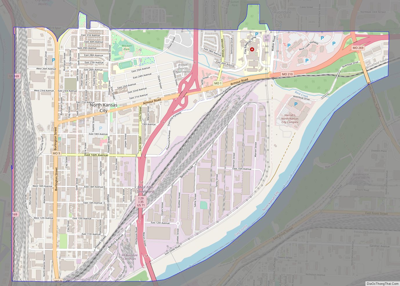
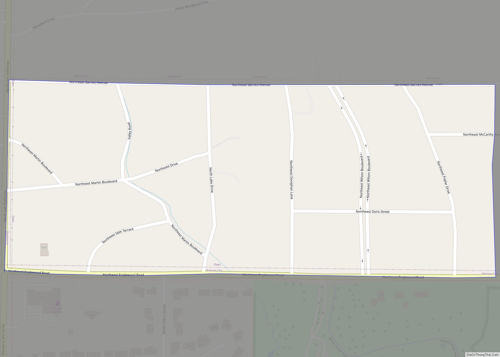
North Kansas City is a city in Clay County, Missouri, United States. It is also enclaved in Kansas City. Even though the name is similar to its larger counterpart, Kansas City, it is an independent municipality part of the Kansas City metropolitan area. The population was 4,467 at the 2020 census. Originally a northern suburb … Read more

Map of Normandy city

Map of Normandy city, Missouri

Normandy is a city in St. Louis County, Missouri, United States. The population was 4,287 at the 2020 census. Normandy city overview: Name: Normandy city LSAD Code: 25 LSAD Description: city (suffix) State: Missouri County: St. Louis County Elevation: 659 ft (201 m) Total Area: 1.85 sq mi (4.80 km²) Land Area: 1.85 sq mi (4.80 km²) Water Area: 0.00 sq mi (0.00 km²) Total Population: … Read more

Map of Norwood Court town

Map of Norwood Court town

Norwood Court is a village in St. Louis County, Missouri, United States. The population was 959 at the 2010 census. Norwood Court town overview: Name: Norwood Court town LSAD Code: 43 LSAD Description: town (suffix) State: Missouri County: St. Louis County Elevation: 600 ft (200 m) Total Area: 0.12 sq mi (0.32 km²) Land Area: 0.12 sq mi (0.32 km²) Water Area: 0.00 sq mi … Read more

Map of Northwoods city

Map of Northwoods city

Northwoods is a city in St. Louis County, Missouri, United States. The population was 4,227 at the 2010 census. Northwoods city overview: Name: Northwoods city LSAD Code: 25 LSAD Description: city (suffix) State: Missouri County: St. Louis County Elevation: 607 ft (185 m) Total Area: 0.70 sq mi (1.81 km²) Land Area: 0.70 sq mi (1.81 km²) Water Area: 0.00 sq mi (0.00 km²) Total Population: … Read more

Map of Northmoor city

Map of Northmoor city

Northmoor is a city in Platte County, Missouri and is part of the Kansas City metropolitan area within the United States. The population was 325 at the 2010 census. Northmoor city overview: Name: Northmoor city LSAD Code: 25 LSAD Description: city (suffix) State: Missouri County: Platte County Elevation: 784 ft (239 m) Total Area: 0.24 sq mi (0.61 km²) Land … Read more

Map of Novinger city

Map of Novinger city

Novinger is a town in Nineveh Township, Adair County, Missouri, United States. The population was 456 at the 2010 census. Novinger city overview: Name: Novinger city LSAD Code: 25 LSAD Description: city (suffix) State: Missouri County: Adair County Elevation: 837 ft (255 m) Total Area: 0.80 sq mi (2.08 km²) Land Area: 0.79 sq mi (2.04 km²) Water Area: 0.01 sq mi (0.04 km²) Total Population: … Read more

Map of Novelty village

Map of Novelty village

Novelty is a village in Knox County, Missouri, United States. As of the 2020 census, its population was 102. Novelty village overview: Name: Novelty village LSAD Code: 47 LSAD Description: village (suffix) State: Missouri County: Knox County Elevation: 837 ft (255 m) Total Area: 0.28 sq mi (0.73 km²) Land Area: 0.28 sq mi (0.73 km²) Water Area: 0.00 sq mi (0.00 km²) Total Population: 102 … Read more

Map of Norwood city, Missouri

Map of Norwood city, Missouri

Norwood is a city in Wright County, Missouri, United States. The population was 665 at the 2010 census. Norwood city overview: Name: Norwood city LSAD Code: 25 LSAD Description: city (suffix) State: Missouri County: Wright County Elevation: 1,489 ft (454 m) Total Area: 1.60 sq mi (4.15 km²) Land Area: 1.60 sq mi (4.15 km²) Water Area: 0.00 sq mi (0.00 km²) Total Population: 578 Population … Read more

Map of Oak Grove city, Missouri

Map of Oak Grove city, Missouri

Oak Grove is a city in Jackson and Lafayette counties in the U.S. state of Missouri. The population was 8,157 at the 2020 census. It is part of the Kansas City metropolitan area. Oak Grove city overview: Name: Oak Grove city LSAD Code: 25 LSAD Description: city (suffix) State: Missouri County: Jackson County, Lafayette County … Read more

Map of Oak Grove Village village

Map of Oak Grove Village village

Oak Grove Village is a village in Franklin County, Missouri, United States. The population was 509 at the 2010 census. Oak Grove Village village overview: Name: Oak Grove Village village LSAD Code: 47 LSAD Description: village (suffix) State: Missouri County: Franklin County Elevation: 938 ft (286 m) Total Area: 0.61 sq mi (1.59 km²) Land Area: 0.61 sq mi (1.59 km²) Water Area: … Read more

Map of O'Fallon city, Missouri

Map of O’Fallon city, Missouri

O’Fallon (/oʊˈfælən/ oh-FAL-ən) is a city in St. Charles County, Missouri, United States. It is part of the St. Louis metropolitan statistical area, located along Interstates 64 and 70 between Lake St. Louis and St. Peters. As of the 2020 census, O’Fallon had a population of 91,316, making it the largest suburb of St. Louis, … Read more

Map of Oakland city, Missouri

Map of Oakland city, Missouri

Oakland is a city in St. Louis County, Missouri, United States. The population was 1,381 at the 2010 census. Oakland city overview: Name: Oakland city LSAD Code: 25 LSAD Description: city (suffix) State: Missouri County: St. Louis County Elevation: 610 ft (190 m) Total Area: 0.60 sq mi (1.56 km²) Land Area: 0.60 sq mi (1.56 km²) Water Area: 0.00 sq mi (0.00 km²) Total Population: … Read more