Map of South Gorin town

Map of South Gorin town

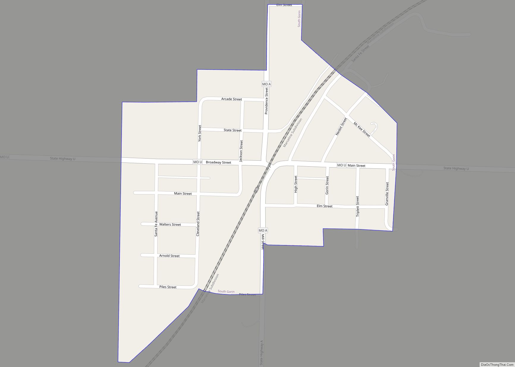
South Gorin is a city located in Scotland County, Missouri, United States. As of the 2020 census, its population was 62. The original name of the city was simply “Gorin”, and it was changed. The official name for the post office in South Gorin is still Gorin. South Gorin town overview: Name: South Gorin town … Read more

Map of South Gifford village

Map of South Gifford village

South Gifford is a village in Macon County, Missouri, United States. The population was 22 at the 2020 census. South Gifford village overview: Name: South Gifford village LSAD Code: 47 LSAD Description: village (suffix) State: Missouri County: Macon County Total Area: 0.21 sq mi (0.53 km²) Land Area: 0.20 sq mi (0.53 km²) Water Area: 0.00 sq mi (0.00 km²) Total Population: 22 Population … Read more

Map of Spanish Lake CDP

Map of Spanish Lake CDP

Spanish Lake is a census-designated place (CDP) in St. Louis County, Missouri, United States. The population was 18,413 at the 2020 census. Spanish Lake CDP overview: Name: Spanish Lake CDP LSAD Code: 57 LSAD Description: CDP (suffix) State: Missouri County: St. Louis County Elevation: 512 ft (156 m) Total Area: 7.49 sq mi (19.39 km²) Land Area: 7.37 sq mi (19.09 km²) Water … Read more

Map of Southwest City town

Map of Southwest City town

Southwest City town overview: Name: Southwest City town LSAD Code: 43 LSAD Description: town (suffix) State: Missouri County: McDonald County FIPS code: 2969230 Online Interactive Map Southwest City online map. Source: Basemap layers from Google Map, Open Street Map (OSM), Arcgisonline, Wmflabs. Boundary Data from Database of Global Administrative Areas. Southwest City location map. Where … Read more

Map of South Lineville town

Map of South Lineville town

South Lineville is a village in Mercer County, Missouri, United States. The population was 13 at the 2020 census, a decline of fifteen people from the 2010 census. The name Lineville refers to the fact the town site lies near the Missouri—Iowa state line. The village is located directly south of its twin city of … Read more

Map of Spokane CDP, Missouri

Map of Spokane CDP, Missouri

Spokane (/spoʊˈkeɪn/ spoh-KAYN) is a census-designated place in Christian County, Missouri, United States. The population was 177 at the 2010 census. It is part of the Springfield, Missouri, Metropolitan Statistical Area. Spokane CDP overview: Name: Spokane CDP LSAD Code: 57 LSAD Description: CDP (suffix) State: Missouri County: Christian County Elevation: 1,335 ft (407 m) Total Area: 3.31 sq mi … Read more

Map of Spickard city

Map of Spickard city

Spickard is a city in Grundy County, Missouri, United States. The population was 222 at the 2020 census. Spickard city overview: Name: Spickard city LSAD Code: 25 LSAD Description: city (suffix) State: Missouri County: Grundy County Elevation: 853 ft (260 m) Total Area: 0.63 sq mi (1.64 km²) Land Area: 0.63 sq mi (1.64 km²) Water Area: 0.00 sq mi (0.00 km²) Total Population: 222 Population … Read more

Map of Sparta city, Missouri

Map of Sparta city, Missouri

Sparta is a city in north central Christian County, Missouri, United States. The population was 1,756 at the 2010 census. Sparta is part of the Springfield, Missouri Metropolitan Statistical Area. Sparta city overview: Name: Sparta city LSAD Code: 25 LSAD Description: city (suffix) State: Missouri County: Christian County Elevation: 1,401 ft (427 m) Total Area: 1.24 sq mi (3.21 km²) … Read more

Map of St. Clair city, Missouri

Map of St. Clair city, Missouri

Saint Clair is a city in Franklin County, Missouri, United States. The population was 4,491 at the 2020 census. St. Clair city overview: Name: St. Clair city LSAD Code: 25 LSAD Description: city (suffix) State: Missouri County: Franklin County Elevation: 699 ft (213 m) Total Area: 4.79 sq mi (12.41 km²) Land Area: 4.78 sq mi (12.37 km²) Water Area: 0.01 sq mi (0.03 km²) Total … Read more

Map of St. Charles city, Missouri

Map of St. Charles city, Missouri

Saint Charles (commonly abbreviated St. Charles) is a city in, and the county seat of, St. Charles County, Missouri, United States. The population was 70,493 at the 2020 census, making St. Charles the ninth-largest city in Missouri. Situated on the Missouri River, St. Charles is a northwestern suburb of St. Louis. The city was founded … Read more

Map of St. Ann city

Map of St. Ann city

St. Ann or Saint Ann is a city in northwest St. Louis County, Missouri, United States. The population was 13,019 at the 2020 census. St. Ann city overview: Name: St. Ann city LSAD Code: 25 LSAD Description: city (suffix) State: Missouri County: St. Louis County Elevation: 594 ft (181 m) Total Area: 3.15 sq mi (8.17 km²) Land Area: 3.15 sq mi … Read more

Map of St. Elizabeth village

Map of St. Elizabeth village

St. Elizabeth village overview: Name: St. Elizabeth village LSAD Code: 47 LSAD Description: village (suffix) State: Missouri County: Miller County FIPS code: 2964190 Online Interactive Map St. Elizabeth online map. Source: Basemap layers from Google Map, Open Street Map (OSM), Arcgisonline, Wmflabs. Boundary Data from Database of Global Administrative Areas. St. Elizabeth location map. Where … Read more