Saint Charles (commonly abbreviated St. Charles) is a city in, and the county seat of, St. Charles County, Missouri, United States. The population was 70,493 at the 2020 census, making St. Charles the ninth-largest city in Missouri. Situated on the Missouri River, St. Charles is a northwestern suburb of St. Louis.
The city was founded circa 1769 as Les Petites Côtes, or “The Little Hills” in French, by Louis Blanchette, a French-Canadian fur trader. This former French area west of the Mississippi River was nominally ruled by Spain following France’s defeat in the Seven Years’ War. France had ceded its eastern territories to Great Britain. St. Charles is the third-oldest city in Missouri. For a time, it played a significant role as a river port in the United States’ westward expansion, including trade with Native American tribes on the upper Missouri River. It was the starting point of the Boone’s Lick Road to the Boonslick.
St. Charles was settled primarily by French-speaking colonists from Canada in its early days. In 1804 the Lewis and Clark Expedition considered this settlement the last “civilized” stop before they headed upriver to explore the western territory that the United States acquired from France in the Louisiana Purchase.
The city served as the first Missouri capital from 1821 to 1826. It is the site of the Saint Rose Philippine Duchesne shrine.
| Name: | St. Charles city |
|---|---|
| LSAD Code: | 25 |
| LSAD Description: | city (suffix) |
| State: | Missouri |
| County: | St. Charles County |
| Total Area: | 25.67 sq mi (66.48 km²) |
| Land Area: | 25.17 sq mi (65.19 km²) |
| Water Area: | 0.50 sq mi (1.29 km²) |
| Total Population: | 70,493 |
| Population Density: | 2,800.79/sq mi (1,081.40/km²) |
| FIPS code: | 2964082 |
| Website: | www.stcharlescitymo.gov |
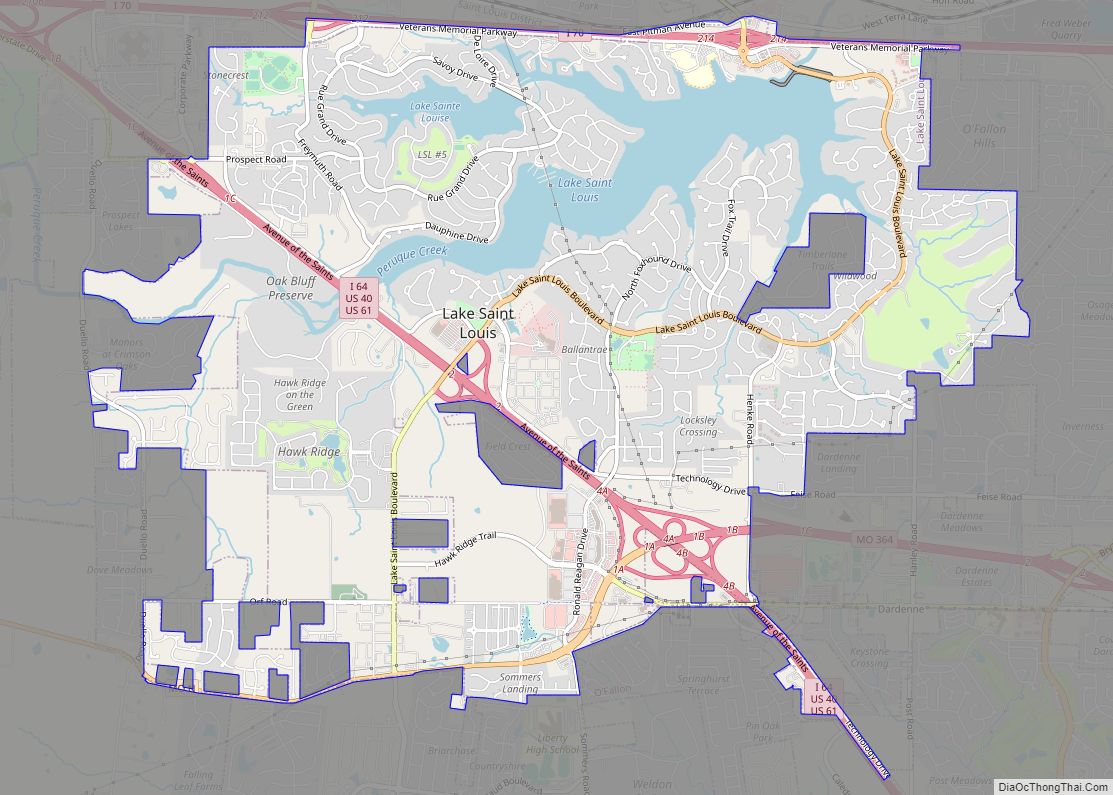
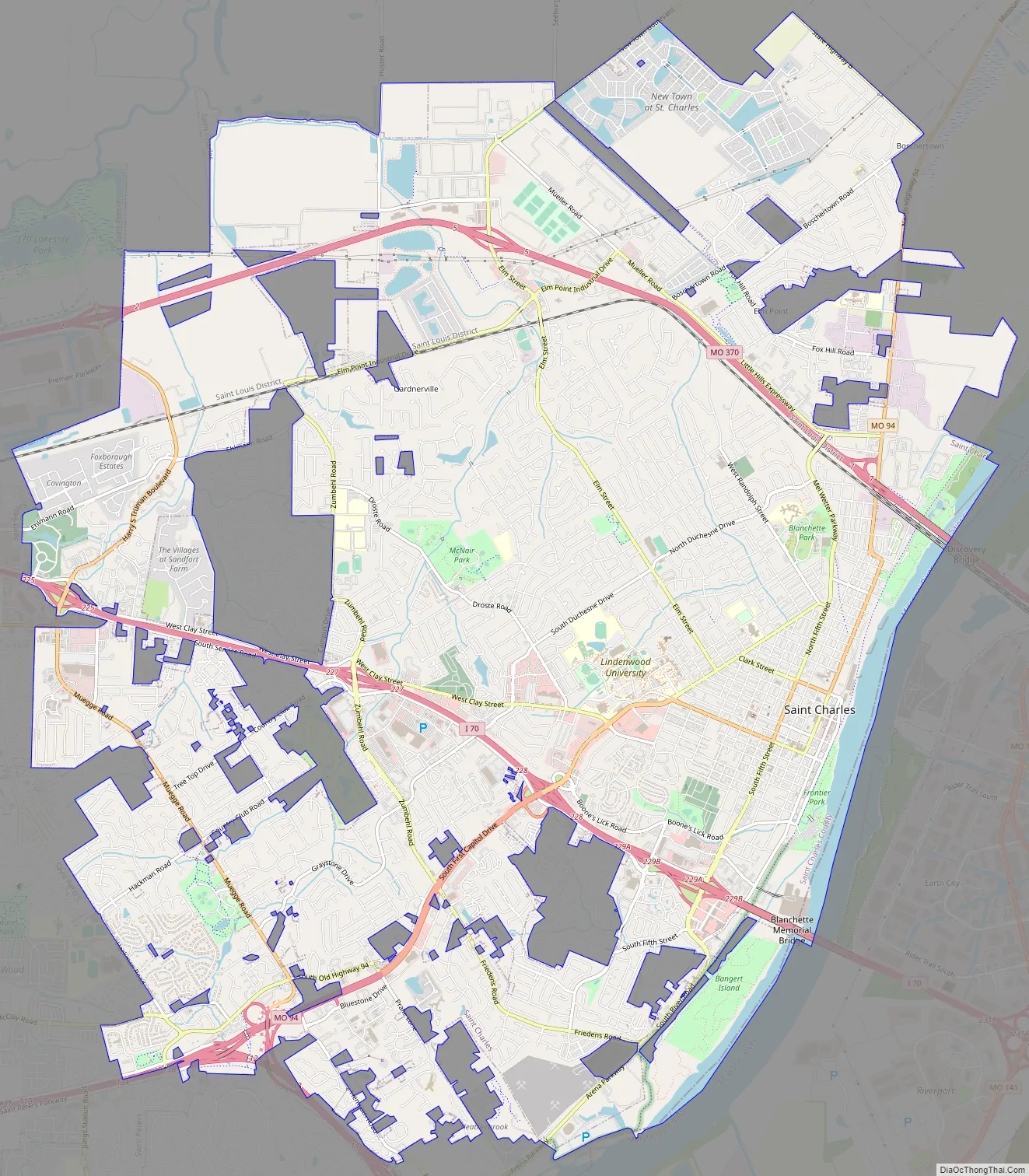
Online Interactive Map
Click on ![]() to view map in "full screen" mode.
to view map in "full screen" mode.
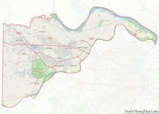
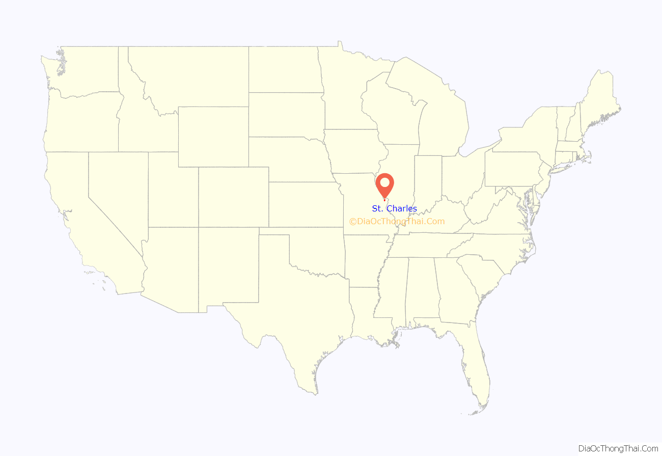
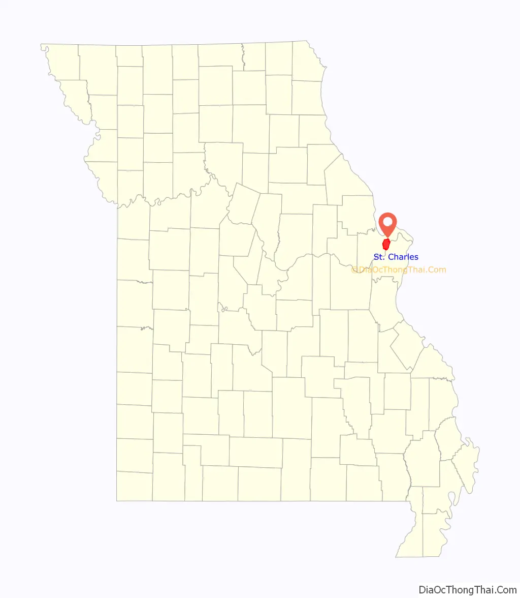
St. Charles location map. Where is St. Charles city?
History
Native American peoples inhabited the area at least as early as 11,000 B.C. When European colonists arrived, the area was inhabited by the historic Ilini, Osage and Missouri tribes.
According to Hopewell’s Legends of the Missouri and Mississippi, Blanchette met another French Canadian (Bernard Guillet) at this site in 1765. Blanchette, determined to settle there, asked if Guillet, who had become an honorary chief of a Dakota band, had chosen a name for it.
Blanchette settled there circa 1769 under the authority of the Spanish governor of Upper Louisiana (the area had been ceded by France to Spain under an agreement with Great Britain following French defeat in the French and Indian Wars). He was appointed as the territory’s civil and military leader, serving until his death in 1793. Although the settlement was under Spanish jurisdiction, the settlers were primarily Native American and French Canadians who had migrated from northern territories. Most settlers spoke French.
Considered to begin in St. Charles, the Boone’s Lick Road along the Missouri River was the major overland route for European-American settlement of central and western Missouri. This area became known as the Boonslick or “Boonslick Country.” At Franklin, the trail ended. Westward progress continued on the Santa Fe Trail.
San Carlos Borromeo
The first church, built in 1791, was Catholic and dedicated to the Italian saint Charles Borromeo, under the Spanish version of his name, San Carlos Borromeo. The town became known as San Carlos del Misuri (“St. Charles of the Missouri”). The original location of the church is not known but a replica has been built just off Main Street. The fourth St. Charles Borromeo Church now stands on Fifth Street.
The Spanish Lieutenant-Governor Carlos de Hault de Lassus appointed Daniel Boone as commandant of the Femme Osage District. He served in this role until the United States government acquired control in 1804 following the Louisiana Purchase from France.
The name of the town, San Carlos, was anglicized to St. Charles. William Clark arrived in St. Charles on May 16, 1804. With him were 40 men and three boats; they made final preparations for their major cross-country expedition, as they waited for Meriwether Lewis to arrive from St. Louis. They attended dances, dinners, and a church service during this time. Excited to be part of the national expedition, the townspeople were very hospitable to the explorers. Lewis arrived via St. Charles Rock Road on May 20. The expedition launched the next day in a keel boat at 3:30 pm. St. Charles was the last established European-American town that the expedition visited for more than two and a half years.
State capital and growth
When Missouri was granted statehood in 1821, the legislature decided to build a “City of Jefferson” to serve as the state capital, in the center of the state, overlooking the Missouri River. Since this land was undeveloped at the time, a temporary capital was needed. St. Charles was chosen over eight other cities in a competition to house the temporary capital. It offered free meeting space for the legislature in rooms located above a hardware store. This building is preserved as the First Missouri State Capitol State Historic Site and may be toured. The Missouri government continued to meet there until buildings were completed in Jefferson City in 1826.
Gottfried Duden was a German who visited in the area in 1824. Travelling under the guidance of Daniel M. Boone, he wrote extensive accounts of life in St. Charles County during his year there. He published these after returning to Germany in 1829, and his favorable impressions of the area led to the immigration of a number of Germans in 1833. The first permanent German settler in the region was probably Louis Eversman, who had arrived with Duden but decided to stay.
In the post-World War II era, the federal government undertook a major program of interstate highway construction. St. Charles is where the first claimed interstate project was started in 1956. A state highway marker is displayed with a logo and information regarding this claim, off Interstate 70 going westbound, to the right of the First Capitol Drive exit. Kansas and Pennsylvania also claim to have had the first interstate project.
St. Charles Road Map
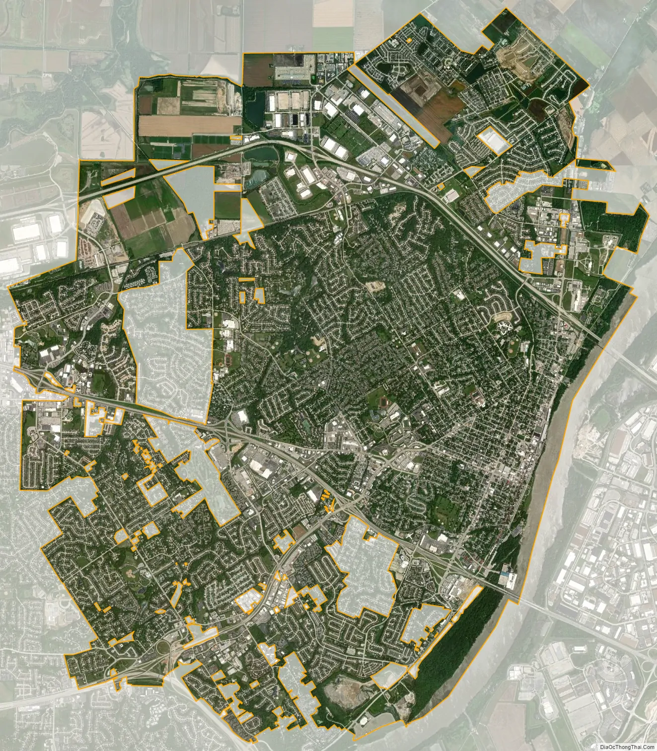
St. Charles city Satellite Map
Geography
St. Charles is located about 20 miles northwest of St. Louis. According to the United States Census Bureau, the city has a total area of 24.03 square miles (62.24 km), of which 23.65 square miles (61.25 km) is land and 0.38 square miles (0.98 km) is water.
Climate
St. Charles has a Köppen humid subtropical climate, with warm and humid summers (eventual hot days) and cool winters (with short cold spells possible sometimes). Precipitation is mostly light to moderate, with occasional stormy weather. Spring is the wettest season on average.
See also
Map of Missouri State and its subdivision:- Adair
- Andrew
- Atchison
- Audrain
- Barry
- Barton
- Bates
- Benton
- Bollinger
- Boone
- Buchanan
- Butler
- Caldwell
- Callaway
- Camden
- Cape Girardeau
- Carroll
- Carter
- Cass
- Cedar
- Chariton
- Christian
- Clark
- Clay
- Clinton
- Cole
- Cooper
- Crawford
- Dade
- Dallas
- Daviess
- De Kalb
- Dent
- Douglas
- Dunklin
- Franklin
- Gasconade
- Gentry
- Greene
- Grundy
- Harrison
- Henry
- Hickory
- Holt
- Howard
- Howell
- Iron
- Jackson
- Jasper
- Jefferson
- Johnson
- Knox
- Laclede
- Lafayette
- Lawrence
- Lewis
- Lincoln
- Linn
- Livingston
- Macon
- Madison
- Maries
- Marion
- McDonald
- Mercer
- Miller
- Mississippi
- Moniteau
- Monroe
- Montgomery
- Morgan
- New Madrid
- Newton
- Nodaway
- Oregon
- Osage
- Ozark
- Pemiscot
- Perry
- Pettis
- Phelps
- Pike
- Platte
- Polk
- Pulaski
- Putnam
- Ralls
- Randolph
- Ray
- Reynolds
- Ripley
- Saint Charles
- Saint Clair
- Saint Francois
- Saint Louis
- Sainte Genevieve
- Saline
- Schuyler
- Scotland
- Scott
- Shannon
- Shelby
- Stoddard
- Stone
- Sullivan
- Taney
- Texas
- Vernon
- Warren
- Washington
- Wayne
- Webster
- Worth
- Wright
- Alabama
- Alaska
- Arizona
- Arkansas
- California
- Colorado
- Connecticut
- Delaware
- District of Columbia
- Florida
- Georgia
- Hawaii
- Idaho
- Illinois
- Indiana
- Iowa
- Kansas
- Kentucky
- Louisiana
- Maine
- Maryland
- Massachusetts
- Michigan
- Minnesota
- Mississippi
- Missouri
- Montana
- Nebraska
- Nevada
- New Hampshire
- New Jersey
- New Mexico
- New York
- North Carolina
- North Dakota
- Ohio
- Oklahoma
- Oregon
- Pennsylvania
- Rhode Island
- South Carolina
- South Dakota
- Tennessee
- Texas
- Utah
- Vermont
- Virginia
- Washington
- West Virginia
- Wisconsin
- Wyoming