Loudon is a census-designated place (CDP) and the main village in the town of Loudon in Merrimack County, New Hampshire, United States. The population of the CDP was 711 at the 2020 census, out of 5,576 in the entire town. Loudon CDP overview: Name: Loudon CDP LSAD Code: 57 LSAD Description: CDP (suffix) State: New ... Read more
New Hampshire Cities and Places
New London is a census-designated place (CDP) and the primary village in the town of New London in Merrimack County, New Hampshire, United States. The population of the CDP was 1,266 at the 2020 census, out of 4,400 in the entire town. The CDP includes the campus of Colby–Sawyer College. New London CDP overview: Name: ... Read more
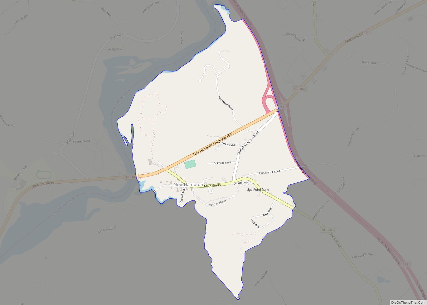
New Hampton is a census-designated place (CDP) and the main village in the town of New Hampton in Belknap County, New Hampshire, United States. The population was 373 at the 2020 census, out of 2,377 people in the entire town of New Hampton. New Hampton CDP overview: Name: New Hampton CDP LSAD Code: 57 LSAD ... Read more
Mountain Lakes is a census-designated place (CDP) in the towns of Haverhill and Bath in Grafton County, New Hampshire, United States. It had a population of 504 at the 2020 census. The Haverhill portion of the community is an independent incorporated district, with its own water system, planning board, and recreation program, and is guided ... Read more
Milton is a census-designated place (CDP) and the primary village in the town of Milton, Strafford County, New Hampshire, United States. The population of the CDP was 593 at the 2020 census, out of 4,482 in the entire town. Milton CDP overview: Name: Milton CDP LSAD Code: 57 LSAD Description: CDP (suffix) State: New Hampshire ... Read more
Milton Mills is a small village and census-designated place in the town of Milton, Strafford County, New Hampshire, United States. It had a population of 313 at the 2020 census. Milton Mills has a separate ZIP code (03852) from the rest of the town of Milton. Milton Mills CDP overview: Name: Milton Mills CDP LSAD ... Read more
Pittsfield is a census-designated place (CDP) and the main village in the town of Pittsfield in Merrimack County, New Hampshire, United States. The population of the CDP was 1,570 at the 2020 census, out of 4,075 in the entire town. Pittsfield CDP overview: Name: Pittsfield CDP LSAD Code: 57 LSAD Description: CDP (suffix) State: New ... Read more
Pinardville is a census-designated place (CDP) in the town of Goffstown, Hillsborough County, New Hampshire, United States. It is a suburban neighborhood adjacent to the city of Manchester. The population was 5,034 at the 2020 census. Pinardville has existed since 1906. Pinardville CDP overview: Name: Pinardville CDP LSAD Code: 57 LSAD Description: CDP (suffix) State: ... Read more
Peterborough is a census-designated place (CDP) and the main village in the town of Peterborough, Hillsborough County, New Hampshire, United States. The population of the CDP was 3,090 at the 2020 census, out of 6,418 in the entire town. Peterborough CDP overview: Name: Peterborough CDP LSAD Code: 57 LSAD Description: CDP (suffix) State: New Hampshire ... Read more
North Woodstock is a census-designated place (CDP) and the primary village in the town of Woodstock in Grafton County, New Hampshire, United States. It had a population of 739 at the 2020 census. North Woodstock CDP overview: Name: North Woodstock CDP LSAD Code: 57 LSAD Description: CDP (suffix) State: New Hampshire County: Grafton County Elevation: ... Read more
North Walpole is a census-designated place (CDP) in the town of Walpole in Cheshire County, New Hampshire, United States. It had a population of 785 at the 2020 census, making it the largest village in the town of Walpole. It is located along New Hampshire Route 12 directly across the Connecticut River from the village ... Read more
North Haverhill CDP overview: Name: North Haverhill CDP LSAD Code: 57 LSAD Description: CDP (suffix) State: New Hampshire FIPS code: 3354740 Online Interactive Map North Haverhill online map. Source: Basemap layers from Google Map, Open Street Map (OSM), Arcgisonline, Wmflabs. Boundary Data from Database of Global Administrative Areas. North Haverhill location map. Where is North ... Read more