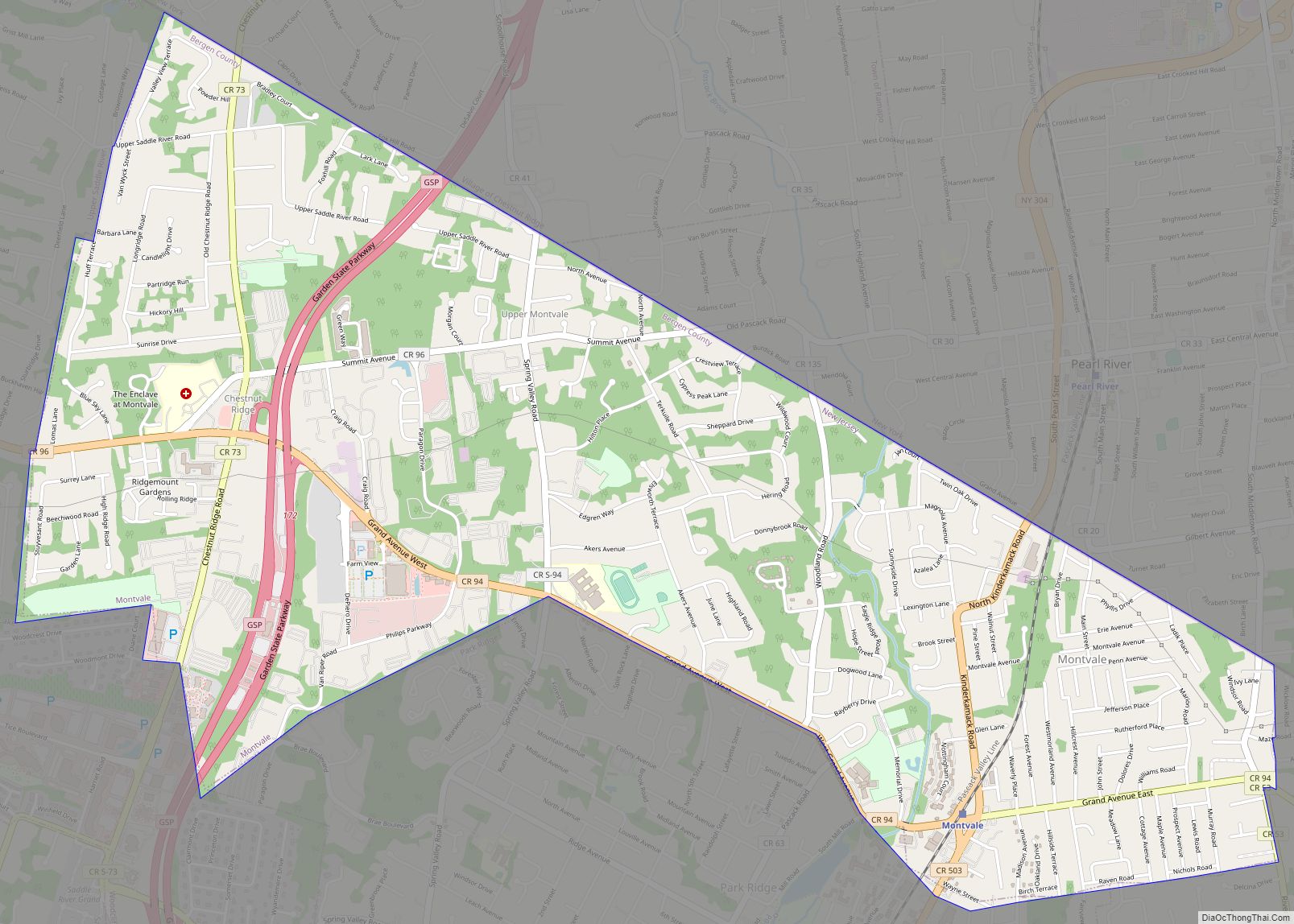
Map of Millville city, New Jersey

Map of Millville city, New Jersey

Millville city overview: Name: Millville city LSAD Code: 25 LSAD Description: city (suffix) State: New Jersey County: Cumberland County Founded: c. 1720 Incorporated: February 24, 1801 (as Township) Elevation: 43 ft (13 m) Total Area: 44.50 sq mi (115.25 km²) Land Area: 42.00 sq mi (108.78 km²) Water Area: 2.50 sq mi (6.47 km²)  5.62% Total Population: 27,491 Population Density: 654.6/sq mi (252.7/km²) ZIP code: 08332 Area code: … Read more

Map of Milltown borough, New Jersey

Map of Milltown borough, New Jersey

Milltown is a borough in Middlesex County, in the U.S. state of New Jersey. The borough is nestled within the heart of the Raritan Valley region, with Lawrence Brook (a Raritan river tributary) flowing through the center of the community. As of the 2020 United States census, the borough’s population was 7,037, an increase of … Read more

Map of Millstone borough, New Jersey

Map of Millstone borough, New Jersey

Millstone borough overview: Name: Millstone borough LSAD Code: 21 LSAD Description: borough (suffix) State: New Jersey County: Somerset County FIPS code: 3446590 Online Interactive Map Millstone online map. Source: Basemap layers from Google Map, Open Street Map (OSM), Arcgisonline, Wmflabs. Boundary Data from Database of Global Administrative Areas. Millstone location map. Where is Millstone borough? … Read more

Map of Milford borough, New Jersey

Map of Milford borough, New Jersey

Milford is a borough located in western Hunterdon County, in the U.S. state of New Jersey. As of the 2020 United States census, the borough’s population was 1,232, a decrease of one person (−0.1%) from the 2010 census count of 1,233, which in turn reflected an increase of 38 (+3.2%) from the 1,195 counted at … Read more

Map of Midland Park borough

Map of Midland Park borough

Midland Park is a borough in Bergen County, in the U.S. state of New Jersey. As of the 2020 United States census, the borough’s population was 7,014, a decrease of 114 (−1.6%) from the 2010 census count of 7,128, which in turn reflected an increase of 181 (+2.6%) from the 6,947 counted in the 2000 … Read more

Map of Middlesex borough, New Jersey

Map of Middlesex borough, New Jersey

Middlesex is a borough in Middlesex County, in the U.S. state of New Jersey. It is located within the Raritan Valley region. As of the 2020 United States census, the borough’s population was 14,636, its highest decennial count and an increase of 1,001 (+7.3%) from the 2010 census count of 13,635, which in turn reflected … Read more

Map of Mount Ephraim borough

Map of Mount Ephraim borough

Mount Ephraim is a borough in Camden County, in the U.S. state of New Jersey. As of the 2020 United States census, the borough’s population was 4,651, a decrease of 25 (−0.5%) from the 2010 census count of 4,676, which in turn reflected an increase of 181 (+4.0%) from the 4,495 counted in the 2000 … Read more

Map of Mount Arlington borough

Map of Mount Arlington borough

Mount Arlington is a borough in Morris County, in the U.S. state of New Jersey. As of the 2020 United States census, the borough’s population was 5,909, an increase of 859 (+17.0%) from the 2010 census count of 5,050, which in turn reflected an increase of 387 (+8.3%) from the 4,663 counted in the 2000 … Read more

Map of Morristown town, New Jersey

Map of Morristown town, New Jersey

Morristown (/ˈmɒrɪstaʊn/) is a town and the county seat of Morris County, in the U.S. state of New Jersey. Morristown has been called “the military capital of the American Revolution” because of its strategic role in the war for independence from Great Britain. Today this history is visible in a variety of locations throughout the … Read more

Map of Morris Plains borough

Map of Morris Plains borough

Morris Plains is a borough in Morris County, in the U.S. state of New Jersey. As of the 2020 United States census, the borough’s population was 6,153, an increase of 621 (+11.2%) from the 2010 census count of 5,532, which in turn reflected an increase of 296 (+5.7%) from the 5,236 counted in the 2000 … Read more

Map of Morganville CDP, New Jersey

Map of Morganville CDP, New Jersey

Morganville is an unincorporated community and census-designated place (CDP) within Marlboro Township, in Monmouth County, New Jersey. As of the 2010 United States Census, the CDP’s population was 5,040. Morganville has its own post office, with a ZIP code of 07751. Morganville CDP overview: Name: Morganville CDP LSAD Code: 57 LSAD Description: CDP (suffix) State: … Read more

Map of Moorestown-Lenola CDP

Map of Moorestown-Lenola CDP

Moorestown-Lenola is an unincorporated community and census-designated place (CDP) located within Moorestown Township in Burlington County, New Jersey, United States. As of the 2010 United States Census, the CDP’s population was 14,217. Moorestown-Lenola CDP overview: Name: Moorestown-Lenola CDP LSAD Code: 57 LSAD Description: CDP (suffix) State: New Jersey County: Burlington County Elevation: 62 ft (19 m) Total … Read more