Map of Duran CDP

Map of Duran CDP

Duran is a census-designated place in Torrance County, New Mexico, United States. Duran is located at the junction of U.S. Route 54 and New Mexico State Road 3, 14 miles (23 km) southwest of Vaughn. As of the 2010 census, its population was 35. Duran CDP overview: Name: Duran CDP LSAD Code: 57 LSAD Description: CDP … Read more

Map of Dulce CDP

Map of Dulce CDP

Dulce (/ˈdʌlsiː/ or /ˈduːsiː/; Jicarilla Apache: Lóosi) is a census-designated place (CDP) in Rio Arriba County, New Mexico, United States. The population was 2,743 at the 2010 census, almost entirely Native American. It is the largest community and tribal headquarters of the Jicarilla Apache Reservation. Dulce CDP overview: Name: Dulce CDP LSAD Code: 57 LSAD … Read more

Map of Doña Ana CDP

Map of Doña Ana CDP

Doña Ana is a census-designated place (CDP) in Doña Ana County, New Mexico, United States. The population was 1,211 at the 2010 census. Doña Ana CDP overview: Name: Doña Ana CDP LSAD Code: 57 LSAD Description: CDP (suffix) State: New Mexico County: Doña Ana County Elevation: 3,960 ft (1,210 m) Total Area: 0.64 sq mi (1.65 km²) Land Area: 0.64 sq mi … Read more

Map of El Duende CDP

Map of El Duende CDP

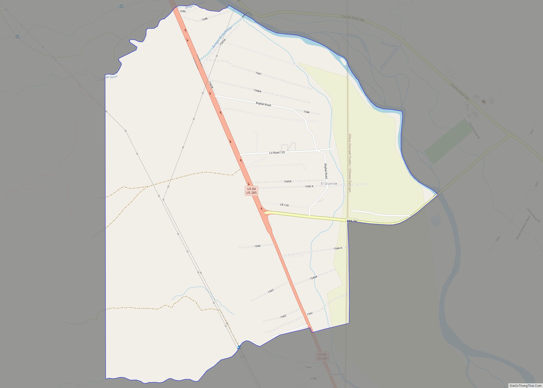
El Duende is an unincorporated community and census-designated place in Rio Arriba County, New Mexico, United States. Its population was 707 as of the 2010 census. The community is located at the junction of U.S. Routes 84/285 and New Mexico State Road 74. El Duende means “the dwarf” in Spanish, but how and why it … Read more

Map of El Cerro CDP

Map of El Cerro CDP

El Cerro is a census-designated place in Valencia County, New Mexico, United States. Its population was 2,953 as of the 2010 census. It is part of the Albuquerque Metropolitan Statistical Area. El Cerro CDP overview: Name: El Cerro CDP LSAD Code: 57 LSAD Description: CDP (suffix) State: New Mexico County: Valencia County Elevation: 4,842 ft (1,476 m) … Read more

Map of El Cerro Mission CDP

Map of El Cerro Mission CDP

El Cerro Mission is a census-designated place (CDP) in Valencia County, New Mexico, United States. The population was 4,657 at the 2010 census. It is part of the Albuquerque Metropolitan Statistical Area. The U.S. Census Bureau previously considered El Cerro Mission and the neighboring community of Monterey Park to be a single CDP, El Cerro-Monterey … Read more

Map of Edith Endave CDP

Map of Edith Endave CDP

Edith Endave is a census-designated place (CDP) in Bernalillo County, New Mexico, United States. The population was 211 at the 2010 census. It is part of the Albuquerque Metropolitan Statistical Area. Edith Endave CDP overview: Name: Edith Endave CDP LSAD Code: 57 LSAD Description: CDP (suffix) State: New Mexico County: Bernalillo County Elevation: 5,015 ft (1,529 m) … Read more

Map of Edgewood town, New Mexico

Map of Edgewood town, New Mexico

Edgewood is a town in Santa Fe County, New Mexico, United States. Through annexations, its town boundaries now extend into Bernalillo and Sandoval counties. It is part of the Albuquerque–Santa Fe–Las Vegas combined statistical area. Although in Santa Fe County, Edgewood is geographically closer to Albuquerque than to the city of Santa Fe. The town’s … Read more

Map of East Pecos CDP

Map of East Pecos CDP

East Pecos is an unincorporated community and census-designated place in San Miguel County, New Mexico, United States. Its population was 757 as of the 2010 census. East Pecos CDP overview: Name: East Pecos CDP LSAD Code: 57 LSAD Description: CDP (suffix) State: New Mexico County: San Miguel County Elevation: 6,936 ft (2,114 m) Total Area: 3.60 sq mi (9.32 km²) … Read more

Map of Eagle Nest village

Map of Eagle Nest village

Eagle Nest is a village in Colfax County, New Mexico. The population was 290 at the time of the 2010 census. Located along the Enchanted Circle Scenic Byway, Eagle Nest is a small summer-home and resort destination. Originally named Therma, the village was renamed Eagle Nest in the 1930s. The town is located in the … Read more

Map of Ensenada CDP

Map of Ensenada CDP

Ensenada is a census-designated place (CDP) in Rio Arriba County, New Mexico, United States. The population was 107 at the 2010 census. It had a post office from 1906 to 1958. Ensenada CDP overview: Name: Ensenada CDP LSAD Code: 57 LSAD Description: CDP (suffix) State: New Mexico County: Rio Arriba County Elevation: 7,539 ft (2,298 m) Total … Read more

Map of Encino village

Map of Encino village, New Mexico

Encino is a village in Torrance County, New Mexico, United States. The population was 82 at the 2010 census. It is part of the Albuquerque Metropolitan Statistical Area. Encino village overview: Name: Encino village LSAD Code: 47 LSAD Description: village (suffix) State: New Mexico County: Torrance County Elevation: 6,119 ft (1,865 m) Total Area: 1.99 sq mi (5.16 km²) Land … Read more