Map of Mescalero CDP

Map of Mescalero CDP

Mescalero (Mescalero-Chiricahua: Mashgal) is a census-designated place (CDP) in Otero County, New Mexico, United States, located on the Mescalero Apache Reservation. The population was 1,338 at the 2010 census. Mescalero CDP overview: Name: Mescalero CDP LSAD Code: 57 LSAD Description: CDP (suffix) State: New Mexico County: Otero County Elevation: 6,611 ft (2,015 m) Total Area: 17.90 sq mi (46.36 km²) … Read more

Map of Melrose village, New Mexico

Map of Melrose village, New Mexico

Melrose is a village in Curry County, New Mexico, United States. Its population was 651 at the 2010 census. The town is losing population due to rural exodus. Melrose is served by Melrose Elementary School and Melrose High School. William Hanna (1910–2001), co-founder of Hanna Barbera Studios, was born in Melrose. Melrose village overview: Name: … Read more

Map of Meadow Lake CDP

Map of Meadow Lake CDP

Meadow Lake is a census-designated place (CDP) in Valencia County, New Mexico, United States. The population was 4,491 at the 2000 census. It is part of the Albuquerque Metropolitan Statistical Area. Meadow Lake CDP overview: Name: Meadow Lake CDP LSAD Code: 57 LSAD Description: CDP (suffix) State: New Mexico County: Valencia County Elevation: 5,449 ft (1,661 m) … Read more

Map of McIntosh CDP, New Mexico

Map of McIntosh CDP, New Mexico

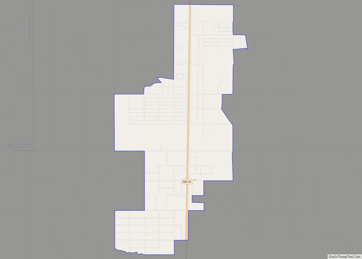
McIntosh is a census-designated place in Torrance County, New Mexico, United States. Its population was 1,484 as of the 2010 census. McIntosh has a post office with ZIP code 87032, which opened on August 28, 1906. New Mexico State Road 41 passes through the community. McIntosh CDP overview: Name: McIntosh CDP LSAD Code: 57 LSAD … Read more

Map of McCartys Village CDP

Map of McCartys Village CDP

McCartys Village is a census-designated place (CDP) in Cibola County, New Mexico, consisting of the unincorporated community known as McCartys. The population was 48 at the time of the 2010 census. It is part of the Acoma Pueblo. McCartys Village CDP overview: Name: McCartys Village CDP LSAD Code: 57 LSAD Description: CDP (suffix) State: New … Read more

Map of Mayhill CDP

Map of Mayhill CDP

Mayhill is an unincorporated community in Otero County, New Mexico, United States. It is surrounded by the Lincoln National Forest on the eastern slope of the Sacramento Mountains, at the confluence of James Canyon and Rio Penasco, approximately 17 miles (27 km) east of Cloudcroft. Mayhill CDP overview: Name: Mayhill CDP LSAD Code: 57 LSAD Description: … Read more

Map of Maxwell village, New Mexico

Map of Maxwell village, New Mexico

Maxwell is a village in Colfax County, New Mexico, United States. The population was 254 at the 2010 census, down from 274 in 2000. Maxwell was established in 1879 as a railroad town on the Atchison, Topeka and Santa Fe Railway. It was named in honor of Lucien Maxwell, who provided the land for the … Read more

Map of Manzano CDP

Map of Manzano CDP

Manzano is a census-designated place (CDP) in Torrance County, New Mexico, United States. The population was 54 at the 2000 census. The Quarai Ruins of Salinas Pueblo Missions National Monument are located near the town. The center of population of New Mexico is located in Manzano. Manzano is part of the Albuquerque Metropolitan Statistical Area. … Read more

Map of Manzano Springs CDP

Map of Manzano Springs CDP

Manzano Springs is a census-designated place (CDP) in Torrance and Bernalillo counties, New Mexico, United States. The population was 137 at the 2010 census. It is part of the Albuquerque Metropolitan Statistical Area. Manzano Springs CDP overview: Name: Manzano Springs CDP LSAD Code: 57 LSAD Description: CDP (suffix) State: New Mexico County: Bernalillo County, Torrance … Read more

Map of Malaga CDP, New Mexico

Map of Malaga CDP, New Mexico

Malaga is a census-designated place and unincorporated community in Eddy County, New Mexico, United States. Its population was 147 as of the 2010 census. Malaga has a post office with ZIP code 88263. U.S. Route 285 passes through the community. Formerly known as Kirkwell, Malaga was founded in the 1890s by Swiss immigrants and was … Read more

Map of Mesita CDP

Map of Mesita CDP

Mesita is a census-designated place (CDP) in Cibola County, New Mexico, United States. The population was 804 at the 2010 census. Mesita CDP overview: Name: Mesita CDP LSAD Code: 57 LSAD Description: CDP (suffix) State: New Mexico County: Cibola County Elevation: 5,669 ft (1,728 m) Total Area: 7.49 sq mi (19.39 km²) Land Area: 7.47 sq mi (19.35 km²) Water Area: 0.01 sq mi (0.04 km²) … Read more

Map of Mesilla town

Map of Mesilla town

Mesilla (also known as La Mesilla and Old Mesilla) is a town in Doña Ana County, New Mexico, United States. The population was 2,196 at the 2010 census. It is part of the Las Cruces Metropolitan Statistical Area. During the Civil War, Mesilla briefly served as capital of the Confederate Territory of Arizona. The Mesilla … Read more