Map of Rancho Grande CDP
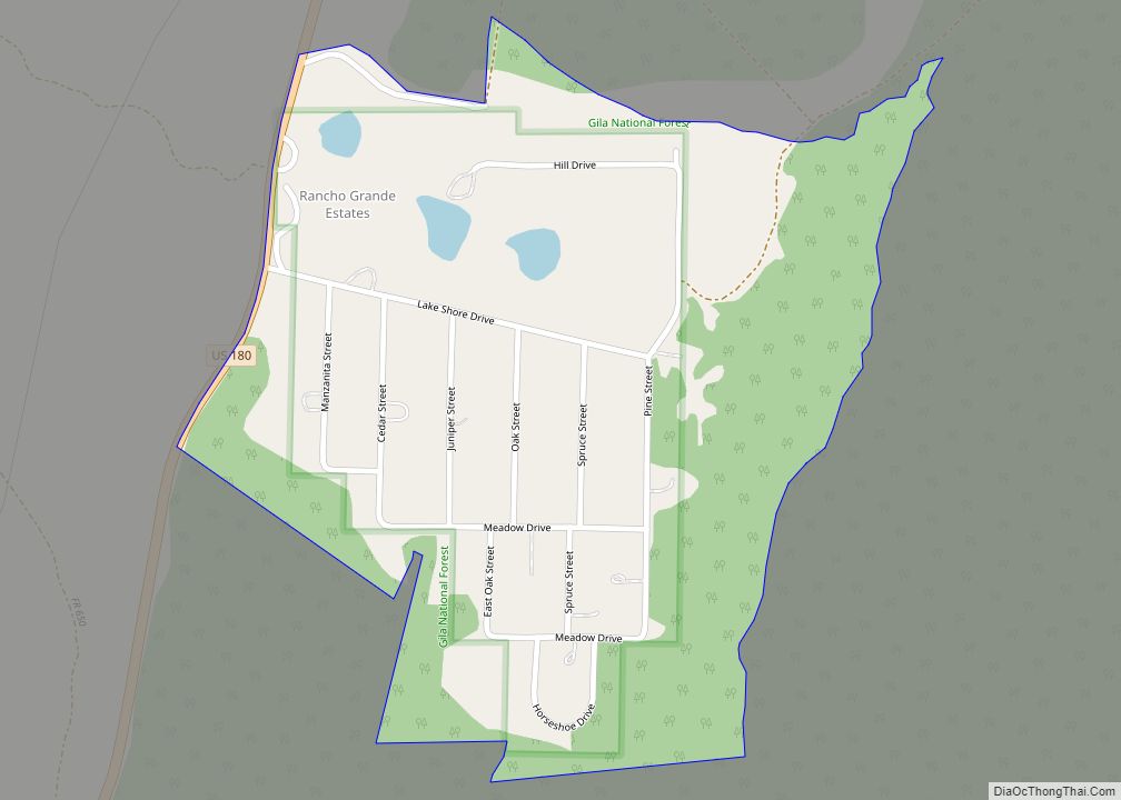
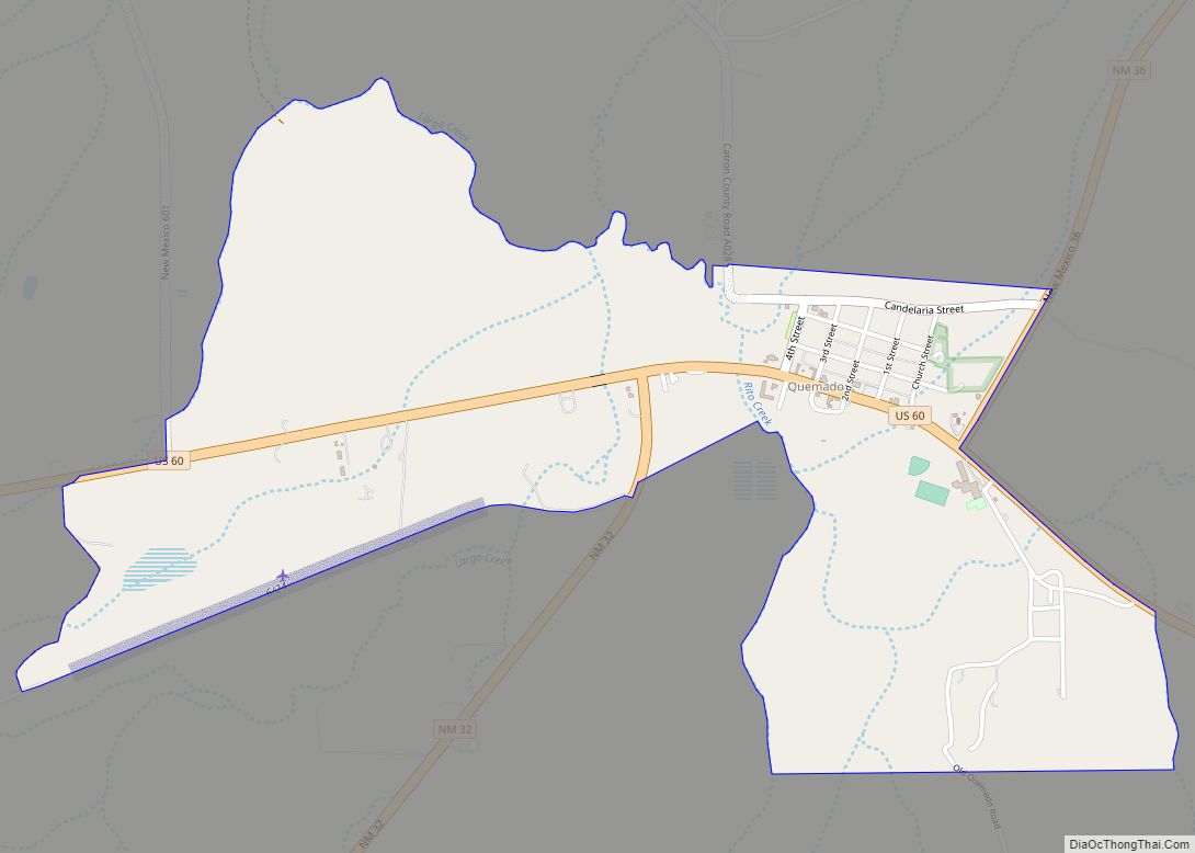
Rancho Grande is a census-designated place in Catron County, New Mexico, United States. Its population was 142 as of the 2010 census. The community is located along U.S. Route 180. Rancho Grande CDP overview: Name: Rancho Grande CDP LSAD Code: 57 LSAD Description: CDP (suffix) State: New Mexico County: Catron County Elevation: 6,345 ft (1,934 m) Total ... Read more
Map of Rancho Grande CDP
Map of Ramah CDP, New Mexico
Ramah (Navajo: Tłʼohchiní – place of wild onions) is a census-designated place (CDP) in McKinley County, New Mexico. The population was 407 at the time of 2000 census and 370 at the 2010 United States Census. Ramah CDP overview: Name: Ramah CDP LSAD Code: 57 LSAD Description: CDP (suffix) State: New Mexico County: McKinley County ... Read more
Map of Ramah CDP, New Mexico
Map of Radium Springs CDP
Radium Springs is a census-designated place (CDP) in Doña Ana County, New Mexico, United States. The population was 1,699 at the 2010 census. It is part of the Las Cruces Metropolitan Statistical Area. Radium Springs CDP overview: Name: Radium Springs CDP LSAD Code: 57 LSAD Description: CDP (suffix) State: New Mexico County: Doña Ana County ... Read more
Map of Radium Springs CDP
Map of Questa village
Questa is a village in Taos County, New Mexico, United States. The population was 1,770 at the 2010 census. The village has trails into the Rio Grande Gorge, trout fishing, and mountain lakes with trails that access the Sangre de Cristo Mountains that overlook the area. Questa is on the Enchanted Circle Scenic Byway, near ... Read more
Map of Questa village
Map of Quemado CDP, New Mexico
Quemado is a census-designated place in Catron County, New Mexico, United States. As of the 2010 census it had a population of 228. Walter De Maria’s 1977 art installation, The Lightning Field, is between Quemado and Pie Town, New Mexico. Jerry D. Thompson, historian of the American Southwest, was reared in Quemado. Quemado CDP overview: ... Read more
Map of Quemado CDP, New Mexico
Map of Pulpotio Bareas CDP
Pulpotio Bareas is a census-designated place in Luna County, New Mexico, United States. Its population was 120 as of the 2010 census. Pulpotio Bareas CDP overview: Name: Pulpotio Bareas CDP LSAD Code: 57 LSAD Description: CDP (suffix) State: New Mexico County: Luna County Elevation: 4,321 ft (1,317 m) Total Area: 0.52 sq mi (1.34 km²) Land Area: 0.52 sq mi (1.34 km²) Water ... Read more
Map of Pulpotio Bareas CDP
Map of Rodey CDP
Rodey is a census-designated place and colonia in Doña Ana County, New Mexico, United States. Its population was 388 as of the 2010 census. The community is located on the southeast border of Hatch along New Mexico State Road 185. Rodey CDP overview: Name: Rodey CDP LSAD Code: 57 LSAD Description: CDP (suffix) State: New ... Read more
Map of Rodey CDP
Map of Rodeo CDP, New Mexico
Rodeo is a census-designated place (CDP) in Hidalgo County, New Mexico, United States, at 31°50′13″N 109°01′54″W / 31.83694°N 109.03167°W / 31.83694; -109.03167. It lies less than one mile (1.6 km) from the border with Arizona on New Mexico State Road 80. As of the 2010 census, the population of Rodeo was 101. Rodeo CDP overview: Name: ... Read more
Map of Rodeo CDP, New Mexico
Map of Rock Springs CDP, New Mexico
Rock Springs (Navajo: Tséchʼízhí) is a census-designated place (CDP) in McKinley County, New Mexico, United States. The population was 558 at the 2000 census. Rock Springs CDP overview: Name: Rock Springs CDP LSAD Code: 57 LSAD Description: CDP (suffix) State: New Mexico County: McKinley County Elevation: 6,581 ft (2,006 m) Total Area: 12.59 sq mi (32.60 km²) Land Area: 12.59 sq mi ... Read more
Map of Rock Springs CDP, New Mexico
Map of Rivers CDP
Rivers is a census-designated place in Catron County, New Mexico, United States. Its population was 28 as of the 2010 census. The community is located at the confluence of the Tularosa River into the San Francisco River. Rivers CDP overview: Name: Rivers CDP LSAD Code: 57 LSAD Description: CDP (suffix) State: New Mexico County: Catron ... Read more
Map of Rivers CDP
Map of Rio Lucio CDP
Rio Lucio is a census-designated place (CDP) in Taos County, New Mexico, United States. The population was 379 at the 2000 census. Rio Lucio CDP overview: Name: Rio Lucio CDP LSAD Code: 57 LSAD Description: CDP (suffix) State: New Mexico County: Taos County Elevation: 7,251 ft (2,210 m) Total Area: 1.05 sq mi (2.72 km²) Land Area: 1.05 sq mi (2.72 km²) Water ... Read more
Map of Rio Lucio CDP
Map of Rio en Medio CDP
Rio en Medio is a census-designated place (CDP) in Santa Fe County, New Mexico, United States. It is part of the Santa Fe, New Mexico Metropolitan Statistical Area. The population was 131 at the 2000 census. Rio en Medio CDP overview: Name: Rio en Medio CDP LSAD Code: 57 LSAD Description: CDP (suffix) State: New ... Read more
Map of Rio en Medio CDP