Reserve is a village in Catron County, New Mexico, United States. The population was 289 as of the 2010 census, down from 387 in 2000. It is the county seat of Catron County. Currently the village has two grocery stores, a hardware store, a bar, fairgrounds, and a health clinic. It is the site where Elfego Baca held off a gang of Texan cowboys who wanted to kill him for arresting cowboy Charles McCarty.
| Name: | Reserve village |
|---|---|
| LSAD Code: | 47 |
| LSAD Description: | village (suffix) |
| State: | New Mexico |
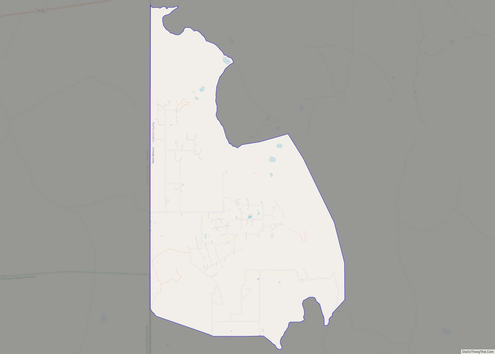
| County: | Catron County |
| Elevation: | 5,771 ft (1,759 m) |
| Total Area: | 0.56 sq mi (1.44 km²) |
| Land Area: | 0.56 sq mi (1.44 km²) |
| Water Area: | 0.00 sq mi (0.00 km²) |
| Total Population: | 293 |
| Population Density: | 526.03/sq mi (203.06/km²) |
| ZIP code: | 87830 |
| Area code: | 575 |
| FIPS code: | 3562620 |
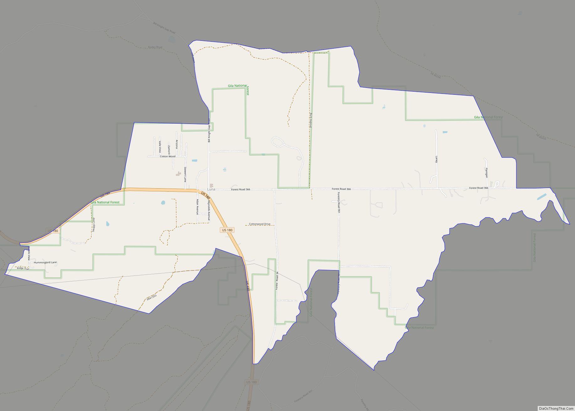
Online Interactive Map
Click on ![]() to view map in "full screen" mode.
to view map in "full screen" mode.
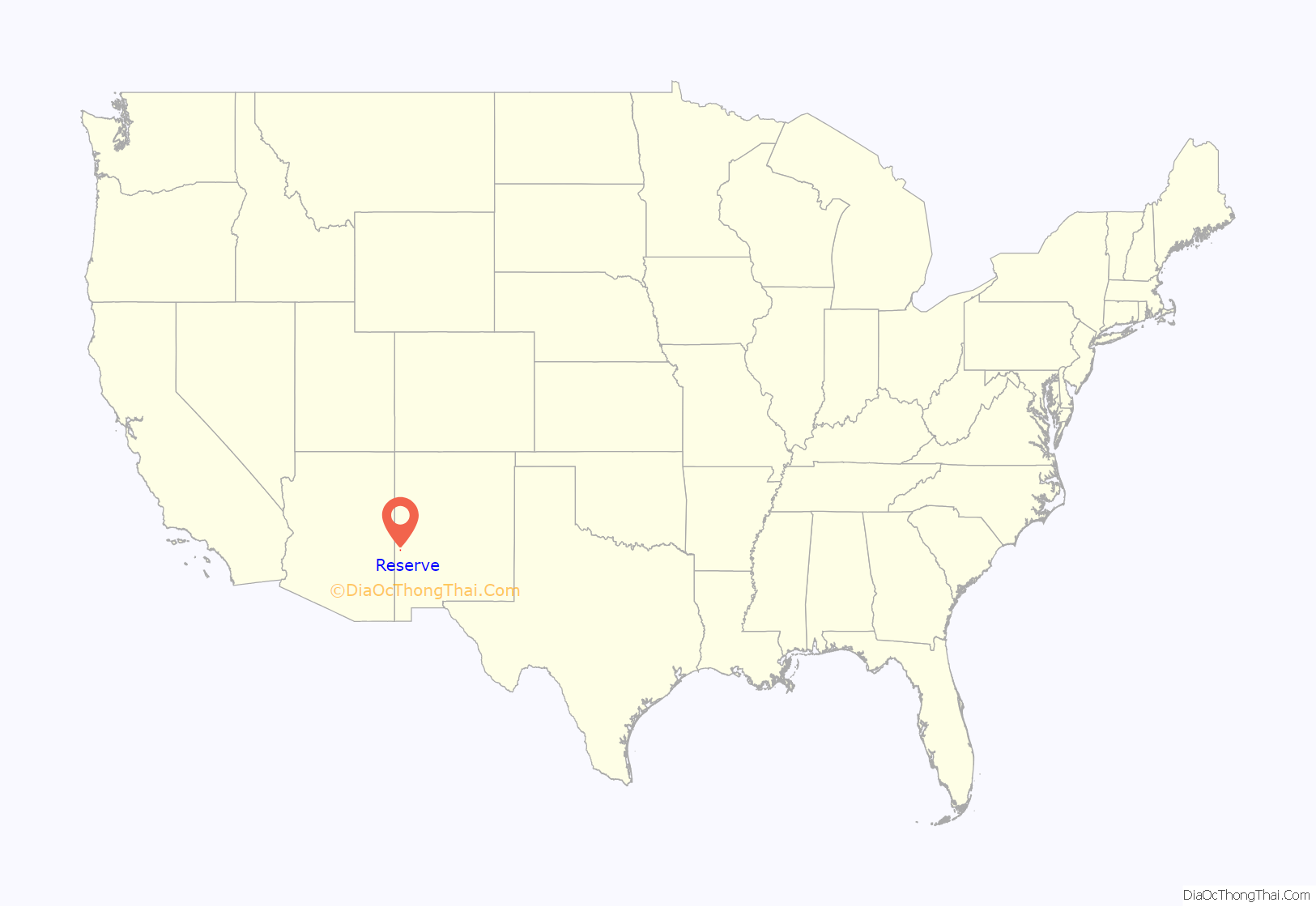
Reserve location map. Where is Reserve village?

History
Catron became a county in 1921. It was named after an attorney and political leader from Santa Fe, Thomas B. Catron.
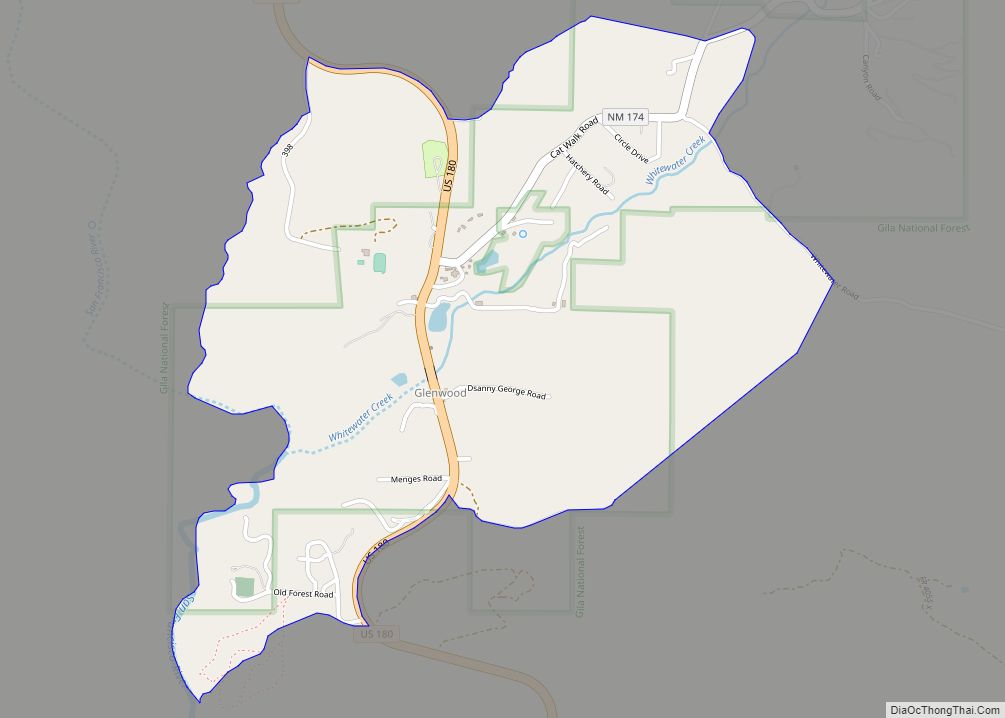
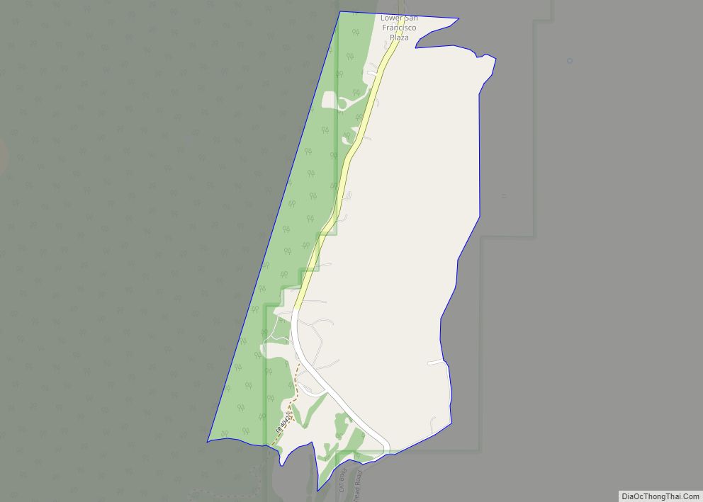
In the 1860s, Mexican-Americans established a string of villages along the San Francisco River, naming them the Upper, Lower, and Middle San Francisco Plazas. In the late 1870s Anglo settlers began arriving. They renamed Upper Frisco Plaza as Milligan’s Plaza, naming it after a merchant and saloon owner.
Milligan’s Plaza was the site of the Frisco shootout of Elfego Baca.
Reserve Road Map
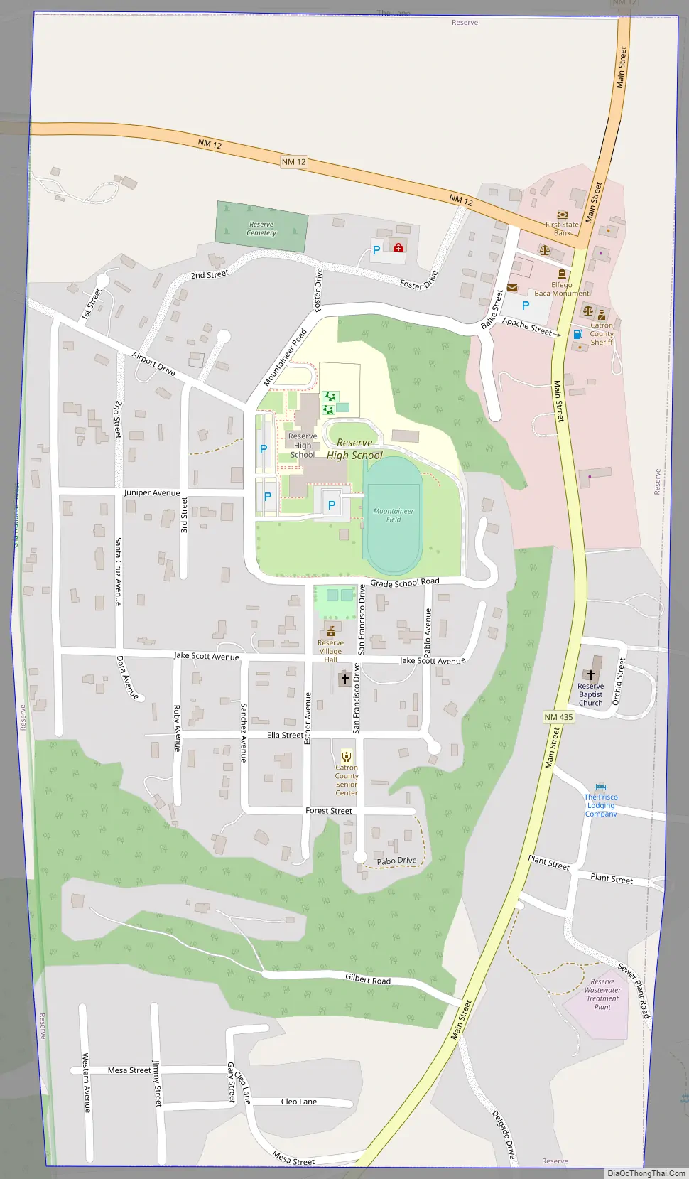
Reserve city Satellite Map

Geography
Reserve is located in western Catron County in the valley of the San Francisco River. New Mexico State Road 12 passes through the village, leading west 7 miles (11 km) to U.S. Route 180 near Reserve Airport and northeast 67 miles (108 km) to U.S. Route 60 at Datil. NM 435 leads south through the communities of San Francisco Plaza and Lower San Francisco Plaza before ending 5 miles (8 km) south of Reserve.
Reserve is situated in the Gila National Forest about 15 mi (24 km) east of the Arizona/New Mexico border. The area includes ruins from the Mogollon and Anasazi tribes, as well as petroglyphs and historic Old West sites.
According to the United States Census Bureau, the village has a total area of 0.54 square miles (1.4 km), all land.
See also
Map of New Mexico State and its subdivision: Map of other states:- Alabama
- Alaska
- Arizona
- Arkansas
- California
- Colorado
- Connecticut
- Delaware
- District of Columbia
- Florida
- Georgia
- Hawaii
- Idaho
- Illinois
- Indiana
- Iowa
- Kansas
- Kentucky
- Louisiana
- Maine
- Maryland
- Massachusetts
- Michigan
- Minnesota
- Mississippi
- Missouri
- Montana
- Nebraska
- Nevada
- New Hampshire
- New Jersey
- New Mexico
- New York
- North Carolina
- North Dakota
- Ohio
- Oklahoma
- Oregon
- Pennsylvania
- Rhode Island
- South Carolina
- South Dakota
- Tennessee
- Texas
- Utah
- Vermont
- Virginia
- Washington
- West Virginia
- Wisconsin
- Wyoming