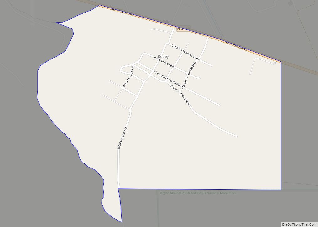
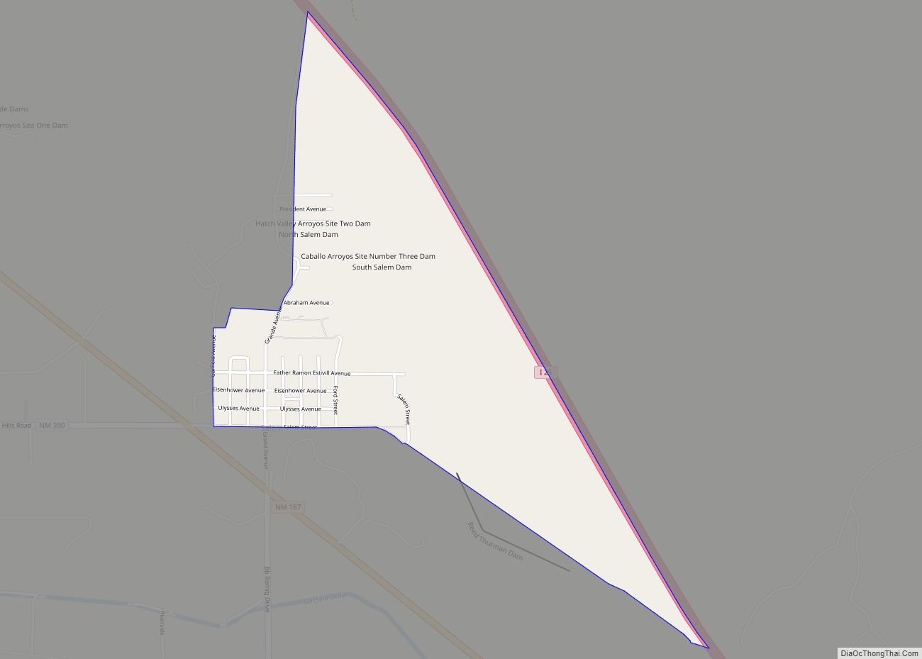
Map of Rodeo CDP, New Mexico

Map of Rodeo CDP, New Mexico

Rodeo is a census-designated place (CDP) in Hidalgo County, New Mexico, United States, at 31°50′13″N 109°01′54″W / 31.83694°N 109.03167°W / 31.83694; -109.03167. It lies less than one mile (1.6 km) from the border with Arizona on New Mexico State Road 80. As of the 2010 census, the population of Rodeo was 101. Rodeo CDP overview: Name: … Read more

Map of Rock Springs city

Map of Rock Springs CDP, New Mexico

Rock Springs (Navajo: Tséchʼízhí) is a census-designated place (CDP) in McKinley County, New Mexico, United States. The population was 558 at the 2000 census. Rock Springs CDP overview: Name: Rock Springs CDP LSAD Code: 57 LSAD Description: CDP (suffix) State: New Mexico County: McKinley County Elevation: 6,581 ft (2,006 m) Total Area: 12.59 sq mi (32.60 km²) Land Area: 12.59 sq mi … Read more

Map of Rivers CDP

Map of Rivers CDP

Rivers is a census-designated place in Catron County, New Mexico, United States. Its population was 28 as of the 2010 census. The community is located at the confluence of the Tularosa River into the San Francisco River. Rivers CDP overview: Name: Rivers CDP LSAD Code: 57 LSAD Description: CDP (suffix) State: New Mexico County: Catron … Read more

Map of Rio Lucio CDP

Map of Rio Lucio CDP

Rio Lucio is a census-designated place (CDP) in Taos County, New Mexico, United States. The population was 379 at the 2000 census. Rio Lucio CDP overview: Name: Rio Lucio CDP LSAD Code: 57 LSAD Description: CDP (suffix) State: New Mexico County: Taos County Elevation: 7,251 ft (2,210 m) Total Area: 1.05 sq mi (2.72 km²) Land Area: 1.05 sq mi (2.72 km²) Water … Read more

Map of San Antonito CDP

Map of San Antonito CDP

San Antonito is a census-designated place in Socorro County, New Mexico, United States. Its population was 94 as of the 2010 census. San Antonito CDP overview: Name: San Antonito CDP LSAD Code: 57 LSAD Description: CDP (suffix) State: New Mexico County: Socorro County Elevation: 4,560 ft (1,390 m) Total Area: 1.730 sq mi (4.48 km²) Land Area: 1.730 sq mi (4.48 km²) Water … Read more

Map of San Antonio CDP, New Mexico

Map of San Antonio CDP, New Mexico

San Antonio is a census-designated place in Socorro County, New Mexico, United States, roughly in the center of the state, on the Rio Grande. The entire population of the county is approximately 18,000. San Antonio CDP overview: Name: San Antonio CDP LSAD Code: 57 LSAD Description: CDP (suffix) State: New Mexico County: Socorro County FIPS … Read more

Map of San Acacia CDP

Map of San Acacia CDP

San Acacia is a small unincorporated community and census-designated place in Socorro County, New Mexico, United States. It was once a prosperous railway town, but is now largely deserted. There is a nearby diversion dam on the Rio Grande, important in irrigation. San Acacia CDP overview: Name: San Acacia CDP LSAD Code: 57 LSAD Description: … Read more

Map of Salem CDP, New Mexico

Map of Salem CDP, New Mexico

Salem is a census-designated place (CDP) in Doña Ana County, New Mexico, United States. The population was 942 at the 2010 census. It is part of the Las Cruces Metropolitan Statistical Area. Salem CDP overview: Name: Salem CDP LSAD Code: 57 LSAD Description: CDP (suffix) State: New Mexico County: Doña Ana County Elevation: 4,081 ft (1,244 m) … Read more

Map of Sacramento CDP, New Mexico

Map of Sacramento CDP, New Mexico

Sacramento is a census-designated place in Otero County, New Mexico, United States. Its population was 58 as of the 2010 census. Sacramento has a post office with ZIP code 88347. New Mexico State Road 521 passes through the community. Sacramento CDP overview: Name: Sacramento CDP LSAD Code: 57 LSAD Description: CDP (suffix) State: New Mexico … Read more

Map of Ruidoso village

Map of Ruidoso village

Ruidoso is a village in Lincoln County, New Mexico, United States, adjacent to the Lincoln National Forest. The population was 8,029 at the 2010 census. The city of Ruidoso Downs and the unincorporated area of Alto are suburbs of Ruidoso, and contribute to the Ruidoso Micropolitan Statistical Area’s population of 21,223. A mountain resort town, … Read more

Map of Ruidoso Downs city

Map of Ruidoso Downs city

Ruidoso Downs is a city in Lincoln County, New Mexico, United States, located within the Lincoln National Forest. The population was 1,824 at the 2000 census and 2,815 at the 2010 census. Originally incorporated as a village, it became a city in May 2002. Known locally as “the Downs”, Ruidoso Downs is a suburb of … Read more

Map of Roy village, New Mexico

Map of Roy village, New Mexico

Roy is a village in Harding County, New Mexico, United States. The population was 234 at the 2010 census. Roy was a filming location in the 2009 comedy film Did You Hear About the Morgans?. Roy village overview: Name: Roy village LSAD Code: 47 LSAD Description: village (suffix) State: New Mexico County: Harding County Elevation: … Read more