Map of Fishers Landing CDP
Fishers Landing is a hamlet and census-designated place (CDP) in the town of Orleans in Jefferson County, New York, United States. It is just southwest of Grass Point State Park in the Thousand Islands region of New York. As of the 2010 census the community had a population of 89. Fishers Landing CDP overview: Name: ... Read more
Map of Fishers Landing CDP
Map of Fishers Island CDP
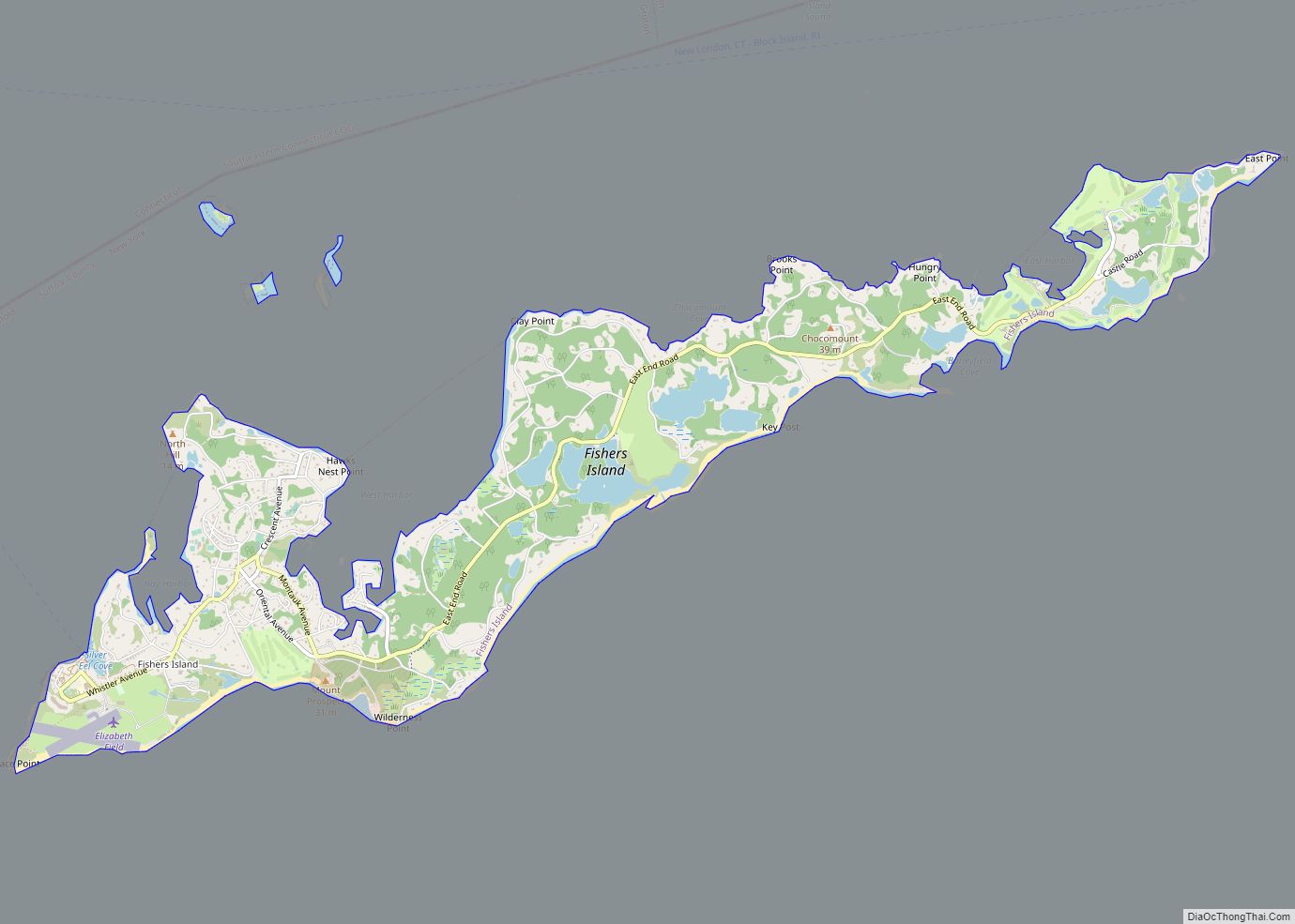
Fishers Island (Pequot: Munnawtawkit) is an island that is part of Southold, New York, United States at the eastern end of Long Island Sound, 2 miles (3 km) off the southeastern coast of Connecticut across Fishers Island Sound. About 9 miles (14 km) long and 1 mile (1.6 km) wide, it is about 11 miles (18 km) from the ... Read more
Map of Fishers Island CDP
Map of Firthcliffe CDP
Firthcliffe is a hamlet (and census-designated place) in Orange County, New York United States. The population was 5,022 at the 2020 Census. It is part of the Poughkeepsie–Newburgh–Middletown, NY Metropolitan Statistical Area as well as the larger New York–Newark–Bridgeport, NY-NJ–CT–PA Combined Statistical Area. Firthcliffe is in the Town of Cornwall. Firthcliffe CDP overview: Name: Firthcliffe ... Read more
Map of Firthcliffe CDP
Map of Fire Island CDP
Fire Island is the large center island of the outer barrier islands parallel to the South Shore of Long Island, in the U.S. state of New York. Occasionally, the name is used to refer collectively to not only the central island, but also Long Beach Barrier Island, Jones Beach Island, and Westhampton Island, since the ... Read more
Map of Fire Island CDP
Map of Fillmore CDP, New York
Fillmore is a hamlet (and census-designated place) in the town of Hume, Allegany County, New York, United States. As of the 2010 census it had a population of 603. It was originally known as “The Mouth of the Creek” but was named for President Millard Fillmore in 1850. The former village of Fillmore dissolved its ... Read more
Map of Fillmore CDP, New York
Map of Felts Mills CDP
Felts Mills is a hamlet and census-designated place (CDP) in the town of Rutland of Jefferson County, New York, United States. The population was 372 at the 2010 census. Felts Mills’ original name was “Mid Road” because it is close to the halfway point between Watertown and Carthage. Felts Mills CDP overview: Name: Felts Mills ... Read more
Map of Felts Mills CDP
Map of Fayetteville village, New York
Fayetteville is a village located in Onondaga County, New York, United States. As of the 2020 U.S. Census, the population was 4,225. The village is named after the Marquis de Lafayette, a national hero of both France and the United States. It is part of the Syracuse Metropolitan Statistical Area. Fayetteville is located in the ... Read more
Map of Fayetteville village, New York
Map of Forestville CDP, New York
Forestville is a hamlet (and census-designated place) in Chautauqua County, New York, United States. The population was 697 at the 2010 census. The hamlet is within the town of Hanover and in the northeast part of the county. It was an incorporated village from 1848 to 2016. Forestville CDP overview: Name: Forestville CDP LSAD Code: ... Read more
Map of Forestville CDP, New York
Map of Forest Home CDP
Forest Home is a census-designated place (CDP) in Tompkins County, New York, United States. The population was 572 at the 2010 census. The community of Forest Home is in the Town of Ithaca, northeast of the City of Ithaca and north of Cornell University. Forest Home CDP overview: Name: Forest Home CDP LSAD Code: 57 ... Read more
Map of Forest Home CDP
Map of Fonda village, New York
Fonda is a village in and the county seat of Montgomery County, New York, United States. The population was 795 at the 2010 census. The village is named after Douw Fonda, a Dutch-American settler who was killed and scalped in 1780, during a Mohawk raid in the Revolutionary War, when the tribe was allied with ... Read more
Map of Fonda village, New York
Map of Flower Hill village
Flower Hill is a village in Nassau County, on the North Shore of Long Island, in New York, United States. The eastern half is considered part of the Greater Roslyn area, which is anchored by the Incorporated Village of Roslyn. Western and northern parts are more closely associated with Manhasset and Port Washington. The population ... Read more
Map of Flower Hill village
Map of Florida village, New York
Florida is a village in Orange County, New York, United States. The population was 3,049 as of the 2020 census. It is part of the Poughkeepsie-Newburgh-Middletown Metropolitan Statistical Area as well as the larger New York–Newark–Bridgeport, NY-NJ–CT–PA Combined Statistical Area. The village is located in the town of Warwick, with two small northern portions in ... Read more
Map of Florida village, New York