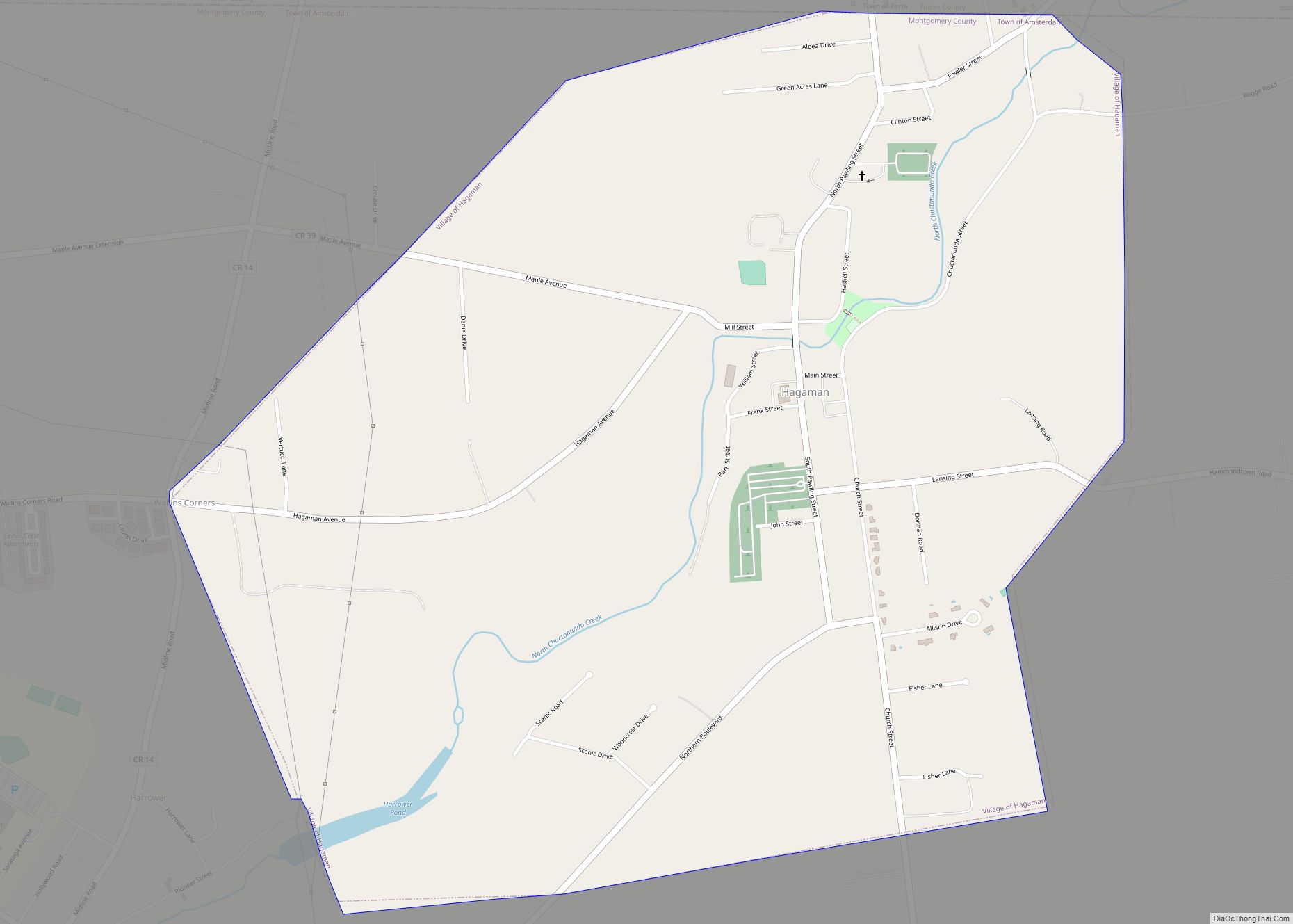
Map of Hall CDP

Map of Hall CDP

Hall is a hamlet (and census-designated place) in Ontario County, New York, United States, near the city of Geneva, along State Route 14A in the Town of Seneca. Located in the Finger Lakes region, Hall has a fire department and a post office with a downtown zip code of 14463, though the urbanized area extends … Read more

Map of Harbor Isle CDP

Map of Harbor Isle CDP

Harbor Isle is a hamlet and census-designated place (CDP) in the Town of Hempstead in Nassau County, New York, United States. The population was 1,301 at the 2010 census. Harbor Isle CDP overview: Name: Harbor Isle CDP LSAD Code: 57 LSAD Description: CDP (suffix) State: New York County: Nassau County Elevation: 0 ft (0 m) Total Area: … Read more

Map of Harbor Hills CDP

Map of Harbor Hills CDP, New York

Harbor Hills is a hamlet and census-designated place (CDP) located on the Great Neck Peninsula within the Town of North Hempstead in Nassau County, on the North Shore of Long Island, in New York, United States. The population was 575 at the 2010 census. Harbor Hills CDP overview: Name: Harbor Hills CDP LSAD Code: 57 … Read more

Map of Hannibal village, New York

Map of Hannibal village, New York

Hannibal is a village in Oswego County, New York, United States. The population was 555 at the 2010 census. The village is named after Hannibal, the hero of ancient Carthage. The Village of Hannibal is located in the western part of the Town of Hannibal on New York State Routes 3 and 104, and Oswego … Read more

Map of Hannawa Falls CDP

Map of Hannawa Falls CDP

Hannawa Falls is a hamlet and census-designated place in St. Lawrence County, New York, United States. Its population was 1,042 as of the 2010 census. Hannawa Falls has a post office with ZIP code 13647. New York State Route 56 passes through the community. Hannawa Falls CDP overview: Name: Hannawa Falls CDP LSAD Code: 57 … Read more

Map of Hancock village, New York

Map of Hancock village, New York

Hancock is a village in Delaware County, New York, United States. The population was 908 at the 2020 census. The village is in the west part of the town of Hancock at the junction of NY Routes 17 and 97. Hancock is located at the confluence of the East and West branches of the Delaware … Read more

Map of Hampton Manor CDP

Map of Hampton Manor CDP

Hampton Manor is a census-designated place in the town of East Greenbush in Rensselaer County, New York, United States. The population was 2,417 at the 2010 census. Hampton Manor is a suburb of the cities of Rensselaer and Albany. Many of the homes built in Hampton Manor were kit houses from Sears Roebuck and Montgomery … Read more

Map of Hampton Bays CDP

Map of Hampton Bays CDP

Hampton Bays is a hamlet and census-designated place (CDP) in the Town of Southampton in Suffolk County, on Long Island, in New York. It is considered as part of the region of Long Island known as The Hamptons. The population was 13,603 at the 2010 census. Hampton Bays CDP overview: Name: Hampton Bays CDP LSAD … Read more

Map of Hammondsport village

Map of Hammondsport village

Hammondsport is a village at the south end of Keuka Lake, in Steuben County, one of the Finger Lakes of New York, United States. The Village of Hammondsport is in the Town of Urbana and is northeast of Bath. Hammondsport village overview: Name: Hammondsport village LSAD Code: 47 LSAD Description: village (suffix) State: New York … Read more

Map of Hammond village, New York

Map of Hammond village, New York

Hammond is a village in St. Lawrence County, New York, United States. The population was 280 at the 2010 census. The village is named after an early landowner. The Village of Hammond is near the center of the Town of Hammond at the western corner of the county. Hammond village overview: Name: Hammond village LSAD … Read more

Map of Hamlin CDP, New York

Map of Hamlin CDP, New York

Hamlin is a census-designated place (CDP) in Monroe County, New York, United States. The population was 5,521 at the 2010 census. Hamlin CDP overview: Name: Hamlin CDP LSAD Code: 57 LSAD Description: CDP (suffix) State: New York County: Monroe County FIPS code: 3631786 Online Interactive Map Hamlin online map. Source: Basemap layers from Google Map, … Read more

Map of Harrison village, New York

Map of Harrison village, New York

Harrison is a town and village in Westchester County, New York, United States, 22 miles (35 km) northeast of Manhattan. The population was 28,218 at the 2020 census. Harrison village overview: Name: Harrison village LSAD Code: 47 LSAD Description: village (suffix) State: New York County: Westchester County Founded: 1696 Elevation: 69 ft (21 m) Total Area: 17.44 sq mi (45.17 km²) … Read more