Map of West Valley CDP
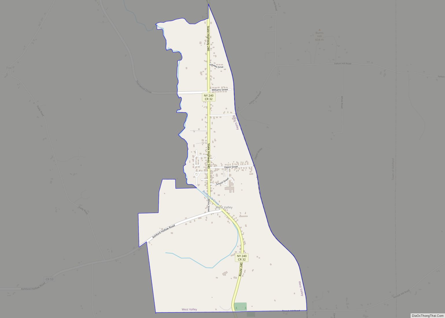
West Valley is a hamlet in the Town of Ashford in Cattaraugus County, New York, United States. The population was 518 at the 2010 census, which lists the community as a census-designated place. Located at the intersection of Cattaraugus County Route 53 and State Route 240/County Route 32, the hamlet is home to West Valley ... Read more
Map of West Valley CDP
Map of West Seneca CDP
West Seneca is a hamlet and census-designated place (CDP) in Erie County, New York, United States. The population was 44,711 at the 2010 census. It is part of the Buffalo–Niagara Falls Metropolitan Statistical Area. The CDP corresponds exactly to the area of the town of West Seneca. West Seneca CDP overview: Name: West Seneca CDP ... Read more
Map of West Seneca CDP
Map of West Sayville CDP
West Sayville is a hamlet and census-designated place (CDP) in Suffolk County, New York, United States. It had a population of 5,011 at the 2010 census. West Sayville CDP overview: Name: West Sayville CDP LSAD Code: 57 LSAD Description: CDP (suffix) State: New York County: Suffolk County Elevation: 13 ft (4 m) Total Area: 2.11 sq mi (5.47 km²) Land ... Read more
Map of West Sayville CDP
Map of Westvale CDP
Westvale is a suburban community (and census-designated place) in Onondaga County, New York, United States. The population was 4,963 at the 2010 census. Westvale is in the town of Geddes, lying east of Fairmount and southwest of Solvay. Westvale is a suburb of Syracuse, which is to the east. Westvale CDP overview: Name: Westvale CDP ... Read more
Map of Westvale CDP
Map of Westport CDP, New York
Westport is a hamlet and census-designated place (CDP) in the town of Westport in Essex County, New York, United States. The population of the CDP was 518 at the 2010 census, or 39.4% of the total population of the town of Westport. Westport CDP overview: Name: Westport CDP LSAD Code: 57 LSAD Description: CDP (suffix) ... Read more
Map of Westport CDP, New York
Map of Weston Mills CDP
Weston Mills (variant names Westons Mills and Weston’s Mills) is a hamlet in the towns of Portville and Olean in Cattaraugus County, New York, United States. It is counted as a census-designated place by the U.S. Census Bureau, which recorded a population of 1,472 at the 2010 census. Weston Mills CDP overview: Name: Weston Mills ... Read more
Map of Weston Mills CDP
Map of Westmoreland CDP, New York
Westmoreland is a census-designated place in the town of Westmoreland in Oneida County, New York, United States. Westmoreland is part of the Utica–Rome Metropolitan Statistical Area. Westmoreland CDP overview: Name: Westmoreland CDP LSAD Code: 57 LSAD Description: CDP (suffix) State: New York County: Oneida County Total Area: 0.71 sq mi (1.85 km²) Land Area: 0.71 sq mi (1.85 km²) Water Area: ... Read more
Map of Westmoreland CDP, New York
Map of Westmere CDP
Westmere is a hamlet in the town of Guilderland, Albany County, New York, United States. Since the 1970 Census, a census-designated place (CDP) has been established with the name of Westmere for tabulating the population of what the census has defined as the boundaries for Westmere. The population was 7,284 at the 2010 census. It ... Read more
Map of Westmere CDP
Map of Westhampton CDP
Westhampton is a hamlet and census-designated place (CDP) in Suffolk County, New York, United States. The population was 3,079 at the 2010 census. Westhampton is in the Town of Southampton. Westhampton CDP overview: Name: Westhampton CDP LSAD Code: 57 LSAD Description: CDP (suffix) State: New York County: Suffolk County Elevation: 36 ft (11 m) Total Area: 14.85 sq mi ... Read more
Map of Westhampton CDP
Map of Westhampton Beach village
Westhampton Beach is an incorporated village in the Town of Southampton, in Suffolk County, on the South Shore of Long Island, in New York, United States. As of the 2010 census, the population was 1,721. Westhampton Beach village overview: Name: Westhampton Beach village LSAD Code: 47 LSAD Description: village (suffix) State: New York County: Suffolk ... Read more
Map of Westhampton Beach village
Map of Westfield village, New York
Westfield is a village in Chautauqua County, New York, United States. The population was 2993 at the 2020 census. The village lies within the town of Westfield in the northern part of the county. The village is known as the “Grape Juice Capital of the World” because it lies roughly in the geographical center of ... Read more
Map of Westfield village, New York
Map of Westbury village
The Incorporated Village of Westbury is a village in the Town of North Hempstead in Nassau County, on Long Island, in New York, United States. It is located about 18 miles (29 km) east of Manhattan. The population was 15,404 at the 2020 census. Westbury village overview: Name: Westbury village LSAD Code: 47 LSAD Description: village ... Read more
Map of Westbury village