Map of Wadesboro town

Map of Wadesboro town

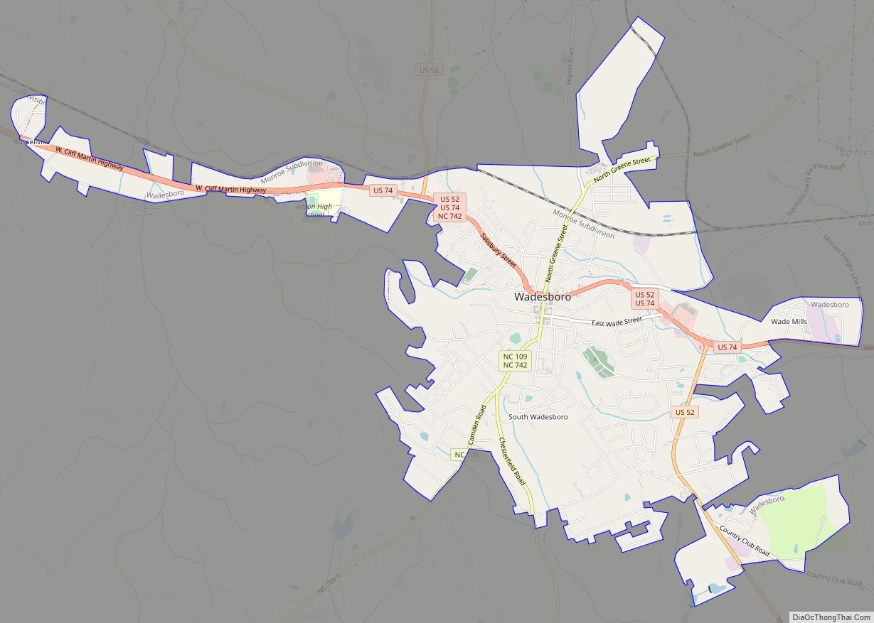
Wadesboro is a town and the county seat of Anson County, North Carolina, United States. The population was 5,049 at the 2020 census. The town was originally found in 1783 as New Town but changed by the North Carolina General Assembly to Wadesboro in 1787 to honor Colonel Thomas Wade, a native son, state legislator, … Read more

Map of Wade town, North Carolina

Map of Wade town, North Carolina

Wade is a town in Cumberland County, North Carolina, United States. The population was 556 at the 2010 census. Wade town overview: Name: Wade town LSAD Code: 43 LSAD Description: town (suffix) State: North Carolina County: Cumberland County Elevation: 138 ft (42 m) Total Area: 1.75 sq mi (4.54 km²) Land Area: 1.74 sq mi (4.51 km²) Water Area: 0.01 sq mi (0.02 km²) Total Population: … Read more

Map of Waco town, North Carolina

Map of Waco town, North Carolina

Waco is a town in Cleveland County, North Carolina, United States. The population was 321 at the 2010 census. Waco town overview: Name: Waco town LSAD Code: 43 LSAD Description: town (suffix) State: North Carolina County: Cleveland County Elevation: 925 ft (282 m) Total Area: 0.84 sq mi (2.18 km²) Land Area: 0.84 sq mi (2.17 km²) Water Area: 0.01 sq mi (0.01 km²) Total Population: … Read more

Map of Vass town

Map of Vass town

Vass is a town in Moore County, North Carolina, United States. The population was 720 at the 2010 census. Vass grew up along the railroad in the late 19th century. It was originally named Bynum and later Winder before being established as Vass in 1892. The town was incorporated in 1907. Vass town overview: Name: … Read more

Map of Waves CDP

Map of Waves CDP

Waves is an unincorporated community and census-designated place (CDP) in Dare County, North Carolina, United States. It is on Hatteras Island, part of North Carolina’s Outer Banks. As of the 2010 census it had a population of 134. Waves, along with Rodanthe and Salvo, are part of the settlement of Chicamacomico. The residents of Waves … Read more

Map of Watha town

Map of Watha town

Watha is a town in Pender County, North Carolina, United States. The population was 190 at the 2010 census. It is part of the Wilmington Metropolitan Statistical Area. Watha town overview: Name: Watha town LSAD Code: 43 LSAD Description: town (suffix) State: North Carolina County: Pender County Elevation: 59 ft (18 m) Total Area: 1.36 sq mi (3.52 km²) Land … Read more

Map of Washington city, North Carolina

Map of Washington city, North Carolina

Washington is a city in Beaufort County, North Carolina, United States, located on the northern bank of the Pamlico River. The population was 9,744 at the 2010 census. It is the county seat of Beaufort County. It is commonly known as “Original Washington” or “Little Washington” to distinguish it from Washington, D.C. The closest major … Read more

Map of Washington Park town, North Carolina

Map of Washington Park town, North Carolina

Washington Park is a town in Beaufort County, North Carolina, United States. The population was 451 at the 2010 Census. Washington Park town overview: Name: Washington Park town LSAD Code: 43 LSAD Description: town (suffix) State: North Carolina County: Beaufort County Elevation: 7 ft (2 m) Total Area: 0.26 sq mi (0.68 km²) Land Area: 0.26 sq mi (0.68 km²) Water Area: 0.00 sq mi … Read more

Map of Warsaw town, North Carolina

Map of Warsaw town, North Carolina

Warsaw is a town in Duplin County, North Carolina, United States. The population was 3,054 at the 2010 census. Warsaw town overview: Name: Warsaw town LSAD Code: 43 LSAD Description: town (suffix) State: North Carolina County: Duplin County Elevation: 154 ft (47 m) Total Area: 3.22 sq mi (8.33 km²) Land Area: 3.22 sq mi (8.33 km²) Water Area: 0.00 sq mi (0.00 km²) Total Population: … Read more

Map of Warrenton town, North Carolina

Map of Warrenton town, North Carolina

Warrenton is a town in, and the county seat of, Warren County, North Carolina, United States. The population was 862 at the 2010 census. Warrenton, now served by U.S. routes 158 and 401, was founded in 1779. It became one of the wealthiest towns in the state from 1840 to 1860, being a trading center … Read more

Map of Wanchese CDP

Map of Wanchese CDP

Wanchese (/ˈwɒntʃiːz/) is a census-designated place (CDP) on Roanoke Island in Dare County, North Carolina, United States. It was named after Wanchese, the last known ruler of the Roanoke Native American tribe encountered by English colonists in the sixteenth century. The population was 1,642 at the 2010 census. Today, Wanchese is the center of commercial … Read more

Map of Walstonburg town

Map of Walstonburg town

Walstonburg is a town in Greene County, North Carolina, United States. The population was 219 at the 2010 census. It is located north of Snow Hill on North Carolina Highway 91. The town is part of the Greenville Metropolitan Area. Walstonburg town overview: Name: Walstonburg town LSAD Code: 43 LSAD Description: town (suffix) State: North … Read more