Map of Whiteville city

Map of Whiteville city, North Carolina

Whiteville is a city in Columbus County, North Carolina, United States. The population was 5,394 at the 2010 census. It is the largest city in Columbus County and is the county seat. Whiteville city overview: Name: Whiteville city LSAD Code: 25 LSAD Description: city (suffix) State: North Carolina County: Columbus County Elevation: 101 ft (30 m) Total … Read more

Map of White Plains CDP, North Carolina

Map of White Plains CDP, North Carolina

White Plains is a census-designated place (CDP) in Surry County, North Carolina, United States. The population was 1,049 at the 2000 census. White Plains CDP overview: Name: White Plains CDP LSAD Code: 57 LSAD Description: CDP (suffix) State: North Carolina County: Surry County Elevation: 1,119 ft (341 m) Total Area: 4.03 sq mi (10.44 km²) Land Area: 4.01 sq mi (10.39 km²) Water … Read more

Map of White Oak CDP, North Carolina

Map of White Oak CDP, North Carolina

White Oak is a census-designated place (CDP) in Bladen County, North Carolina, United States. The population was 338 at the 2010 census. White Oak CDP overview: Name: White Oak CDP LSAD Code: 57 LSAD Description: CDP (suffix) State: North Carolina County: Bladen County Elevation: 59 ft (18 m) Total Area: 5.11 sq mi (13.23 km²) Land Area: 5.11 sq mi (13.23 km²) Water … Read more

Map of White Lake town

Map of White Lake town, North Carolina

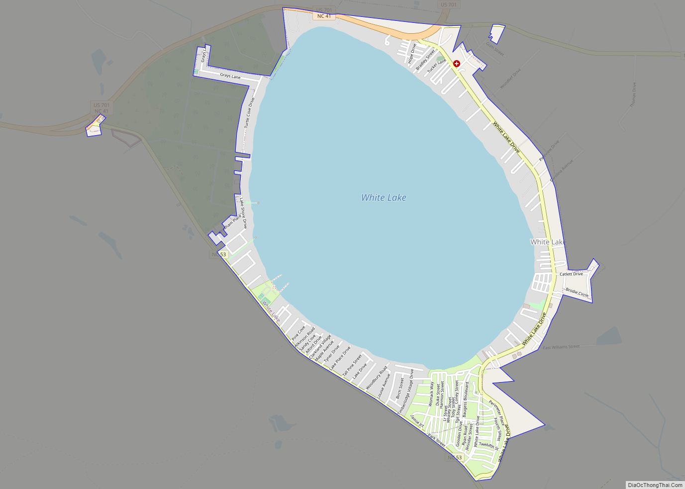
White Lake is a town in Bladen County, North Carolina, United States. The population was 802 at the 2010 census, up from 529 in 2000. White Lake town overview: Name: White Lake town LSAD Code: 43 LSAD Description: town (suffix) State: North Carolina County: Bladen County Elevation: 69 ft (21 m) Total Area: 2.66 sq mi (6.89 km²) Land Area: … Read more

Map of Whitakers town

Map of Whitakers town

Whitakers /ˈhwɪtəkərz/ is a town in Edgecombe and Nash Counties in the U.S. state of North Carolina. It is divided between the two counties by railroad tracks and is the northernmost town in the two counties. It is part of the Rocky Mount, North Carolina Metropolitan Statistical Area. The population was 744 in 2010. Whitakers … Read more

Map of Whispering Pines village, North Carolina

Map of Whispering Pines village, North Carolina

Whispering Pines is a village in Moore County, North Carolina, United States. The population was 2,928 at the 2010 census. Whispering Pines village overview: Name: Whispering Pines village LSAD Code: 47 LSAD Description: village (suffix) State: North Carolina County: Moore County Elevation: 371 ft (113 m) Total Area: 4.42 sq mi (11.44 km²) Land Area: 3.79 sq mi (9.82 km²) Water Area: 0.63 sq mi … Read more

Map of Westport CDP, North Carolina

Map of Westport CDP, North Carolina

Westport is an unincorporated community and census-designated place (CDP) located in Lincoln County, North Carolina, United States. The population of the CDP was 4,026 at the 2010 census, up from 2,006 at the 2000 census. The community’s name comes from its location on the west side of Lake Norman. Westport CDP overview: Name: Westport CDP … Read more

Map of West Marion CDP

Map of West Marion CDP

West Marion is a census-designated place (CDP) in McDowell County, North Carolina, United States, adjacent to the city of Marion, the county seat. The population was 1,348 at the 2010 census, down from 1,556 in 2000. West Marion CDP overview: Name: West Marion CDP LSAD Code: 57 LSAD Description: CDP (suffix) State: North Carolina County: … Read more

Map of West Jefferson town, North Carolina

Map of West Jefferson town, North Carolina

West Jefferson is a town in Ashe County, North Carolina, United States. The population was 1,299 at the 2010 census. West Jefferson town overview: Name: West Jefferson town LSAD Code: 43 LSAD Description: town (suffix) State: North Carolina County: Ashe County Elevation: 3,000 ft (908 m) Total Area: 2.15 sq mi (5.58 km²) Land Area: 2.15 sq mi (5.57 km²) Water Area: 0.00 sq mi … Read more

Map of West Canton CDP

Map of West Canton CDP

West Canton is an unincorporated community and census-designated place (CDP) in Haywood County, North Carolina, United States. The population was 1,247 at the 2010 census. It is part of the Asheville Metropolitan Statistical Area. West Canton CDP overview: Name: West Canton CDP LSAD Code: 57 LSAD Description: CDP (suffix) State: North Carolina County: Haywood County … Read more

Map of Williamston town, North Carolina

Map of Williamston town, North Carolina

Williamston is a town and the county seat of Martin County, North Carolina, United States. The population was 5,511 at the 2010 census. It is located in North Carolina’s Inner Banks region. The closest major city is Greenville, approximately 28 mi to the southwest. Williamston town overview: Name: Williamston town LSAD Code: 43 LSAD Description: town … Read more

Map of Wilkesboro town

Map of Wilkesboro town

Wilkesboro is a town in and the county seat of Wilkes County, North Carolina, United States. The population was 3,687 at the 2020 census. The town is located along the south bank of the Yadkin River, directly opposite the town of North Wilkesboro. Wilkesboro is a Small Town Main Street community and has recently revitalized … Read more