Map of Clifton village, Ohio
Clifton is a village in Clark and Greene counties in the U.S. state of Ohio and is home to the Clifton Mill, one of the largest water-powered grist mills still in existence. The population was 152 at the 2010 census. The Greene County portion of Clifton is part of the Dayton Metropolitan Statistical Area, while ... Read more
Map of Clifton village, Ohio
Map of Cleves village
Cleves is a village in Miami Township, Hamilton County, Ohio, United States, located along the Ohio River. The population was 3,414 at the 2020 census. Founded in 1818, it is named for John Cleves Symmes who lived here, laid out the original town site, and sold lots. Cleves village overview: Name: Cleves village LSAD Code: ... Read more
Map of Cleves village
Map of Cleveland Heights city
Cleveland Heights is a city in Cuyahoga County, Ohio, United States, and one of Cleveland’s historical streetcar suburbs. The city’s population was 45,312 at the 2020 census. As of the 2010 census, Cleveland Heights was ranked the 8th largest city by population in the Greater Cleveland area and ranked 20th in Ohio. It was founded ... Read more
Map of Cleveland Heights city
Map of Clayton city, Ohio
Clayton is a city in Montgomery county in the U.S. state of Ohio. The population was 13,310 at the 2020 United States census. A suburb of Dayton. It is part of the Dayton Metropolitan Statistical Area. The city was named after John Clayton, a War of 1812 veteran. Clayton city overview: Name: Clayton city LSAD ... Read more
Map of Clayton city, Ohio
Map of Clay Center village, Ohio
Clay Center is a village in Ottawa County, Ohio, United States. The population was 276 at the 2010 census. Clay Center village overview: Name: Clay Center village LSAD Code: 47 LSAD Description: village (suffix) State: Ohio County: Ottawa County Elevation: 610 ft (186 m) Total Area: 1.01 sq mi (2.62 km²) Land Area: 1.01 sq mi (2.62 km²) Water Area: 0.00 sq mi (0.00 km²) Total ... Read more
Map of Clay Center village, Ohio
Map of Clarktown CDP
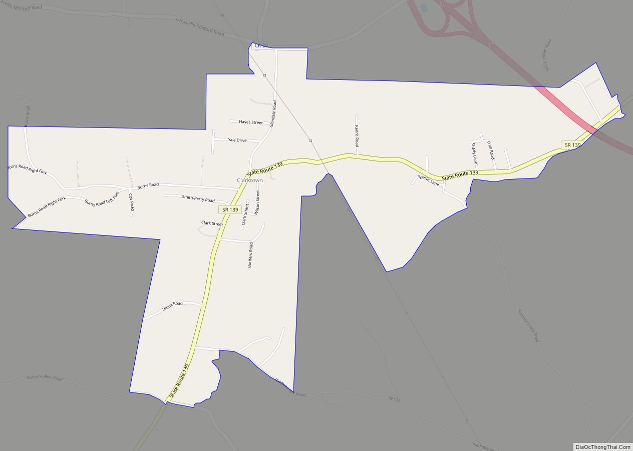
Clarktown is an unincorporated community and census-designated place in southeastern Jefferson Township, Scioto County, Ohio, United States. As of the 2010 census it had a population of 958. Located at the intersection of State Route 139 with Burns Hollow and Blue Run roads, it lies 5 miles (8 km) southeast of Lucasville and 10 miles (16 km) ... Read more
Map of Clarktown CDP
Map of Clarksville village, Ohio
Clarksville is a village in Clinton County, Ohio, United States. The population was 548 at the 2010 census. It is served by the Clinton Massie branch of the Wilmington Public Library of Clinton County. Clarksville village overview: Name: Clarksville village LSAD Code: 47 LSAD Description: village (suffix) State: Ohio County: Clinton County Elevation: 820 ft (250 m) ... Read more
Map of Clarksville village, Ohio
Map of Clarksburg village, Ohio
Clarksburg is a village in Ross County, Ohio, United States. The population was 409 at the 2020 census. Clarksburg village overview: Name: Clarksburg village LSAD Code: 47 LSAD Description: village (suffix) State: Ohio County: Ross County Elevation: 771 ft (235 m) Total Area: 0.16 sq mi (0.41 km²) Land Area: 0.16 sq mi (0.41 km²) Water Area: 0.00 sq mi (0.00 km²) Total Population: 409 Population ... Read more
Map of Clarksburg village, Ohio
Map of Clarington village
Clarington is a village in Monroe County, Ohio, United States, along the Ohio River. The population was 280 at the 2020 census. Clarington village overview: Name: Clarington village LSAD Code: 47 LSAD Description: village (suffix) State: Ohio County: Monroe County Elevation: 633 ft (193 m) Total Area: 1.24 sq mi (3.22 km²) Land Area: 1.14 sq mi (2.96 km²) Water Area: 0.10 sq mi (0.26 km²) ... Read more
Map of Clarington village
Map of Coldwater village, Ohio
Coldwater is a village in Mercer County, Ohio, United States. The population was 4,427 at the 2010 census. Coldwater village overview: Name: Coldwater village LSAD Code: 47 LSAD Description: village (suffix) State: Ohio County: Mercer County Elevation: 909 ft (277 m) Total Area: 1.99 sq mi (5.16 km²) Land Area: 1.94 sq mi (5.02 km²) Water Area: 0.05 sq mi (0.13 km²) Total Population: 4,774 Population ... Read more
Map of Coldwater village, Ohio
Map of Coldstream CDP, Ohio
Coldstream is a census-designated place (CDP) in southern Anderson Township, Hamilton County, Ohio, United States. The population was 1,322 at the 2020 census. Coldstream CDP overview: Name: Coldstream CDP LSAD Code: 57 LSAD Description: CDP (suffix) State: Ohio County: Hamilton County Elevation: 822 ft (251 m) Total Area: 2.87 sq mi (7.42 km²) Land Area: 2.79 sq mi (7.21 km²) Water Area: 0.08 sq mi ... Read more
Map of Coldstream CDP, Ohio
Map of Coalton village, Ohio
Coalton is a village in Jackson County, Ohio, United States. The population was 479 at the 2010 census. The village derives its name from Coal Township. Coalton village overview: Name: Coalton village LSAD Code: 47 LSAD Description: village (suffix) State: Ohio County: Jackson County Elevation: 692 ft (211 m) Total Area: 0.56 sq mi (1.44 km²) Land Area: 0.56 sq mi (1.44 km²) ... Read more
Map of Coalton village, Ohio