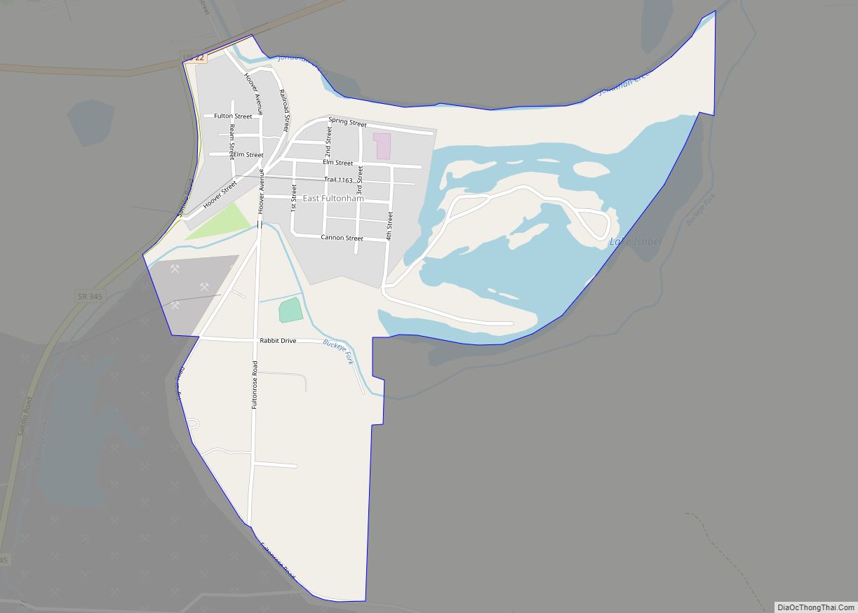
East Fultonham is a census-designated place in central Newton Township, Muskingum County, Ohio, United States. It has a post office with the ZIP code 43735. It is located along U.S. Route 22 a short distance east of the village of Fultonham. East Fultonham had its start when the railroad was extended to that point. The ... Read more
Ohio Cities and Places
Eaton is a city in, and the county seat of Preble County, Ohio, United States, approximately 24 mi (38 km) west of Dayton. The population was 8,375 at the 2020 census, down 0.4% from the population of 8,407 at the 2010 census. Eaton’s sister city is Rödental bei Coburg (Germany). Eaton city overview: Name: Eaton city LSAD ... Read more
Eaton Estates is an unincorporated community and census-designated place (CDP) in Lorain County, Ohio, United States. The population was 1,222 at the 2010 census, down from 1,409 at the 2000 census. Eaton Estates CDP overview: Name: Eaton Estates CDP LSAD Code: 57 LSAD Description: CDP (suffix) State: Ohio County: Lorain County Elevation: 801 ft (244 m) Total ... Read more
Elmwood Place is a village in Hamilton County, Ohio, United States. The population was 2,087 at the 2020 census. Except for a small portion which touches neighboring St. Bernard, Elmwood Place is nearly surrounded by the city of Cincinnati. Elmwood Place village overview: Name: Elmwood Place village LSAD Code: 47 LSAD Description: village (suffix) State: ... Read more
Elmore is a village in Ottawa and Sandusky counties in the U.S. state of Ohio. The population was 1,410 at the 2010 census. The Ottawa County portion of Elmore is part of the Toledo Metropolitan Statistical Area, while the Sandusky County portion is part of the Fremont Micropolitan Statistical Area. Elmore village overview: Name: Elmore ... Read more
Elizabethtown is a census-designated place (CDP) in Whitewater Township, Hamilton County, Ohio, United States. The population was 323 at the 2020 census. Elizabethtown CDP overview: Name: Elizabethtown CDP LSAD Code: 57 LSAD Description: CDP (suffix) State: Ohio County: Hamilton County Elevation: 491 ft (150 m) Total Area: 0.90 sq mi (2.34 km²) Land Area: 0.89 sq mi (2.30 km²) Water Area: 0.01 sq mi (0.04 km²) ... Read more
Elida is a village in Allen County, Ohio, United States. The population was 1,923 at the 2020 census. It is included in the Lima, Ohio Metropolitan Statistical Area. Elida village overview: Name: Elida village LSAD Code: 47 LSAD Description: village (suffix) State: Ohio County: Allen County Elevation: 801 ft (244 m) Total Area: 1.17 sq mi (3.02 km²) Land Area: ... Read more
Elgin is a village in Van Wert County, Ohio, United States. The population was 57 at the 2010 census. It is included within the Van Wert, Ohio Micropolitan Statistical Area. Elgin village overview: Name: Elgin village LSAD Code: 47 LSAD Description: village (suffix) State: Ohio County: Van Wert County Elevation: 814 ft (248 m) Total Area: 0.22 sq mi ... Read more
Eldorado is a village in Preble County, Ohio, United States. The population was 509 at the 2010 census. It is part of the Dayton Metropolitan Statistical Area. Eldorado village overview: Name: Eldorado village LSAD Code: 47 LSAD Description: village (suffix) State: Ohio County: Preble County Elevation: 1,135 ft (346 m) Total Area: 0.23 sq mi (0.59 km²) Land Area: 0.23 sq mi ... Read more
Edon is a village in Williams County, Ohio, United States. The population was 834 at the 2010 census. Edon village overview: Name: Edon village LSAD Code: 47 LSAD Description: village (suffix) State: Ohio County: Williams County Elevation: 899 ft (274 m) Total Area: 1.10 sq mi (2.84 km²) Land Area: 1.10 sq mi (2.84 km²) Water Area: 0.00 sq mi (0.00 km²) Total Population: 796 Population ... Read more
Edison is a village in Morrow County, Ohio, United States. The population was 437 at the 2010 census. Edison is adjacent to and west of Mount Gilead, Ohio, the county seat. Edison village overview: Name: Edison village LSAD Code: 47 LSAD Description: village (suffix) State: Ohio County: Morrow County Elevation: 1,063 ft (324 m) Total Area: 0.29 sq mi ... Read more
Edgewood is a census-designated place (CDP) in Ashtabula County, Ohio, United States. The population was 4,185 at the 2020 census. Edgewood CDP overview: Name: Edgewood CDP LSAD Code: 57 LSAD Description: CDP (suffix) State: Ohio County: Ashtabula County Elevation: 682 ft (208 m) Total Area: 6.85 sq mi (17.73 km²) Land Area: 6.84 sq mi (17.71 km²) Water Area: 0.01 sq mi (0.02 km²) Total Population: ... Read more