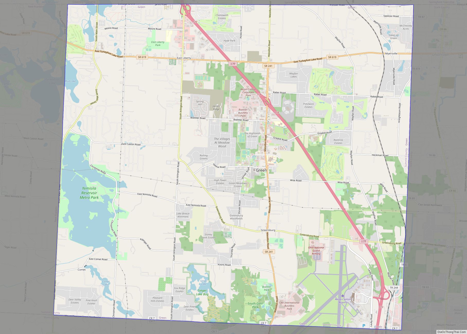
Map of Green Springs village
Green Springs is a village in Sandusky and Seneca counties in the U.S. state of Ohio. The population was 1,368 at the 2010 census. Its “claim to fame” is Mineral Springs, the largest natural sulfur spring in the world. Elmwood at the Springs Healthcare Center, formerly St. Francis Health Care Centre, is located there. Green ... Read more
Map of Green Springs village
Map of Green Meadows CDP
Green Meadows is a census-designated place (CDP) in Mad River Township, Clark County, Ohio, United States, on the west side of Enon. The population was 2,327 at the 2010 census. It is part of the Springfield, Ohio Metropolitan Statistical Area. Green Meadows CDP overview: Name: Green Meadows CDP LSAD Code: 57 LSAD Description: CDP (suffix) ... Read more
Map of Green Meadows CDP
Map of Green Camp village
Green Camp is a village in Marion County, Ohio, United States, standing at the confluence of the Scioto and Little Scioto Rivers. The population was 374 at the 2010 census. Green Camp is served by Elgin Local School District. Green Camp village overview: Name: Green Camp village LSAD Code: 47 LSAD Description: village (suffix) State: ... Read more
Map of Green Camp village
Map of Graysville village, Ohio
Graysville is a village in Monroe County, Ohio, United States. The population was 70 at the 2020 census. Graysville village overview: Name: Graysville village LSAD Code: 47 LSAD Description: village (suffix) State: Ohio County: Monroe County Elevation: 1,102 ft (336 m) Total Area: 1.01 sq mi (2.61 km²) Land Area: 1.01 sq mi (2.61 km²) Water Area: 0.00 sq mi (0.00 km²) Total Population: 70 Population ... Read more
Map of Graysville village, Ohio
Map of Greenwich village, Ohio
Greenwich is a village in Huron County, Ohio, United States. The population was 1,476 at the 2010 census. It is served by a branch of the Willard Memorial Library. Greenwich village overview: Name: Greenwich village LSAD Code: 47 LSAD Description: village (suffix) State: Ohio County: Huron County Elevation: 1,030 ft (314 m) Total Area: 1.56 sq mi (4.03 km²) Land ... Read more
Map of Greenwich village, Ohio
Map of Hannibal CDP, Ohio
Hannibal is a census-designated place in eastern Ohio Township, Monroe County, Ohio, United States. It has a post office with the ZIP code 43931. In the 2020 Census, it had a population of 314. Hannibal lies along Ohio State Route 7, near an intersection with Ohio State Route 536. It is located along the Ohio ... Read more
Map of Hannibal CDP, Ohio
Map of Hanging Rock village
Hanging Rock is a village in Lawrence County, Ohio, United States, along the Ohio River. The population was 221 at the 2010 census. It is regularly labeled a speed trap; the village earned revenues of $109,186 in mayor’s court receipts in 2000, compared with $3,106 in property taxes. Hanging Rock is a part of the ... Read more
Map of Hanging Rock village
Map of Hamler village
Hamler is a village in Henry County, Ohio, United States. The population was 576 at the 2010 census. Hamler is a rural farming community in Northwest Ohio about 40 miles (64 km) southwest of Toledo, Ohio. It is located at the intersection of the former Baltimore and Ohio (B&O) and former Detroit, Toledo and Ironton (D, ... Read more
Map of Hamler village
Map of Hamilton city, Ohio
Hamilton is a city in and the county seat of Butler County, Ohio, United States. Located 20 miles (32 km) north of Cincinnati, Hamilton is the second largest city in the Greater Cincinnati area and the 10th largest city in Ohio. The population was 63,399 at the 2020 census. Hamilton is governed under a council-manager form ... Read more
Map of Hamilton city, Ohio
Map of Hamersville village
Hamersville (/ˈheɪmərzvɪl/ HAY-mərz-vil is a village in Clark Township, Brown County, Ohio, United States. The population was 546 at the 2010 census. Hamersville village overview: Name: Hamersville village LSAD Code: 47 LSAD Description: village (suffix) State: Ohio County: Brown County Elevation: 968 ft (295 m) Total Area: 0.44 sq mi (1.13 km²) Land Area: 0.44 sq mi (1.13 km²) Water Area: 0.00 sq mi (0.00 km²) ... Read more
Map of Hamersville village
Map of Hamden village
Hamden is a village in Vinton County, Ohio, United States. The population was 879 at the 2010 census. Hamden village overview: Name: Hamden village LSAD Code: 47 LSAD Description: village (suffix) State: Ohio County: Vinton County Elevation: 722 ft (220 m) Total Area: 0.55 sq mi (1.43 km²) Land Area: 0.55 sq mi (1.42 km²) Water Area: 0.00 sq mi (0.00 km²) Total Population: 727 Population ... Read more
Map of Hamden village
Map of Grover Hill village
Grover Hill is a village in Paulding County, Ohio, United States. The population was 402 at the 2010 census. The village is named after President Grover Cleveland. Grover Hill village overview: Name: Grover Hill village LSAD Code: 47 LSAD Description: village (suffix) State: Ohio County: Paulding County Elevation: 722 ft (220 m) Total Area: 0.28 sq mi (0.71 km²) Land ... Read more
Map of Grover Hill village