Map of Holiday City village
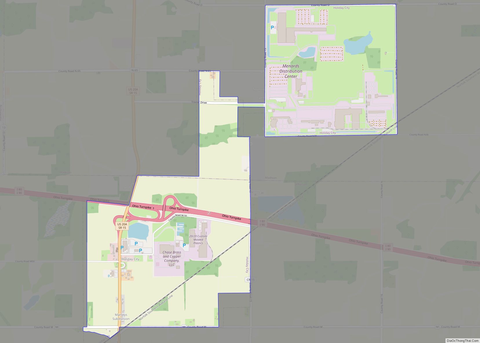
Holiday City is a village in Williams County, Ohio, United States. The population was 52 at the 2010 census. Holiday City village overview: Name: Holiday City village LSAD Code: 47 LSAD Description: village (suffix) State: Ohio County: Williams County Elevation: 899 ft (274 m) Total Area: 2.57 sq mi (6.67 km²) Land Area: 2.55 sq mi (6.62 km²) Water Area: 0.02 sq mi (0.05 km²) Total ... Read more
Map of Holiday City village
Map of Holgate village
Holgate is a village in Henry County, Ohio, United States. The population was 1,109 at the 2010 census. Holgate village overview: Name: Holgate village LSAD Code: 47 LSAD Description: village (suffix) State: Ohio County: Henry County Elevation: 712 ft (217 m) Total Area: 1.15 sq mi (2.99 km²) Land Area: 1.15 sq mi (2.99 km²) Water Area: 0.00 sq mi (0.00 km²) Total Population: 1,061 Population ... Read more
Map of Holgate village
Map of Hockingport CDP
Hockingport is a census-designated place in southeastern Troy Township, Athens County, Ohio, United States. As of the 2020 census it had a population of 205. It has a post office with the ZIP code 45739. It is located at the intersection of State Routes 124 and 144. It lies on the Ohio River, located below ... Read more
Map of Hockingport CDP
Map of Hiram village, Ohio
Hiram is a village in northern Portage County, Ohio, United States. It was formed from portions of Hiram Township in the Connecticut Western Reserve. The population was 996 at the 2020 census. Hiram is part of the Akron metropolitan area. It is the home of Hiram College, a small, private liberal arts college. Hiram village ... Read more
Map of Hiram village, Ohio
Map of Hilltop CDP, Ohio
Hilltop is an unincorporated community and census-designated place in central Weathersfield Township, Trumbull County, Ohio, United States. The population was 658 at the 2020 census. It is part of the Youngstown–Warren metropolitan area. Hilltop CDP overview: Name: Hilltop CDP LSAD Code: 57 LSAD Description: CDP (suffix) State: Ohio County: Trumbull County Elevation: 978 ft (298 m) Total ... Read more
Map of Hilltop CDP, Ohio
Map of Hillsboro city, Ohio
Hillsboro is a city in and the county seat of Highland County, Ohio, United States approximately 35 mi (56 km) west of Chillicothe, and 50 miles east of Cincinnati. The population was 6,605 at the 2010 census. Hillsboro city overview: Name: Hillsboro city LSAD Code: 25 LSAD Description: city (suffix) State: Ohio County: Highland County Elevation: 1,122 ft ... Read more
Map of Hillsboro city, Ohio
Map of Hills and Dales village, Ohio
Hills and Dales is a village in Stark County, Ohio, United States. It is an affluent suburban enclave near Canton. Hills and Dales is part of the Canton–Massillon Metropolitan Statistical Area. The population was 221 at the 2010 census. The name Hills and Dales was coined by property developers for the terrain of the town ... Read more
Map of Hills and Dales village, Ohio
Map of Hubbard city, Ohio
Hubbard is a city in southeastern Trumbull County, Ohio, United States. It is formed from part of Hubbard Township, which was formed from the Connecticut Western Reserve. The population was 7,636 at the 2020 census. It is a suburb of the Youngstown–Warren metropolitan area. Hubbard city overview: Name: Hubbard city LSAD Code: 25 LSAD Description: ... Read more
Map of Hubbard city, Ohio
Map of Hoytville village
Hoytville is a village in Wood County, Ohio, United States. The population was 303 at the 2010 census. Hoytville village overview: Name: Hoytville village LSAD Code: 47 LSAD Description: village (suffix) State: Ohio County: Wood County Elevation: 709 ft (216 m) Total Area: 0.75 sq mi (1.95 km²) Land Area: 0.74 sq mi (1.92 km²) Water Area: 0.01 sq mi (0.03 km²) Total Population: 220 Population ... Read more
Map of Hoytville village
Map of Howland Center CDP
Howland Center is an unincorporated community and census-designated place in south-central Trumbull County, Ohio, United States. The population was 6,351 at the 2020 census. A suburb consisting of unincorporated urban portions of Howland Township, it is part of the Youngstown–Warren metropolitan area. Howland Center CDP overview: Name: Howland Center CDP LSAD Code: 57 LSAD Description: ... Read more
Map of Howland Center CDP
Map of Howard CDP, Ohio
Howard is a census-designated place (CDP) in southern Howard Township, Knox County, Ohio, United States. As of the 2010 census it had a population of 242. The United States Postal Service has assigned Howard the ZIP Code 43028. The community lies along U.S. Route 36. Howard CDP overview: Name: Howard CDP LSAD Code: 57 LSAD ... Read more
Map of Howard CDP, Ohio
Map of Hopedale village, Ohio
Hopedale is a village in Harrison County, Ohio, United States. The population was 920 at the 2020 census. Hopedale village overview: Name: Hopedale village LSAD Code: 47 LSAD Description: village (suffix) State: Ohio County: Harrison County Incorporated: April 1, 1860 Elevation: 1,158 ft (353 m) Total Area: 1.17 sq mi (3.04 km²) Land Area: 1.17 sq mi (3.04 km²) Water Area: 0.00 sq mi (0.00 km²) ... Read more
Map of Hopedale village, Ohio