Map of New Marshfield CDP

Map of New Marshfield CDP

New Marshfield is a census-designated place in central Waterloo Township, Athens County, Ohio, United States. The population was 316 at the 2020 census. It has a post office with the ZIP code 45766. It is located along State Route 56 west of the county seat of Athens. New Marshfield CDP overview: Name: New Marshfield CDP … Read more

Map of New Madison village

Map of New Madison village

New Madison is a village in Darke County, Ohio, United States. The population was 892 at the 2010 census. New Madison village overview: Name: New Madison village LSAD Code: 47 LSAD Description: village (suffix) State: Ohio County: Darke County Elevation: 1,111 ft (339 m) Total Area: 0.47 sq mi (1.23 km²) Land Area: 0.47 sq mi (1.23 km²) Water Area: 0.00 sq mi (0.00 km²) Total … Read more

Map of New Straitsville village

Map of New Straitsville village

New Straitsville is a village in Perry County, Ohio, United States. The population was 652 at the 2020 census. New Straitsville village overview: Name: New Straitsville village LSAD Code: 47 LSAD Description: village (suffix) State: Ohio County: Perry County Elevation: 787 ft (240 m) Total Area: 1.30 sq mi (3.37 km²) Land Area: 1.30 sq mi (3.37 km²) Water Area: 0.00 sq mi (0.00 km²) Total … Read more

Map of New Riegel village

Map of New Riegel village

New Riegel is a village in Seneca County, Ohio, United States. The 2020 census enumerated 286 residents at that time. New Riegel village overview: Name: New Riegel village LSAD Code: 47 LSAD Description: village (suffix) State: Ohio County: Seneca County Elevation: 830 ft (253 m) Total Area: 0.20 sq mi (0.52 km²) Land Area: 0.20 sq mi (0.52 km²) Water Area: 0.00 sq mi (0.00 km²) … Read more

Map of New Richmond village, Ohio

Map of New Richmond village, Ohio

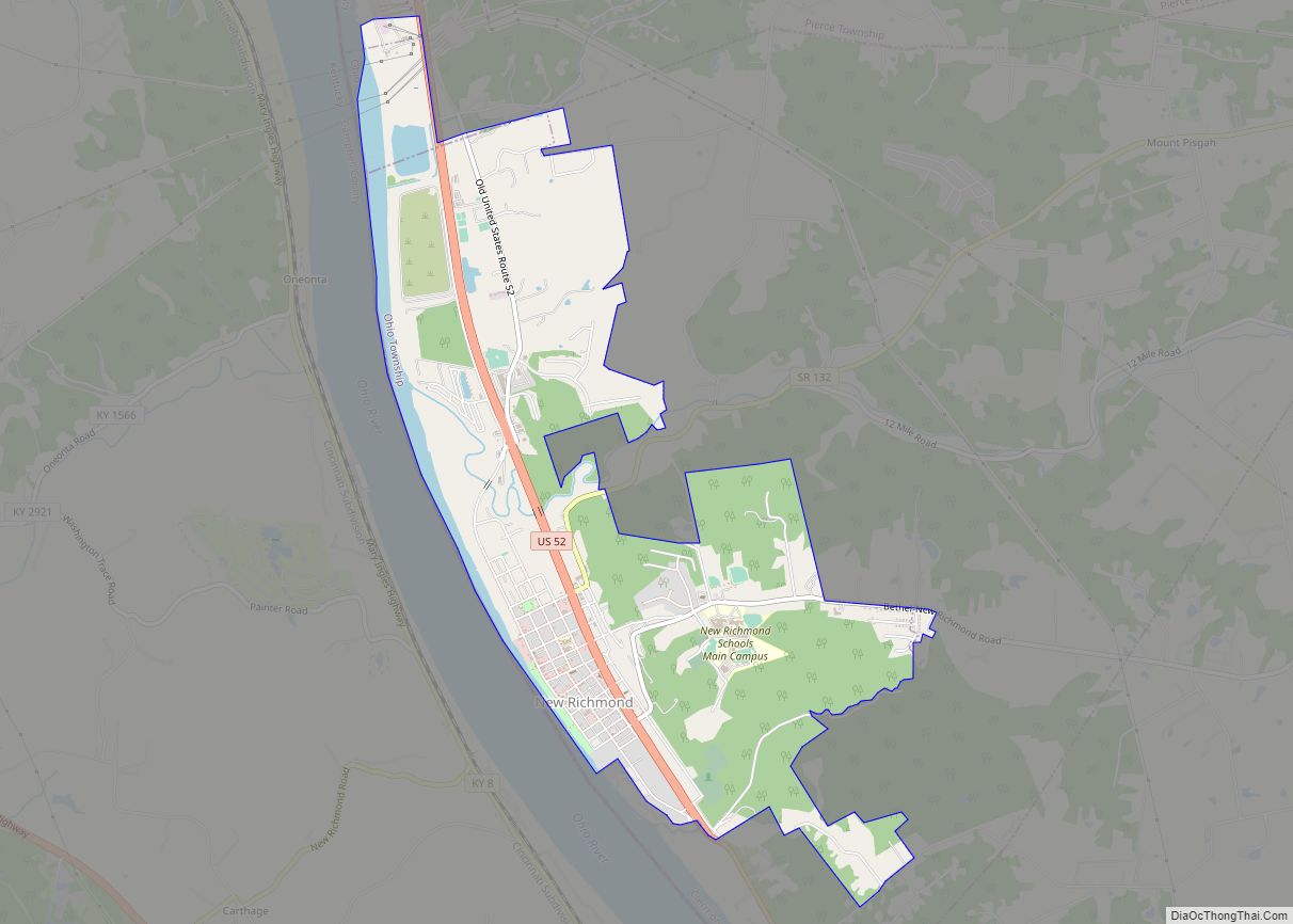
New Richmond, also known as New Richmond on the Ohio, is a village in Ohio and Pierce townships in Clermont County, Ohio, United States, founded in 1814, along the Ohio River. The population was 2,727 at the 2020 census. New Richmond village overview: Name: New Richmond village LSAD Code: 47 LSAD Description: village (suffix) State: … Read more

Map of New Pittsburg CDP

Map of New Pittsburg CDP

New Pittsburg is a census-designated place in Wayne County, in the U.S. state of Ohio. It lies northwest of Wooster, Ohio, along U.S. Route 250 New Pittsburg CDP overview: Name: New Pittsburg CDP LSAD Code: 57 LSAD Description: CDP (suffix) State: Ohio County: Wayne County FIPS code: 3955244 Online Interactive Map New Pittsburg online map. … Read more

Map of New Philadelphia city

Map of New Philadelphia city, Ohio

New Philadelphia is a city in and the county seat of Tuscarawas County, Ohio, United States. The county’s largest city, New Philadelphia lies along the Tuscarawas River. The population was 17,677 at the 2020 census. It is a principal city in the New Philadelphia–Dover micropolitan area, approximately 71 miles (114 km) south of Cleveland. In 1772, … Read more

Map of New Paris village, Ohio

Map of New Paris village, Ohio

New Paris is a village in Preble County, Ohio, United States. The population was 1,629 at the 2010 census. It is part of the Dayton Metropolitan Statistical Area. New Paris village overview: Name: New Paris village LSAD Code: 47 LSAD Description: village (suffix) State: Ohio County: Preble County Elevation: 1,037 ft (316 m) Total Area: 0.76 sq mi (1.96 km²) … Read more

Map of New Middletown village, Ohio

Map of New Middletown village, Ohio

New Middletown is a village in southeastern Mahoning County, Ohio, United States. The population was 1,507 at the 2020 census. It is part of the Youngstown–Warren metropolitan area. New Middletown village overview: Name: New Middletown village LSAD Code: 47 LSAD Description: village (suffix) State: Ohio County: Mahoning County Elevation: 1,253 ft (382 m) Total Area: 0.88 sq mi (2.27 km²) … Read more

Map of Newton Falls village

Map of Newton Falls village

Newton Falls is a village in southwestern Trumbull County, Ohio, United States. The population was 4,557 at the 2020 census. It is part of the Youngstown–Warren metropolitan area. The city takes its name from the two sets of waterfalls within the village, each on different branches of the Mahoning River. The city is known for … Read more

Map of Newport CDP, Ohio

Map of Newport CDP, Ohio

Newport is a census-designated place in eastern Newport Township, Washington County, Ohio, United States. It has a post office with the ZIP code 45768. Newport lies along the Ohio River several miles above the county seat of Marietta. Today its main street is designated as State Route 7. Newport is the location of the Carpenter … Read more

Map of Newcomerstown village

Map of Newcomerstown village

Newcomerstown is a village in Tuscarawas County, Ohio, United States, 85 miles (137 km) east-northeast of Columbus. In the late 1770s, this was the largest Delaware Indian village on the Tuscarawas River, with 700 residents. Chief Newcomer (Netawatwes) was the leader of the western Delawares here, and they called the village Gekelmukpechunk. Early French traders and … Read more