Map of Stone Creek village

Map of Stone Creek village

Stone Creek is a village in Tuscarawas County, Ohio, United States. The population was 153 at the 2020 census. Stone Creek has a youth baseball league called the Stone Creek Panthers, based on the name of mascot of the former high school. Stone Creek village overview: Name: Stone Creek village LSAD Code: 47 LSAD Description: … Read more

Map of Stockport village, Ohio

Map of Stockport village, Ohio

Stockport is a village in Morgan County, Ohio, United States, along the Muskingum River. The population was 483 at the 2020 census. Stockport village overview: Name: Stockport village LSAD Code: 47 LSAD Description: village (suffix) State: Ohio County: Morgan County Elevation: 692 ft (211 m) Total Area: 0.33 sq mi (0.85 km²) Land Area: 0.33 sq mi (0.85 km²) Water Area: 0.00 sq mi (0.00 km²) … Read more

Map of Stockdale CDP

Map of Stockdale CDP, Ohio

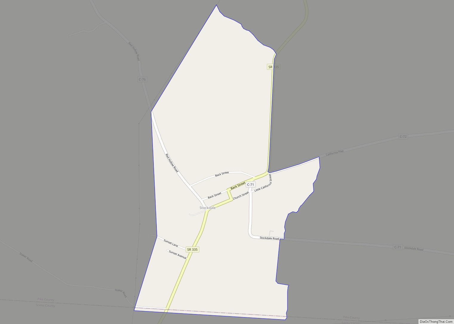
Stockdale is an unincorporated community and census-designated place in southern Marion Township, Pike County, Ohio, United States. Stockdale has a post office with the ZIP code 45683. Stockdale is served by the Minford Telephone Company and Eastern Local Schools. Baseball Hall of Famer Branch Rickey was born in Stockdale in 1881. IndyCar Driver Zach Veach … Read more

Map of Summitville village, Ohio

Map of Summitville village, Ohio

Summitville is a village in southwestern Columbiana County, Ohio, United States. The population was 110 at the 2020 census. It is part of the Salem micropolitan area, 27 miles (43 km) miles southeast of Canton and 32 miles (51 km) southwest of Youngstown. Summitville village overview: Name: Summitville village LSAD Code: 47 LSAD Description: village (suffix) State: … Read more

Map of Summerside CDP

Map of Summerside CDP

Summerside is a census-designated place (CDP) in Union Township, Clermont County, Ohio, United States. Its population was 4,941 as of the 2020 census. Summerside CDP overview: Name: Summerside CDP LSAD Code: 57 LSAD Description: CDP (suffix) State: Ohio County: Clermont County Elevation: 879 ft (268 m) Total Area: 2.07 sq mi (5.36 km²) Land Area: 2.06 sq mi (5.34 km²) Water Area: 0.01 sq mi … Read more

Map of Summerfield village, Ohio

Map of Summerfield village, Ohio

Summerfield is a village in Noble County, Ohio, United States. The population was 237 at the 2020 census. Summerfield village overview: Name: Summerfield village LSAD Code: 47 LSAD Description: village (suffix) State: Ohio County: Noble County Elevation: 1,201 ft (366 m) Total Area: 0.37 sq mi (0.96 km²) Land Area: 0.37 sq mi (0.96 km²) Water Area: 0.00 sq mi (0.00 km²) Total Population: 237 Population … Read more

Map of Sulphur Springs CDP, Ohio

Map of Sulphur Springs CDP, Ohio

Sulphur Springs is a census-designated place (CDP) in eastern Liberty Township, Crawford County, Ohio, United States. As of the 2010 census it had a population of 194. It has a post office with the ZIP code 44881. It is located along State Route 98 northeast of the city of Bucyrus, the county seat of Crawford … Read more

Map of Sugarcreek village

Map of Sugarcreek village, Ohio

Sugarcreek is a village in Tuscarawas County, Ohio, United States. The population was 2,373 at the 2020 census. It is known as “The Little Switzerland of Ohio.” Located in Ohio’s Amish Country, the village is part of a large regional tourism industry. In the center of town stands one of the world’s largest cuckoo clocks, … Read more

Map of Sugar Grove village, Ohio

Map of Sugar Grove village, Ohio

Sugar Grove is a village in Fairfield County, Ohio, United States. The population was 426 at the 2010 census. Sugar Grove village overview: Name: Sugar Grove village LSAD Code: 47 LSAD Description: village (suffix) State: Ohio County: Fairfield County Elevation: 781 ft (238 m) Total Area: 0.32 sq mi (0.83 km²) Land Area: 0.31 sq mi (0.80 km²) Water Area: 0.01 sq mi (0.03 km²) Total … Read more

Map of Sugar Bush Knolls village

Map of Sugar Bush Knolls village

Sugar Bush Knolls is a village in western Portage County, Ohio, United States. The population was 217 at the 2020 census. It was formed from portions of Streetsboro and Franklin townships in 1964. The community has the highest median household income in the Akron metropolitan area. Sugar Bush Knolls village overview: Name: Sugar Bush Knolls … Read more

Map of Stryker village, Ohio

Map of Stryker village, Ohio

Stryker is a village in Williams County, Ohio, United States. The population was 1,335 at the 2010 census. Stryker village overview: Name: Stryker village LSAD Code: 47 LSAD Description: village (suffix) State: Ohio County: Williams County Elevation: 712 ft (217 m) Total Area: 0.90 sq mi (2.32 km²) Land Area: 0.90 sq mi (2.32 km²) Water Area: 0.00 sq mi (0.00 km²) Total Population: 1,259 Population … Read more

Map of Struthers city

Map of Struthers city

Struthers is a city in eastern Mahoning County, Ohio, United States, along the Mahoning River. The population was 10,063 at the 2020 census. Located directly southeast of Youngstown, it is a suburb of the Youngstown–Warren metropolitan area. Struthers city overview: Name: Struthers city LSAD Code: 25 LSAD Description: city (suffix) State: Ohio County: Mahoning County … Read more