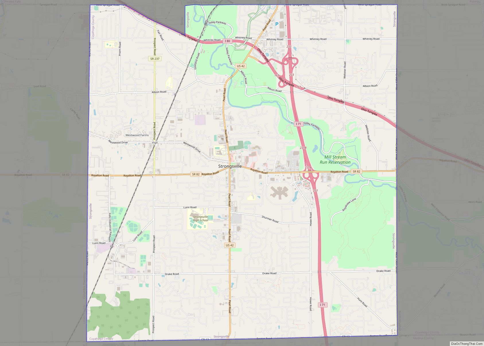
Map of Summerfield village, Ohio

Map of Summerfield village, Ohio

Summerfield is a village in Noble County, Ohio, United States. The population was 237 at the 2020 census. Summerfield village overview: Name: Summerfield village LSAD Code: 47 LSAD Description: village (suffix) State: Ohio County: Noble County Elevation: 1,201 ft (366 m) Total Area: 0.37 sq mi (0.96 km²) Land Area: 0.37 sq mi (0.96 km²) Water Area: 0.00 sq mi (0.00 km²) Total Population: 237 Population … Read more

Map of Terrace Park village

Map of Terrace Park village

Terrace Park is a village in Hamilton County, Ohio, and a wealthy suburb of Greater Cincinnati. The population was 2,355 at the 2020 census. Terrace Park village overview: Name: Terrace Park village LSAD Code: 47 LSAD Description: village (suffix) State: Ohio County: Hamilton County Elevation: 561 ft (171 m) Total Area: 1.24 sq mi (3.21 km²) Land Area: 1.19 sq mi (3.07 km²) … Read more

Map of Tedrow CDP

Map of Tedrow CDP

Tedrow is an unincorporated community and census-designated place (CDP) in southwestern Dover Township, Fulton County, Ohio, United States. It lies at the intersection of the east-west County Road J with the north-south County Roads 17-2 and 17-3, 3 miles (5 km) north and 3.5 miles (5.6 km) west of the northern edge of the city of Wauseon, … Read more

Map of Taylor Creek CDP, Ohio

Map of Taylor Creek CDP, Ohio

Taylor Creek is a census-designated place (CDP) in Colerain Township, Hamilton County, Ohio, United States. The population was 4,056 at the 2020 census. Taylor Creek CDP overview: Name: Taylor Creek CDP LSAD Code: 57 LSAD Description: CDP (suffix) State: Ohio County: Hamilton County Elevation: 790 ft (240 m) Total Area: 8.74 sq mi (22.63 km²) Land Area: 8.57 sq mi (22.20 km²) Water … Read more

Map of Tarlton village

Map of Tarlton village

Tarlton is a village in Fairfield and Pickaway counties in the U.S. state of Ohio. The population was 282 at the 2010 census. Tarlton village overview: Name: Tarlton village LSAD Code: 47 LSAD Description: village (suffix) State: Ohio County: Fairfield County, Pickaway County Elevation: 902 ft (275 m) Total Area: 0.38 sq mi (0.99 km²) Land Area: 0.38 sq mi (0.99 km²) Water … Read more

Map of Tallmadge city

Map of Tallmadge city

Tallmadge (/ˈtælmɪdʒ/ TAL-mij) is a city in eastern Summit County, Ohio, United States, with a small district in neighboring Portage County. It is a suburb of Akron and part of the Akron metropolitan area. The population was 18,394 at the 2020 census. Tallmadge was founded in 1807 and is the second-oldest city in Summit County, … Read more

Map of Syracuse village, Ohio

Map of Syracuse village, Ohio

Syracuse is a village in Meigs County, Ohio, United States, along the Ohio River. The population was 781 at the 2020 census. Syracuse village overview: Name: Syracuse village LSAD Code: 47 LSAD Description: village (suffix) State: Ohio County: Meigs County Elevation: 587 ft (179 m) Total Area: 0.90 sq mi (2.34 km²) Land Area: 0.88 sq mi (2.28 km²) Water Area: 0.02 sq mi (0.06 km²) … Read more

Map of Sylvania city, Ohio

Map of Sylvania city, Ohio

Sylvania is a city in Lucas County, Ohio, United States. The population was 19,011 at the 2020 census. Sylvania is a suburb of Toledo, and encompassed by Sylvania Township. Its northern border is the southern border of the state of Michigan. The name “Sylvania” is borrowed from the Latin sylvan or sylva, meaning “forest land”, … Read more

Map of Sycamore village, Ohio

Map of Sycamore village, Ohio

Sycamore is a village in Wyandot County, Ohio, United States. The population was 861 at the 2010 census. Sycamore village overview: Name: Sycamore village LSAD Code: 47 LSAD Description: village (suffix) State: Ohio County: Wyandot County Elevation: 850 ft (259 m) Total Area: 0.64 sq mi (1.65 km²) Land Area: 0.64 sq mi (1.65 km²) Water Area: 0.00 sq mi (0.00 km²) Total Population: 793 Population … Read more

Map of Swanton village, Ohio

Map of Swanton village, Ohio

Swanton is a village located in Fulton and Lucas counties in the U.S. state of Ohio. The population was 3,897 at the 2020 census. Total area is 8.90 km (3.44 sq mi). Swanton village overview: Name: Swanton village LSAD Code: 47 LSAD Description: village (suffix) State: Ohio County: Fulton County, Lucas County Elevation: 682 ft (208 m) … Read more

Map of Sunbury village, Ohio

Map of Sunbury village, Ohio

Sunbury is a city in Delaware County, Ohio, United States. The population was 4,389 during the 2010 census. The city is centered on a New England-styled traditional town square with a historic village hall located in the center of a village green. Located here is a major Showa Corporation factory, which produces automotive parts for … Read more

Map of Thornport CDP

Map of Thornport CDP

Thornport is a census-designated place in Perry County, in the U.S. state of Ohio. It is 2 miles north of Thornville and 22 miles north of the county seat of New Lexington. Thornport CDP overview: Name: Thornport CDP LSAD Code: 57 LSAD Description: CDP (suffix) State: Ohio County: Perry County FIPS code: 3976666 Online Interactive … Read more