Map of Wellsville village, Ohio
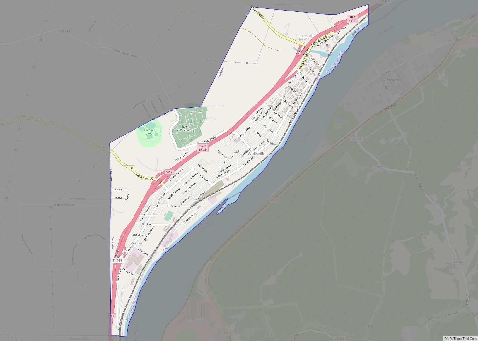
Wellsville is a village in southern Columbiana County, Ohio, United States, along the Ohio River. Its population was 3,113 at the 2020 census. It is part of the Salem micropolitan area, 16 miles (26 km) north of Steubenville and 34 miles (55 km) south of Youngstown. In its heyday, Wellsville was home to industries in transportation, both ... Read more
Map of Wellsville village, Ohio
Map of Wellston city, Ohio
Wellston is a city in Jackson County, Ohio, United States, in the southeastern part of the state. The population was 5,663 at the 2010 census. Wellston city overview: Name: Wellston city LSAD Code: 25 LSAD Description: city (suffix) State: Ohio County: Jackson County Elevation: 741 ft (226 m) Total Area: 7.05 sq mi (18.26 km²) Land Area: 6.97 sq mi (18.04 km²) Water ... Read more
Map of Wellston city, Ohio
Map of Wellington village, Ohio
Wellington is a village in Lorain County, Ohio. The population was 4,799 at the time of the 2020 census. Wellington village overview: Name: Wellington village LSAD Code: 47 LSAD Description: village (suffix) State: Ohio County: Lorain County Total Area: 3.94 sq mi (10.19 km²) Land Area: 3.64 sq mi (9.44 km²) Water Area: 0.29 sq mi (0.75 km²)  7.46% Total Population: 4,799 Population Density: ... Read more
Map of Wellington village, Ohio
Map of Waynesville village, Ohio
Waynesville is a village in Wayne Township, Warren County, Ohio, United States. The population was 2,669 at the 2020 census. It is named for General “Mad” Anthony Wayne. The village, located at the crossroads of U.S. Route 42 and State Route 73, is known for its antique stores and its annual sauerkraut festival. Caesar Creek ... Read more
Map of Waynesville village, Ohio
Map of Waynesfield village
Waynesfield is a village in Auglaize County, Ohio, United States. The population was 847 at the 2010 census. It is included in the Wapakoneta, Ohio Micropolitan Statistical Area. Waynesfield village overview: Name: Waynesfield village LSAD Code: 47 LSAD Description: village (suffix) State: Ohio County: Auglaize County Total Area: 0.66 sq mi (1.72 km²) Land Area: 0.66 sq mi (1.72 km²) Water ... Read more
Map of Waynesfield village
Map of Waynesburg village, Ohio
Waynesburg is a village in Stark County, Ohio, United States. The population was 923 at the 2010 census, a decrease from 1,003 in 2000. It is part of the Canton-Massillon, OH Metropolitan Statistical Area. Waynesburg village overview: Name: Waynesburg village LSAD Code: 47 LSAD Description: village (suffix) State: Ohio County: Stark County Total Area: 0.49 sq mi ... Read more
Map of Waynesburg village, Ohio
Map of Wayne village, Ohio
Wayne is a village in Wood County, Ohio, United States. The population was 887 at the 2010 census. Wayne village overview: Name: Wayne village LSAD Code: 47 LSAD Description: village (suffix) State: Ohio County: Wood County Total Area: 0.32 sq mi (0.83 km²) Land Area: 0.32 sq mi (0.83 km²) Water Area: 0.00 sq mi (0.00 km²) Total Population: 841 Population Density: 2,611.80/sq mi (1,007.92/km²) ... Read more
Map of Wayne village, Ohio
Map of West Jefferson village, Ohio
West Jefferson is a village in Madison County, Ohio, United States. The population was 4,222 at the 2010 census. Located along U.S. Route 40, the village has a fairly close relationship with the surrounding township, which include various out-of-corporation-limit neighborhoods (including Haymarket Road, Olmstead Road, Forrest Lake Estates, Goodson Road/Enchanted Valley, and North and South ... Read more
Map of West Jefferson village, Ohio
Map of West Hill CDP
West Hill is an unincorporated community and census-designated place in eastern Brookfield Township, Trumbull County, Ohio, United States. The population was 2,218 at the 2020 census. It is part of the Youngstown–Warren metropolitan area. West Hill CDP overview: Name: West Hill CDP LSAD Code: 57 LSAD Description: CDP (suffix) State: Ohio County: Trumbull County Elevation: ... Read more
Map of West Hill CDP
Map of West Farmington village
West Farmington is a village in northwestern Trumbull County, Ohio, United States, along the Grand River. The population was 542 at the 2020 census. It is part of the Youngstown–Warren metropolitan area. West Farmington village overview: Name: West Farmington village LSAD Code: 47 LSAD Description: village (suffix) State: Ohio County: Trumbull County Total Area: 0.90 sq mi ... Read more
Map of West Farmington village
Map of West Milton village, Ohio
West Milton is a village in Miami County, Ohio, United States. The population was 4,630 at the 2010 census. It is part of the Dayton Metropolitan Statistical Area. West Milton village overview: Name: West Milton village LSAD Code: 47 LSAD Description: village (suffix) State: Ohio County: Miami County Total Area: 3.49 sq mi (9.04 km²) Land Area: 3.39 sq mi ... Read more
Map of West Milton village, Ohio
Map of West Millgrove village
West Millgrove is a village in Wood County, Ohio, United States. The population was 174 at the 2010 census. West Millgrove village overview: Name: West Millgrove village LSAD Code: 47 LSAD Description: village (suffix) State: Ohio County: Wood County Total Area: 0.26 sq mi (0.67 km²) Land Area: 0.26 sq mi (0.67 km²) Water Area: 0.00 sq mi (0.00 km²) Total Population: 131 Population ... Read more
Map of West Millgrove village