Wellston is a city in Jackson County, Ohio, United States, in the southeastern part of the state. The population was 5,663 at the 2010 census.
| Name: | Wellston city |
|---|---|
| LSAD Code: | 25 |
| LSAD Description: | city (suffix) |
| State: | Ohio |
| County: | Jackson County |
| Elevation: | 741 ft (226 m) |
| Total Area: | 7.05 sq mi (18.26 km²) |
| Land Area: | 6.97 sq mi (18.04 km²) |
| Water Area: | 0.08 sq mi (0.22 km²) |
| Total Population: | 5,412 |
| Population Density: | 776.80/sq mi (299.92/km²) |
| ZIP code: | 45692 |
| Area code: | 740 |
| FIPS code: | 3982712 |
| GNISfeature ID: | 1049301 |
| Website: | cityofwellston.org |
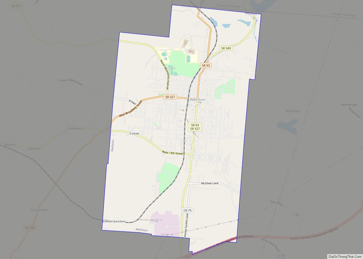
Online Interactive Map
Click on ![]() to view map in "full screen" mode.
to view map in "full screen" mode.
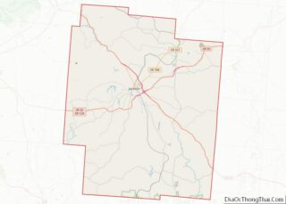
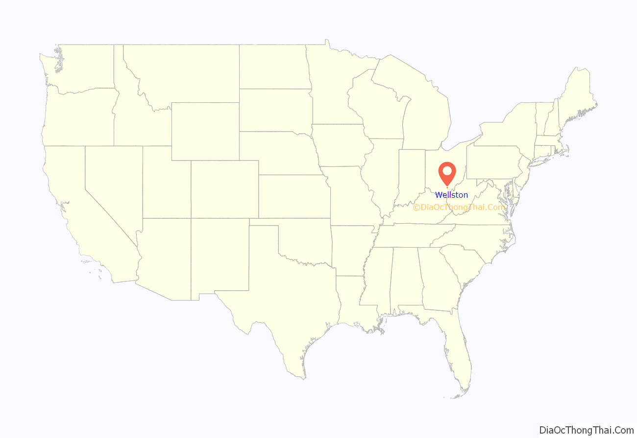
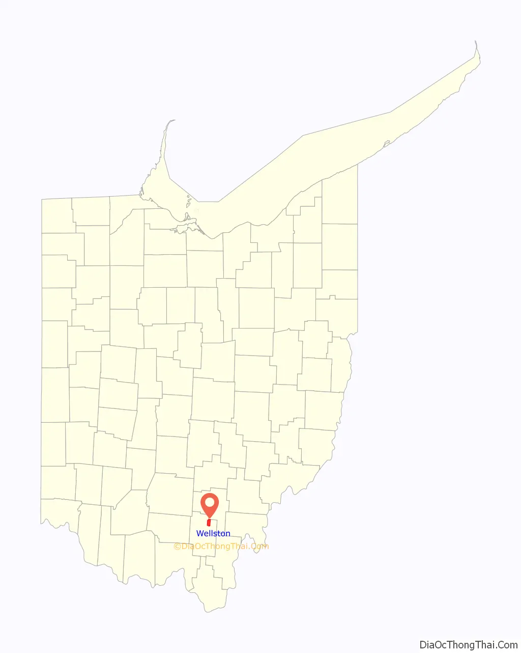
Wellston location map. Where is Wellston city?
History
Wellston was laid out and founded in 1873 on land owned by Harvey Wells. Wells constructed a blast furnace in 1874, and the town was incorporated in 1876. Wellston flourished for several years on the furnace and local mining industry, but most of the resources have now been depleted.
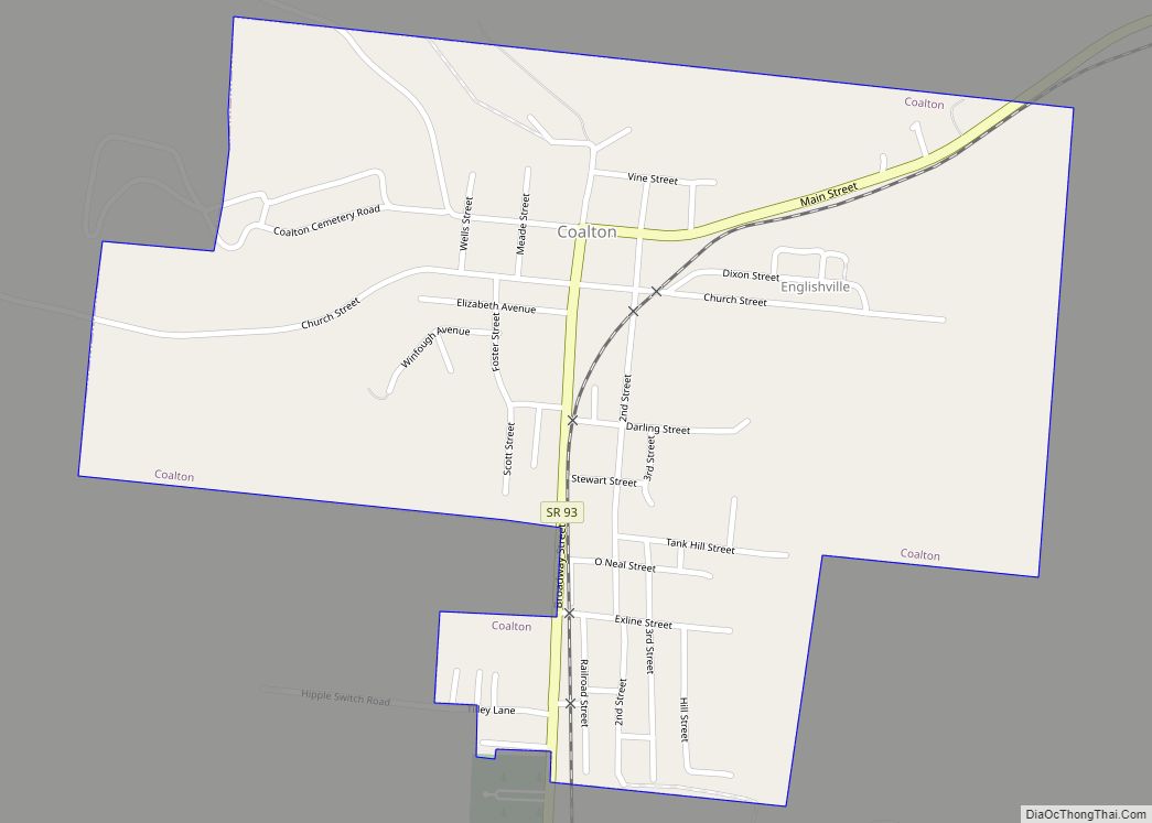
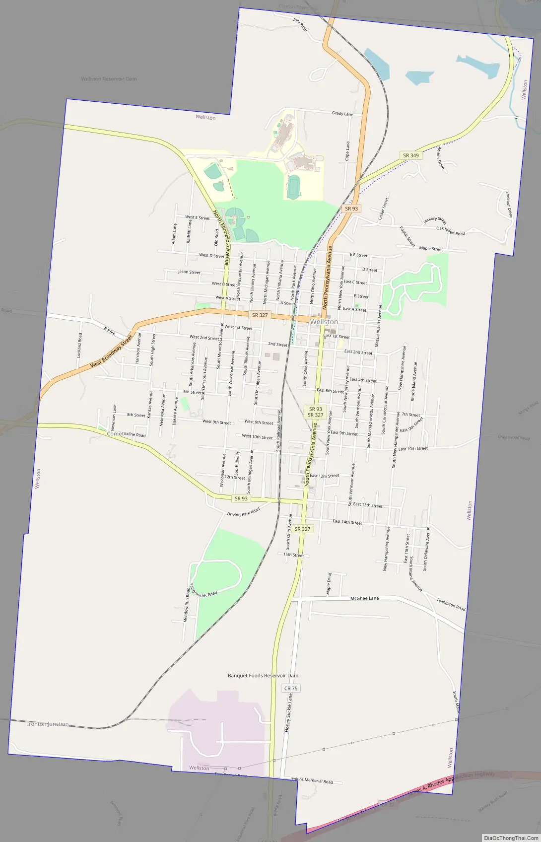
Wellston Road Map
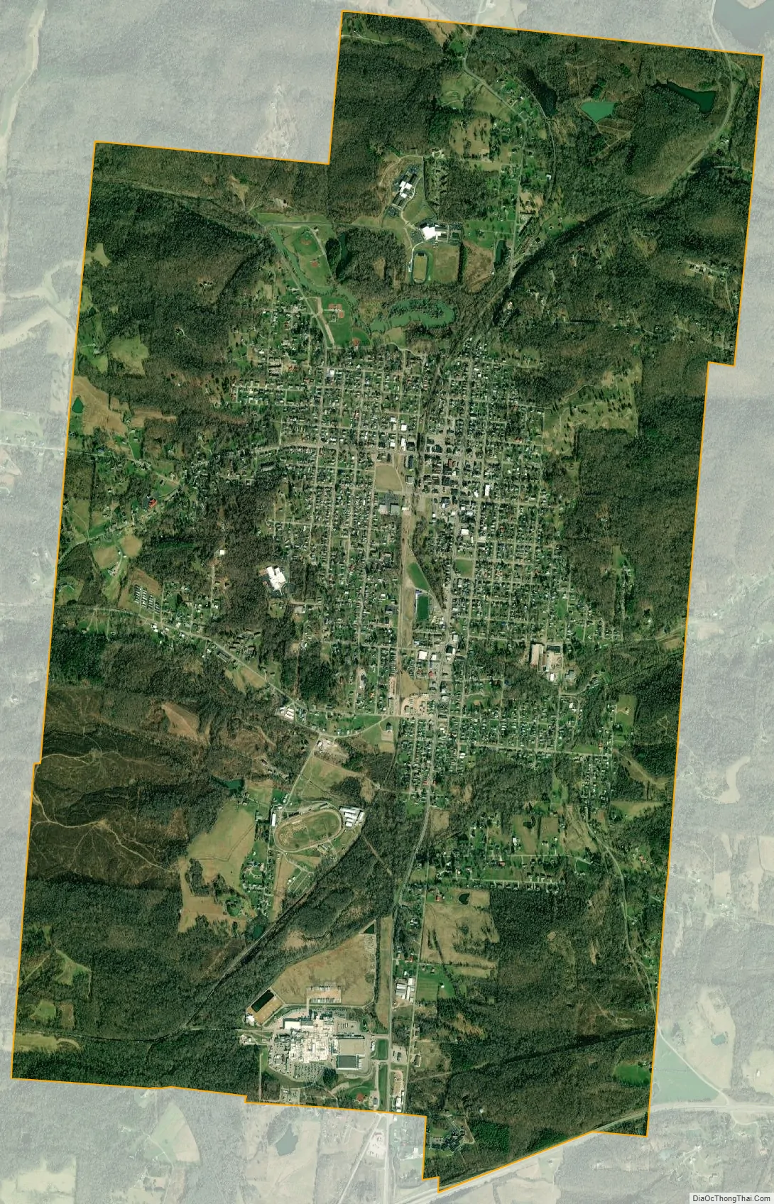
Wellston city Satellite Map
Geography
Wellston is located at 39°7′11″N 82°32′3″W / 39.11972°N 82.53417°W / 39.11972; -82.53417 (39.119693, -82.534139). According to the United States Census Bureau, the city has a total area of 7.05 square miles (18.26 km), of which 6.97 square miles (18.05 km) is land and 0.08 square miles (0.21 km) is water.
See also
Map of Ohio State and its subdivision:- Adams
- Allen
- Ashland
- Ashtabula
- Athens
- Auglaize
- Belmont
- Brown
- Butler
- Carroll
- Champaign
- Clark
- Clermont
- Clinton
- Columbiana
- Coshocton
- Crawford
- Cuyahoga
- Darke
- Defiance
- Delaware
- Erie
- Fairfield
- Fayette
- Franklin
- Fulton
- Gallia
- Geauga
- Greene
- Guernsey
- Hamilton
- Hancock
- Hardin
- Harrison
- Henry
- Highland
- Hocking
- Holmes
- Huron
- Jackson
- Jefferson
- Knox
- Lake
- Lake Erie
- Lawrence
- Licking
- Logan
- Lorain
- Lucas
- Madison
- Mahoning
- Marion
- Medina
- Meigs
- Mercer
- Miami
- Monroe
- Montgomery
- Morgan
- Morrow
- Muskingum
- Noble
- Ottawa
- Paulding
- Perry
- Pickaway
- Pike
- Portage
- Preble
- Putnam
- Richland
- Ross
- Sandusky
- Scioto
- Seneca
- Shelby
- Stark
- Summit
- Trumbull
- Tuscarawas
- Union
- Van Wert
- Vinton
- Warren
- Washington
- Wayne
- Williams
- Wood
- Wyandot
- Alabama
- Alaska
- Arizona
- Arkansas
- California
- Colorado
- Connecticut
- Delaware
- District of Columbia
- Florida
- Georgia
- Hawaii
- Idaho
- Illinois
- Indiana
- Iowa
- Kansas
- Kentucky
- Louisiana
- Maine
- Maryland
- Massachusetts
- Michigan
- Minnesota
- Mississippi
- Missouri
- Montana
- Nebraska
- Nevada
- New Hampshire
- New Jersey
- New Mexico
- New York
- North Carolina
- North Dakota
- Ohio
- Oklahoma
- Oregon
- Pennsylvania
- Rhode Island
- South Carolina
- South Dakota
- Tennessee
- Texas
- Utah
- Vermont
- Virginia
- Washington
- West Virginia
- Wisconsin
- Wyoming