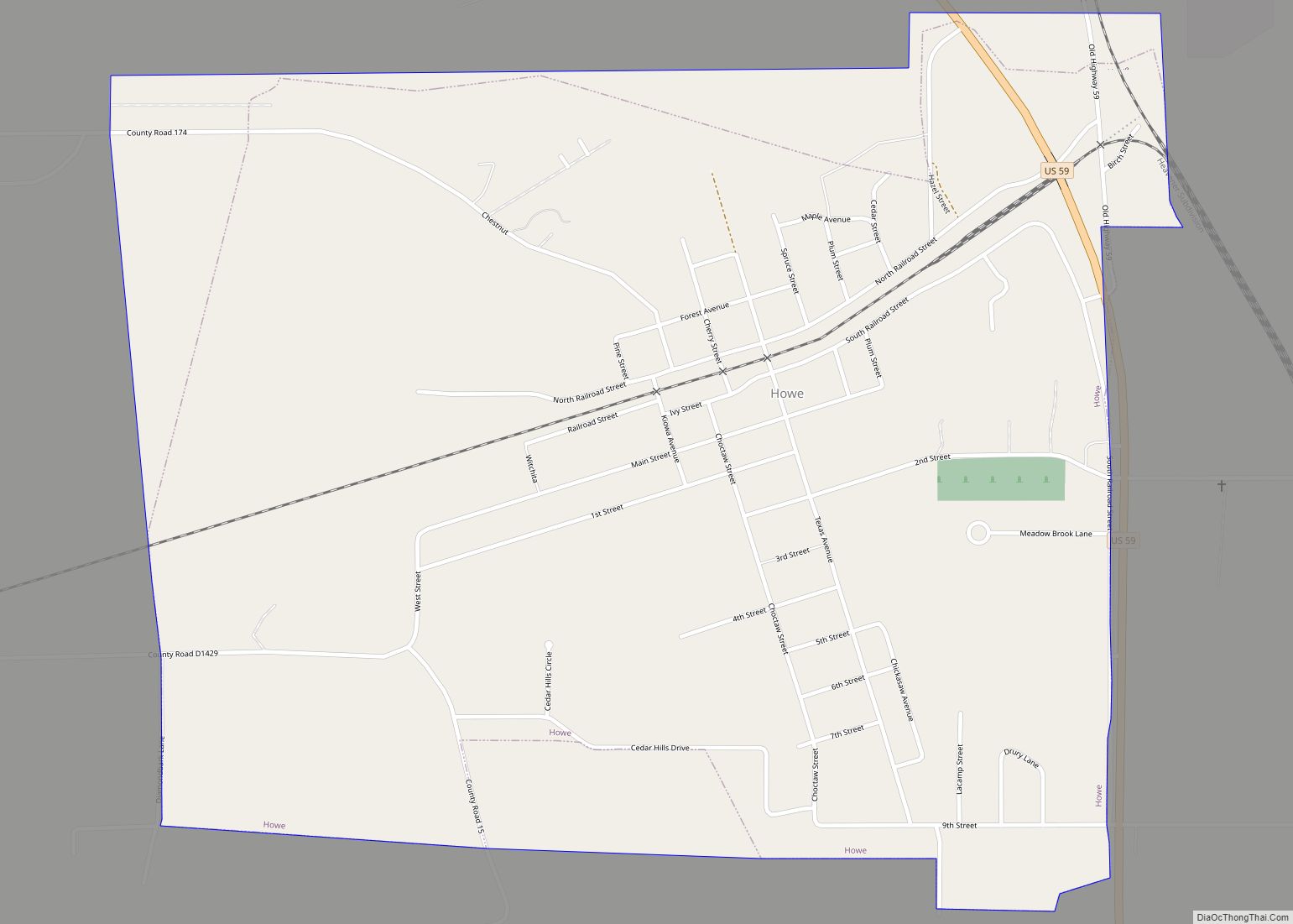
Map of Hollister town, Oklahoma

Map of Hollister town, Oklahoma

Hollister is a town in Tillman County, Oklahoma, United States. The population was 50 at the 2010 census, a decline of 16.7 percent from 60 in 2000. Hollister town overview: Name: Hollister town LSAD Code: 43 LSAD Description: town (suffix) State: Oklahoma County: Tillman County Elevation: 1,125 ft (343 m) Total Area: 0.27 sq mi (0.69 km²) Land Area: 0.27 sq mi … Read more

Map of Hollis city, Oklahoma

Map of Hollis city, Oklahoma

Hollis is a city in and the county seat of Harmon County, Oklahoma, United States. The population was 2,060 at the 2010 census. Hollis city overview: Name: Hollis city LSAD Code: 25 LSAD Description: city (suffix) State: Oklahoma County: Harmon County Elevation: 1,627 ft (496 m) Total Area: 1.49 sq mi (3.85 km²) Land Area: 1.49 sq mi (3.85 km²) Water Area: 0.00 sq mi … Read more

Map of Iron Post CDP

Map of Iron Post CDP

Iron Post is a census-designated place (CDP) in Mayes County, Oklahoma, United States. The population was 117 at the 2000 census, but had declined to 92 in 2010, a loss of more than 21 percent. Iron Post CDP overview: Name: Iron Post CDP LSAD Code: 57 LSAD Description: CDP (suffix) State: Oklahoma County: Mayes County … Read more

Map of Inola town

Map of Inola town

Inola is a town in Rogers County, Oklahoma, United States. It is included in the Tulsa Metropolitan Statistical Area (TMSA). The population was 1,788 at the 2010 census, a 12.5 percent increase from 1,589 at the 2000 census. Inola is a Cherokee word meaning “Black Fox.” The town styles itself as “The Hay Capital of … Read more

Map of Indianola CDP, Oklahoma

Map of Indianola CDP, Oklahoma

Indianola is an unincorporated area and census-designated place (CDP) in Delaware County, Oklahoma, United States. The population was 48 at the 2010 census. Indianola CDP overview: Name: Indianola CDP LSAD Code: 57 LSAD Description: CDP (suffix) State: Oklahoma County: Delaware County Elevation: 1,100 ft (300 m) Total Area: 0.88 sq mi (2.28 km²) Land Area: 0.88 sq mi (2.28 km²) Water Area: 0.00 sq mi … Read more

Map of Indiahoma town

Map of Indiahoma town

Indiahoma is a town in Comanche County, Oklahoma, United States. It is located just south of US Route 62, about 24.4 driving miles west of Lawton. The population was 344 at the 2010 census. It is included as an exurb in the Lawton, Oklahoma, Metropolitan Statistical Area. It is also home to the Treasure Lake … Read more

Map of Idabel city

Map of Idabel city

Idabel is a city in and county seat of McCurtain County, Oklahoma, United States. The population was 7,010 at the 2010 census. It is located in the southeast corner of Oklahoma, a tourist area known as Choctaw Country. Idabel city overview: Name: Idabel city LSAD Code: 25 LSAD Description: city (suffix) State: Oklahoma County: McCurtain … Read more

Map of Hydro town

Map of Hydro town

Hydro is a town in Caddo and Blaine counties in the U.S. state of Oklahoma. As of the 2010 census, the town population was 969. Hydro town overview: Name: Hydro town LSAD Code: 43 LSAD Description: town (suffix) State: Oklahoma County: Blaine County, Caddo County Elevation: 1,526 ft (465 m) Total Area: 0.70 sq mi (1.80 km²) Land Area: 0.70 sq mi … Read more

Map of Hunter town, Oklahoma

Map of Hunter town, Oklahoma

Hunter is a town in Garfield County, Oklahoma, United States. The population was 165 at the 2010 census, a 4.6 percent decline from the figure of 173 in 2000. Hunter town overview: Name: Hunter town LSAD Code: 43 LSAD Description: town (suffix) State: Oklahoma County: Garfield County Elevation: 1,096 ft (334 m) Total Area: 0.23 sq mi (0.61 km²) Land … Read more

Map of Hulbert town

Map of Hulbert town

Hulbert is a town in Cherokee County, Oklahoma, United States, named after Ben H. Hulbert, a prominent Cherokee man. The population was 483 at the 2020 census, previously it was 590 in 2010. Our Lady of the Annunciation of Clear Creek Monastery is a Benedictine monastery located in Hulbert. The Clear Creek Monastery, recently elevated … Read more

Map of IXL town

Map of IXL town

IXL (or I.X.L.) is an historical freedmen’s town in Okfuskee County, Oklahoma, United States. While founded perhaps as early as 1900, it was only incorporated in 2016 and had an estimated population of 59 in 2007. The 2010 census listed the population at 51. The source of IXL’s unusual name is disputed. A 2012 article … Read more

Map of Isabella CDP

Map of Isabella CDP

Isabella is a census-designated place and unincorporated community in Major County, Oklahoma, United States. Its population was 136 as of the 2010 census. Isabella has a post office with ZIP code 73747. Isabella CDP overview: Name: Isabella CDP LSAD Code: 57 LSAD Description: CDP (suffix) State: Oklahoma County: Major County Elevation: 1,299 ft (396 m) Total Area: … Read more