Map of Luther town, Oklahoma

Map of Luther town, Oklahoma

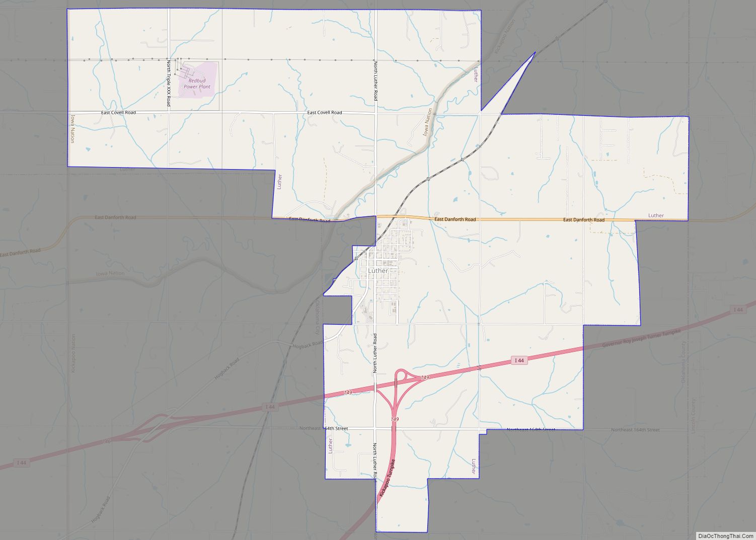
Luther is a town in Oklahoma County, Oklahoma, United States, and a part of the Oklahoma City Metropolitan Area. The population was 1,221 at the 2010 census. Sperling Best Places lists the population of 4073 for the 73054 Luther zip code, which includes the town and immediate surrounding area of rural residents. Luther town overview: … Read more

Map of Lucien CDP

Map of Lucien CDP

Lucien is a census-designated place (CDP) and unincorporated community in Noble County, Oklahoma, United States. Its population was 88 as of the 2010 census. Lucien CDP overview: Name: Lucien CDP LSAD Code: 57 LSAD Description: CDP (suffix) State: Oklahoma County: Noble County Elevation: 1,122 ft (342 m) Total Area: 0.55 sq mi (1.42 km²) Land Area: 0.55 sq mi (1.42 km²) Water Area: … Read more

Map of Loyal town

Map of Loyal town, Oklahoma

Loyal is a town in Kingfisher County, Oklahoma, United States. The population was 79 at the 2010 census. Loyal town overview: Name: Loyal town LSAD Code: 43 LSAD Description: town (suffix) State: Oklahoma County: Kingfisher County Elevation: 1,116 ft (340 m) Total Area: 0.09 sq mi (0.23 km²) Land Area: 0.09 sq mi (0.23 km²) Water Area: 0.00 sq mi (0.00 km²) Total Population: 71 Population … Read more

Map of Loveland town, Oklahoma

Map of Loveland town, Oklahoma

Loveland is a town in Tillman County, Oklahoma, United States. The population was 13 at the 2010 census. Loveland once had a post office that has since closed. The post office was popular around Valentine’s Day, when people often drove many miles to have their valentines postmarked “Loveland”. Loveland town overview: Name: Loveland town LSAD … Read more

Map of Lotsee town

Map of Lotsee town

Lotsee is a town in Tulsa County, Oklahoma, United States. The population was 6 at the 2020 census, compared to a total of 2 in 2010. It is the smallest incorporated municipality in Oklahoma. The entire town is a 2,000 acres (8.1 km) family-owned cattle and pecan ranch, the Flying G Ranch, whose owner, George Campbell, … Read more

Map of Lost City CDP

Map of Lost City CDP

Lost City is an unincorporated community and census-designated place (CDP) in Cherokee County, Oklahoma, United States. The population was 770 at the 2010 census, a 4.8 percent decline from the figure of 809 recorded in 2000. It was the site of the first meteorite fall in the US to be recorded by a camera network. … Read more

Map of Lookeba town

Map of Lookeba town

Lookeba is a town in Caddo County, Oklahoma, United States. The population was 166 at the 2010 census. The name is a portmanteau of the names of three founding fathers: Lowe, Kelley and Baker. Lookeba town overview: Name: Lookeba town LSAD Code: 43 LSAD Description: town (suffix) State: Oklahoma County: Caddo County Elevation: 1,368 ft (417 m) … Read more

Map of Longtown CDP, Oklahoma

Map of Longtown CDP, Oklahoma

Longtown is a census-designated place (CDP) and unincorporated community in Pittsburg County, Oklahoma, United States. The population was 2,397 at the 2000 census. Longtown CDP overview: Name: Longtown CDP LSAD Code: 57 LSAD Description: CDP (suffix) State: Oklahoma County: Pittsburg County Elevation: 614 ft (187 m) Total Area: 35.75 sq mi (92.58 km²) Land Area: 26.11 sq mi (67.64 km²) Water Area: 9.63 sq mi … Read more

Map of Longdale town

Map of Longdale town

Longdale is a town in northwestern Blaine County, Oklahoma, United States. The population was 262 at the 2010 census, down 18.3 percent from the figure of 310 in 2000. Longdale town overview: Name: Longdale town LSAD Code: 43 LSAD Description: town (suffix) State: Oklahoma County: Blaine County Elevation: 1,654 ft (504 m) Total Area: 0.26 sq mi (0.68 km²) Land … Read more

Map of Long CDP

Map of Long CDP

Long is a census-designated place (CDP) in Sequoyah County, Oklahoma, United States. It is part of the Fort Smith, Arkansas-Oklahoma Metropolitan Statistical Area. The population was 363 at the 2000 census. The post office existed from August 22, 1894, until April 15, 1937, with William J. Webb as the first postmaster. Long had 130 residents … Read more

Map of Lyons Switch CDP

Map of Lyons Switch CDP

Lyons Switch is a census-designated place (CDP) in Adair County, Oklahoma, United States. The population was 288 at the 2010 census. Lyons Switch CDP overview: Name: Lyons Switch CDP LSAD Code: 57 LSAD Description: CDP (suffix) State: Oklahoma County: Adair County Total Area: 13.06 sq mi (33.82 km²) Land Area: 12.70 sq mi (32.90 km²) Water Area: 0.35 sq mi (0.92 km²) Total Population: … Read more

Map of Marble City town

Map of Marble City town

Marble City (often simply called Marble) is a town in Sequoyah County, Oklahoma, United States. It is part of the Fort Smith, Arkansas-Oklahoma Metropolitan Statistical Area. The population was 263 at the 2010 census, an increase of 8.7 percent over the figure of 242 recorded in 2000, making it the seventh-largest town by population in … Read more