Mangum is a city in and county seat of Greer County, Oklahoma, United States. The population was 3,010 at the 2010 census. It was originally part of Old Greer County in the Texas panhandle. The community was named for A. S. Mangum, who owned the land on which the town was founded in 1882. It became part of the Oklahoma Territory in 1896, and thus part of the state of Oklahoma on November 16, 1907.
| Name: | Mangum city |
|---|---|
| LSAD Code: | 25 |
| LSAD Description: | city (suffix) |
| State: | Oklahoma |
| County: | Greer County |
| Elevation: | 1,598 ft (487 m) |
| Total Area: | 1.68 sq mi (4.36 km²) |
| Land Area: | 1.68 sq mi (4.36 km²) |
| Water Area: | 0.00 sq mi (0.00 km²) |
| Total Population: | 2,762 |
| Population Density: | 1,641.12/sq mi (633.47/km²) |
| ZIP code: | 73554 |
| Area code: | 580 |
| FIPS code: | 4046050 |
| GNISfeature ID: | 1095109 |
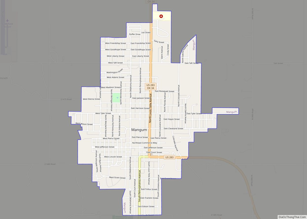
Online Interactive Map
Click on ![]() to view map in "full screen" mode.
to view map in "full screen" mode.
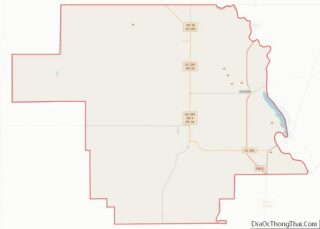
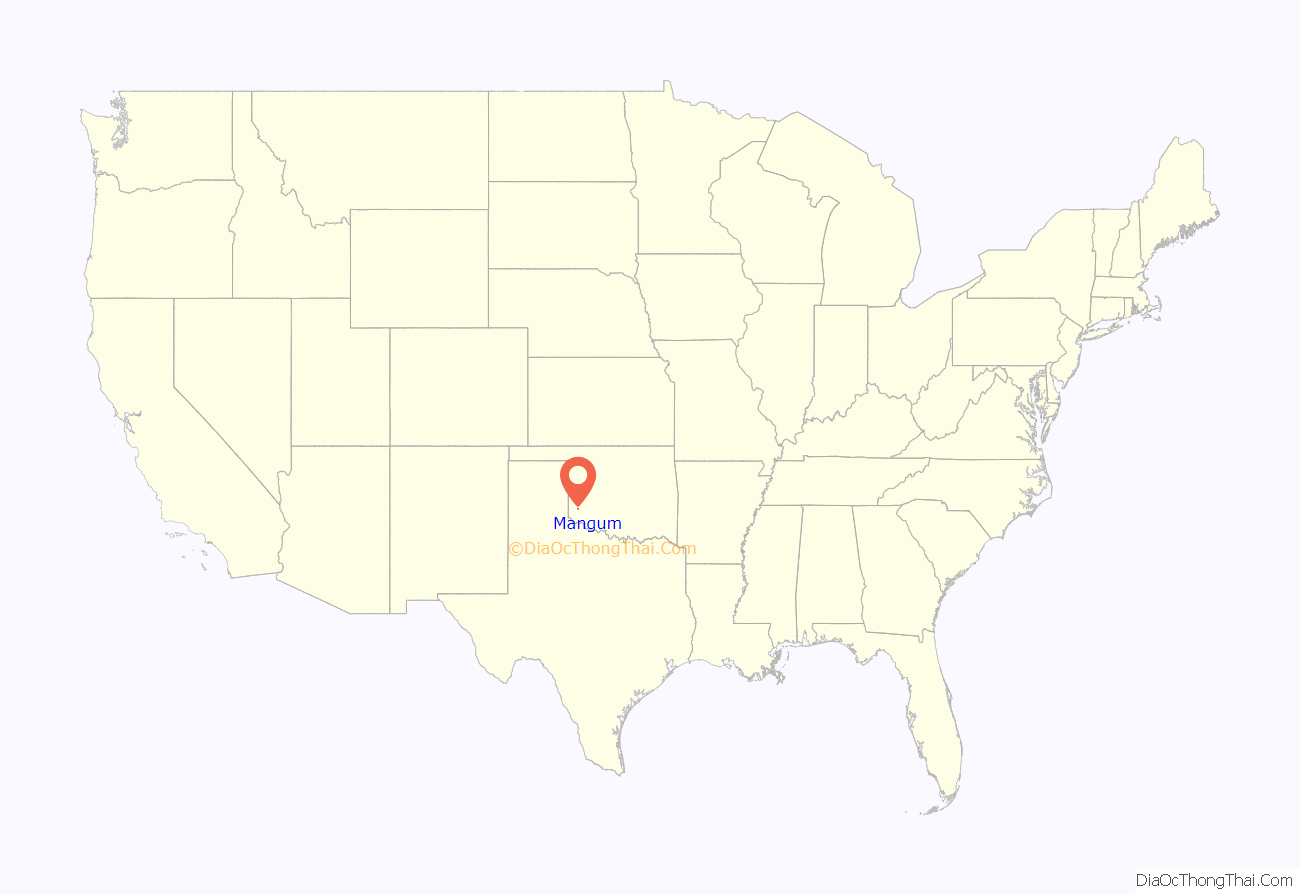
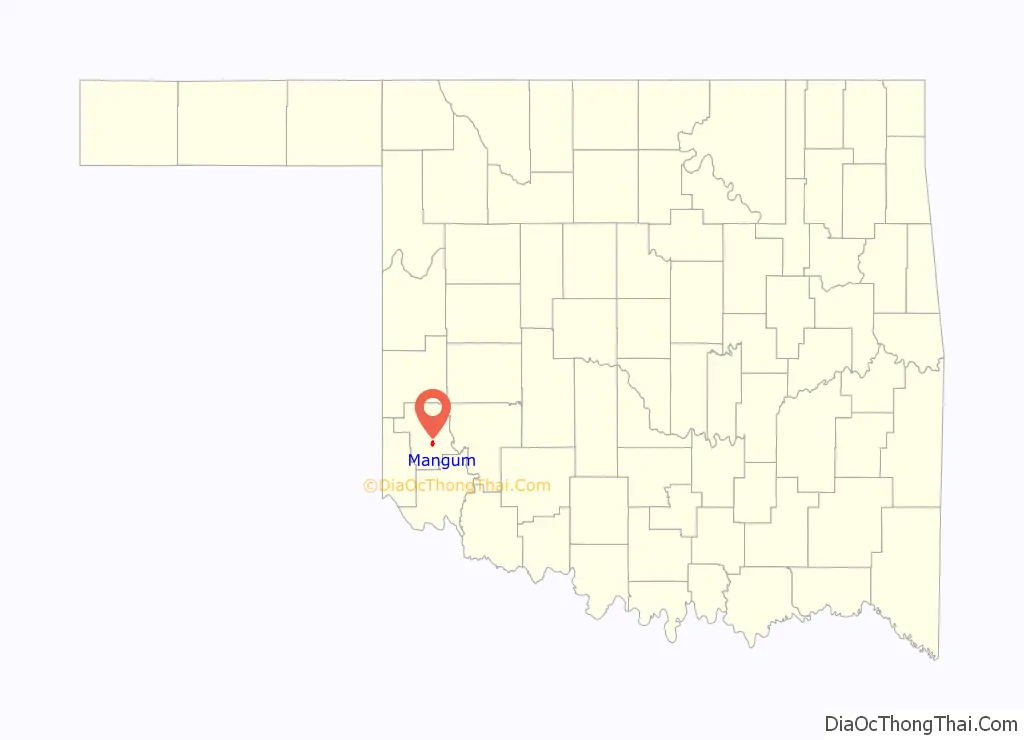
Mangum location map. Where is Mangum city?
History
Beginning in 1876, the nearby Great Western Cattle Trail was used to drive cattle north from Texas to market. The community of Mangum began in 1882 when Henry Clay Sweet established it on land granted to A. S. Mangum by the state of Texas. The Mangum post office was established April 15, 1886. This part of Texas (old Greer County) was given to Oklahoma in 1896. During Mangum’s early days, the community’s economy largely depended on very large cattle ranches owned or leased by land companies such as the Day Land and Cattle Company of Texas and the Franklyn Land and Cattle Company, an English syndicate. The local cowboys called Mangum “Tin City” because so many tin cans were unrolled and nailed over the wooden planks that served as sidewalks.
The Kiser Salt Works, named for owner Ben Kiser and located on the Elm Fork of the Red River was one of the earliest production operations in what would become western Oklahoma.
Other early businesses in or around Mangum included the Oklahoma Granite Company, which opened in 1904, the Mangum Star newspaper, first published in 1887, and the Mangum Brick Plant, established in 1903 by D. J. Doyle. The newspaper still publishes in the 21st Century. The brick plant, now owned by Jewett Scott, also still operates and has greatly expanded production.
By statehood, Mangum had a population of 2,672. It had two school buildings, an opera house and a county courthouse, listed in the National Register of Historical Places, NR 85000682. By 1930, the population had expanded to 4,806 (the highest recorded in the U.S. census). Agriculture had largely displaced the old cattle ranches, so the city could also boast of seven cotton gins, one cotton oil mill, one cotton compress, and one flour mill.
Mangum is the birthplace of many famous people. Most are singers. These people include Margaret Avery, Blake Ragsdale Van Leer, Gary McSpadden, Russell Pierson, James P. Garrett, and many more.
The Chicago, Rock Island and Pacific Railroad (aka Rock Island or CRI&P) built a line from Chickasha, Oklahoma to Mangum in 1900. The Wichita Falls and Northwestern Railway, acquired by the Missouri, Kansas and Texas Railway (also known as M-K-T or Katy) in 1911, operated its own line through Mangum by 1910.
Mangum is home to the fourth longest-lasting light bulb, located in a fire house, according to Guinness World Records.
Mangum is the setting for the 2008 movie Beer for My Horses, starring Toby Keith and Rodney Carrington.
On May 20, 2019, Western Mangum was hit hard by a destructive EF2 tornado during a tornado outbreak that impacted central Oklahoma.
In 2020, during the COVID-19 Pandemic Mangum made national news when a local church was instrumental in spreading COVID-19 throughout the town, resulting in several fatalities. Mayor at the time, Mary Jane Scott, put the town on lockdown following direction from state governor, Kevin Stitt. After the lockdown was lifted and many states reopened, the safety measures in place in Mangum were also removed.
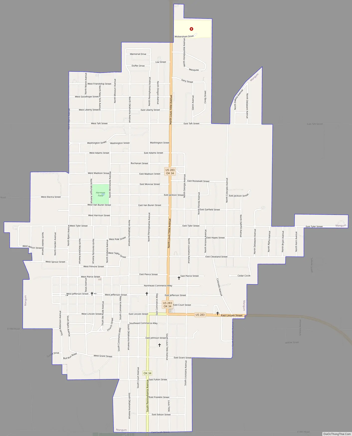
Mangum Road Map
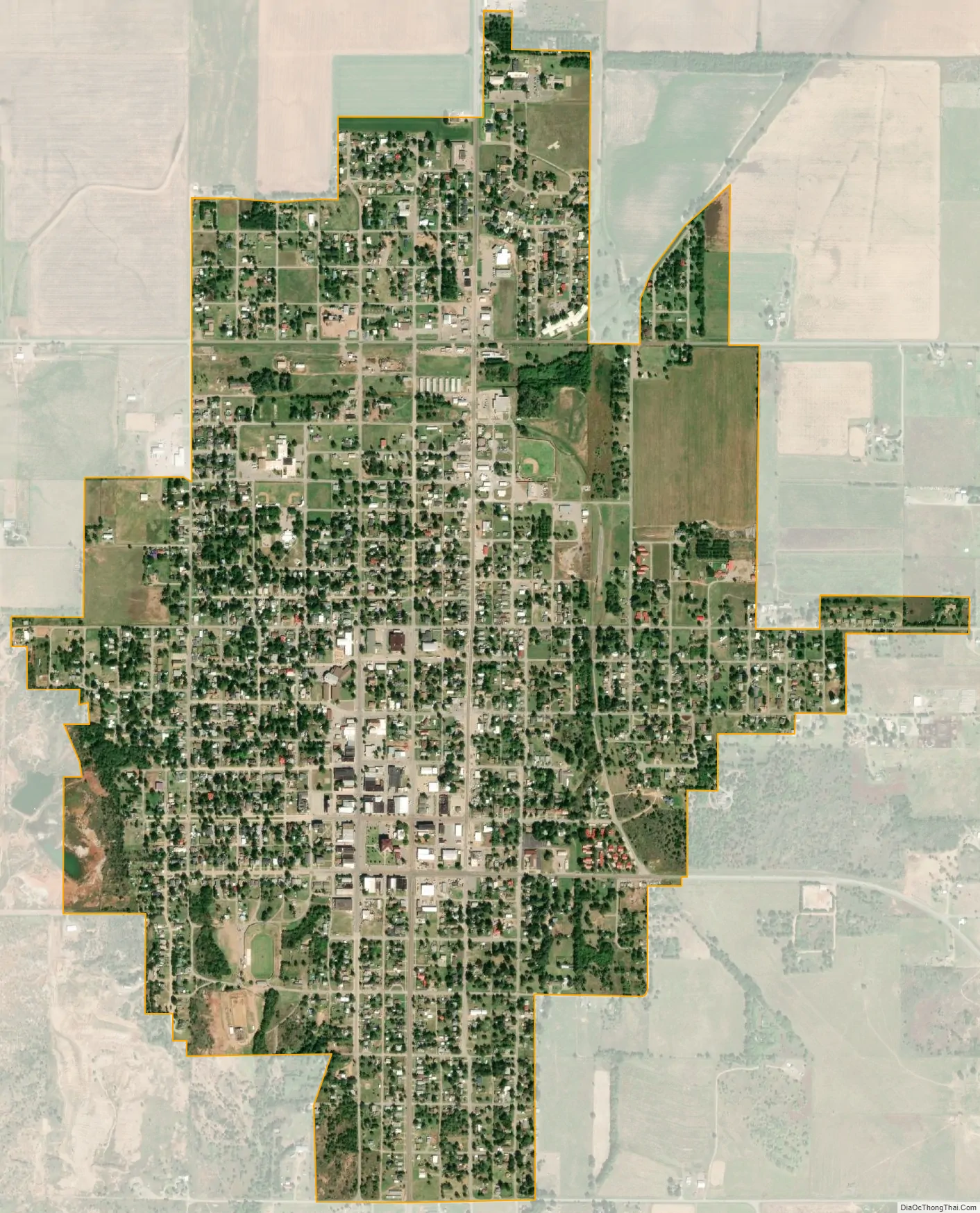
Mangum city Satellite Map
Geography
According to the United States Census Bureau, the city has a total area of 1.8 square miles (4.7 km), all land.
Lake Altus-Lugert is to the east-northeast.
Climate
Mangum, Oklahoma’s climate is humid subtropical (Köppen Cfa, Trewartha Cf), giving the area mild winters and hot, humid summers. Mangum is in USDA Plant Hardiness Zone 7a, strongly suggesting that the coldest night of each year averages between 0 °F (-18 °C) and 5 °F (-15 °C).
On February 11, 2017, Mangum reached a high of 99.41 °F (37.45 °C). This is the Oklahoma state record high for meteorological winter (December through February). What’s even more remarkable is that this occurred just three days before snow fell on Mangum.
See also
Map of Oklahoma State and its subdivision:- Adair
- Alfalfa
- Atoka
- Beaver
- Beckham
- Blaine
- Bryan
- Caddo
- Canadian
- Carter
- Cherokee
- Choctaw
- Cimarron
- Cleveland
- Coal
- Comanche
- Cotton
- Craig
- Creek
- Custer
- Delaware
- Dewey
- Ellis
- Garfield
- Garvin
- Grady
- Grant
- Greer
- Harmon
- Harper
- Haskell
- Hughes
- Jackson
- Jefferson
- Johnston
- Kay
- Kingfisher
- Kiowa
- Latimer
- Le Flore
- Lincoln
- Logan
- Love
- Major
- Marshall
- Mayes
- McClain
- McCurtain
- McIntosh
- Murray
- Muskogee
- Noble
- Nowata
- Okfuskee
- Oklahoma
- Okmulgee
- Osage
- Ottawa
- Pawnee
- Payne
- Pittsburg
- Pontotoc
- Pottawatomie
- Pushmataha
- Roger Mills
- Rogers
- Seminole
- Sequoyah
- Stephens
- Texas
- Tillman
- Tulsa
- Wagoner
- Washington
- Washita
- Woods
- Woodward
- Alabama
- Alaska
- Arizona
- Arkansas
- California
- Colorado
- Connecticut
- Delaware
- District of Columbia
- Florida
- Georgia
- Hawaii
- Idaho
- Illinois
- Indiana
- Iowa
- Kansas
- Kentucky
- Louisiana
- Maine
- Maryland
- Massachusetts
- Michigan
- Minnesota
- Mississippi
- Missouri
- Montana
- Nebraska
- Nevada
- New Hampshire
- New Jersey
- New Mexico
- New York
- North Carolina
- North Dakota
- Ohio
- Oklahoma
- Oregon
- Pennsylvania
- Rhode Island
- South Carolina
- South Dakota
- Tennessee
- Texas
- Utah
- Vermont
- Virginia
- Washington
- West Virginia
- Wisconsin
- Wyoming