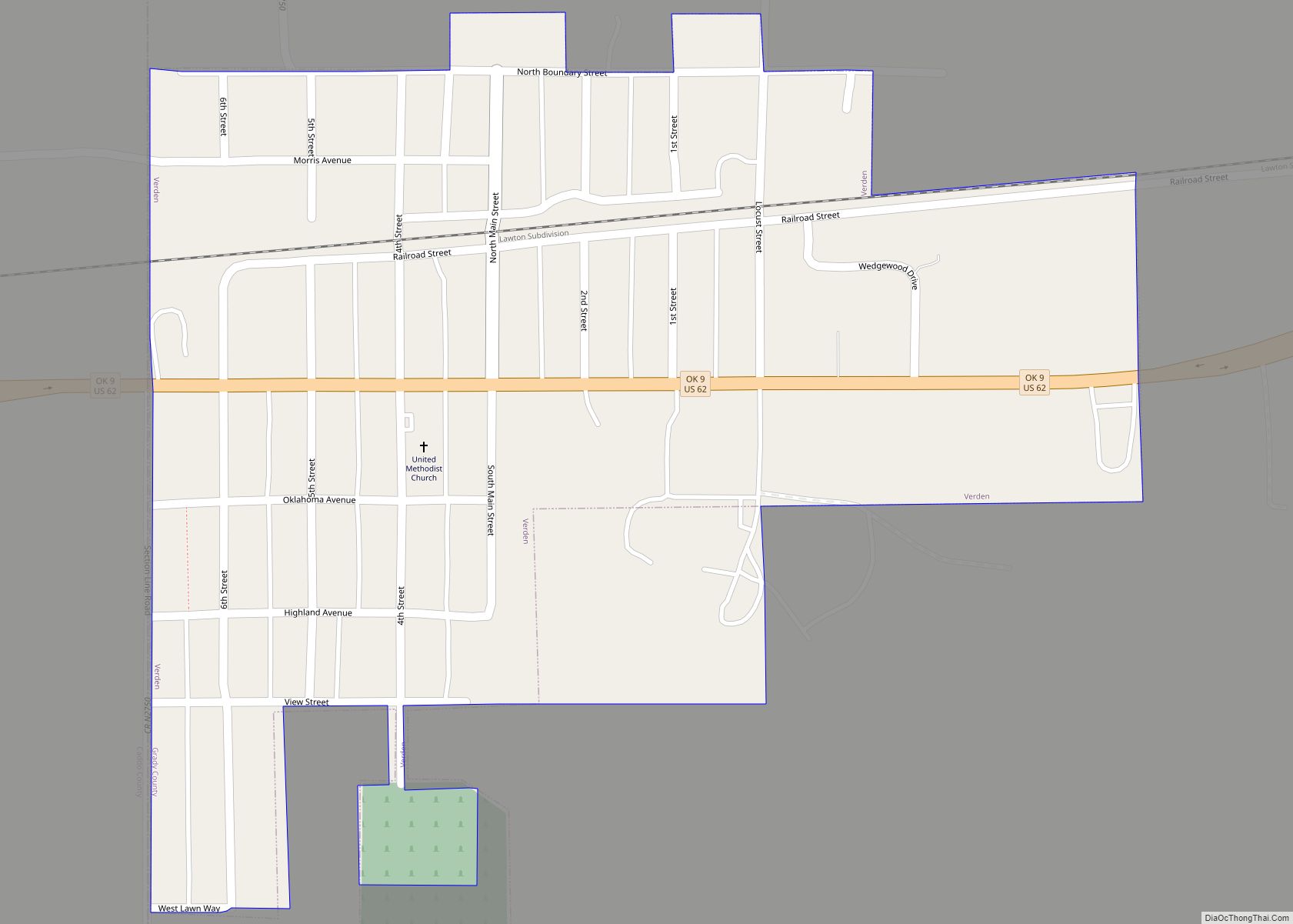
Map of Walters city, Oklahoma
Walters is a town in Cotton County, Oklahoma, United States. The population was 2,551 at the 2010 census. The city, nestled between twin creeks, is the county seat of Cotton County. The city’s motto is “Small town; Big heart.” Walters city overview: Name: Walters city LSAD Code: 25 LSAD Description: city (suffix) State: Oklahoma County: ... Read more
Map of Walters city, Oklahoma
Map of Wakita town
Wakita is a town in Grant County, Oklahoma, United States, founded in 1898, approximately 8 miles (13 km) south of the Kansas border. Its population was 344 at the 2010 census, a decrease of 18.1 percent (from 420) at the 2000 census. Wakita is notable as a location in the 1996 feature film Twister. Wakita town ... Read more
Map of Wakita town
Map of Watts town
Watts is a town in northern Adair County, Oklahoma, United States. It was named for John Watts, also known as Young Tassel, a Chickamauga Cherokee chief, who died in 1802. The population was 324 at the 2010 census, an increase of 2.5 percent over the figure of 316 recorded in 2000. Watts town overview: Name: ... Read more
Map of Watts town
Map of Watonga city
Watonga is a city in Blaine County, Oklahoma. It is 70 miles northwest of Oklahoma City. The population was 5,111 at the 2010 census. It is the county seat of Blaine County. Watonga city overview: Name: Watonga city LSAD Code: 25 LSAD Description: city (suffix) State: Oklahoma County: Blaine County Elevation: 1,522 ft (464 m) Total Area: ... Read more
Map of Watonga city
Map of Washington town, Oklahoma
Washington is a town in McClain County, Oklahoma, United States. The population was 673 as of the 2020 census, a 0.2% increase from 2010. Washington town overview: Name: Washington town LSAD Code: 43 LSAD Description: town (suffix) State: Oklahoma County: McClain County Elevation: 1,112 ft (339 m) Total Area: 1.46 sq mi (3.79 km²) Land Area: 1.45 sq mi (3.75 km²) Water Area: ... Read more
Map of Washington town, Oklahoma
Map of Warwick town, Oklahoma
Warwick is a town in Lincoln County, Oklahoma, United States. The population was 184 at the 2020 census, up from 148 in 2010. Warwick town overview: Name: Warwick town LSAD Code: 43 LSAD Description: town (suffix) State: Oklahoma County: Lincoln County Elevation: 873 ft (266 m) Total Area: 2.78 sq mi (7.20 km²) Land Area: 2.75 sq mi (7.11 km²) Water Area: 0.03 sq mi ... Read more
Map of Warwick town, Oklahoma
Map of Warr Acres city
Warr Acres is a city in Oklahoma County, Oklahoma, United States, and a part of the Oklahoma City metropolitan area. It was established after World War II by C.B. Warr, a dynamic businessman, builder, and commercial developer. The population was 10,452 at the 2020 census, a 4.1% increase from 2010. The city lies within the ... Read more
Map of Warr Acres city
Map of Warner town, Oklahoma
Warner is a town in Muskogee County, Oklahoma, United States. The population was 1,641 at the 2010 census, an increase of 14.8 percent over the figure of 1,430 recorded in 2000. The town is home to one of the two Connors State College campuses. Warner town overview: Name: Warner town LSAD Code: 43 LSAD Description: ... Read more
Map of Warner town, Oklahoma
Map of Wardville CDP
Wardville CDP overview: Name: Wardville CDP LSAD Code: 57 LSAD Description: CDP (suffix) State: Oklahoma FIPS code: 4078350 Online Interactive Map Wardville online map. Source: Basemap layers from Google Map, Open Street Map (OSM), Arcgisonline, Wmflabs. Boundary Data from Database of Global Administrative Areas. Wardville location map. Where is Wardville CDP? Wardville Road Map Wardville ... Read more
Map of Wardville CDP
Map of Wapanucka town
Wapanucka (pronounced Wop´-uh-nuck´-uh) is a town in northeastern Johnston County, Oklahoma, United States. The population was 438 at the 2010 census, a 1.6 percent decrease from the figure of 445 in 2000. It is about 20 miles (32 km) northeast of Tishomingo. The town name refers to the Delaware Nation and means “Eastern Land People.” Wapanucka ... Read more
Map of Wapanucka town
Map of Wann town, Oklahoma
Wann is a town in Nowata County, Oklahoma, United States. The population was 125 at the 2010 census, a decrease of 5.3 percent from the figure of 132 recorded in 2000. Wann is known for the “Six Flag Poles Over Wann America. Wann town overview: Name: Wann town LSAD Code: 43 LSAD Description: town (suffix) ... Read more
Map of Wann town, Oklahoma
Map of Wanette town
Wanette is a town in Pottawatomie County, Oklahoma, United States. The population was 350 at the 2010 census, a decline of 13 percent from the figure of 402 in 2000. Wanette is part of the Purcell-Lexington retail trade area and is within the Greater Oklahoma City Metropolitan Area. Wanette town overview: Name: Wanette town LSAD ... Read more
Map of Wanette town