Bluejacket is a town in eastern Craig County, Oklahoma, United States. The population was 339 at the 2010 census, an increase of 23.7 percent over the figure of 274 recorded in 2000. Bluejacket was named for its first postmaster, the Rev. Charles Blue Jacket, one-time chief of the Shawnee and grandson of noted leader Blue ... Read more
Oklahoma Cities and Places
Blue is an unincorporated community and census-designated place in Bryan County, Oklahoma, United States. It is located 9 miles (14 km) east of Durant, the county seat. It is named after the nearby Blue River. As of the 2010 census it had a population of 195. Its post office was established on July 1, 1874. At ... Read more
Blanco CDP overview: Name: Blanco CDP LSAD Code: 57 LSAD Description: CDP (suffix) State: Oklahoma FIPS code: 4006750 Online Interactive Map Blanco online map. Source: Basemap layers from Google Map, Open Street Map (OSM), Arcgisonline, Wmflabs. Boundary Data from Database of Global Administrative Areas. Blanco location map. Where is Blanco CDP? Blanco Road Map Blanco ... Read more
Blanchard is a city in McClain and Grady counties in the U.S. state of Oklahoma. The population was 8,879 at the 2020 census, up from 7,670 at the 2010 census. Blanchard is part of a rapidly growing area of northern McClain and Grady counties known as the “Tri-City Area” with Newcastle and Tuttle. Blanchard city ... Read more
Blair is a town in Jackson County, Oklahoma, United States. The population was 818 at the 2010 census. Blair town overview: Name: Blair town LSAD Code: 43 LSAD Description: town (suffix) State: Oklahoma County: Jackson County Elevation: 1,463 ft (446 m) Total Area: 0.48 sq mi (1.24 km²) Land Area: 0.48 sq mi (1.24 km²) Water Area: 0.00 sq mi (0.00 km²) Total Population: 727 Population ... Read more
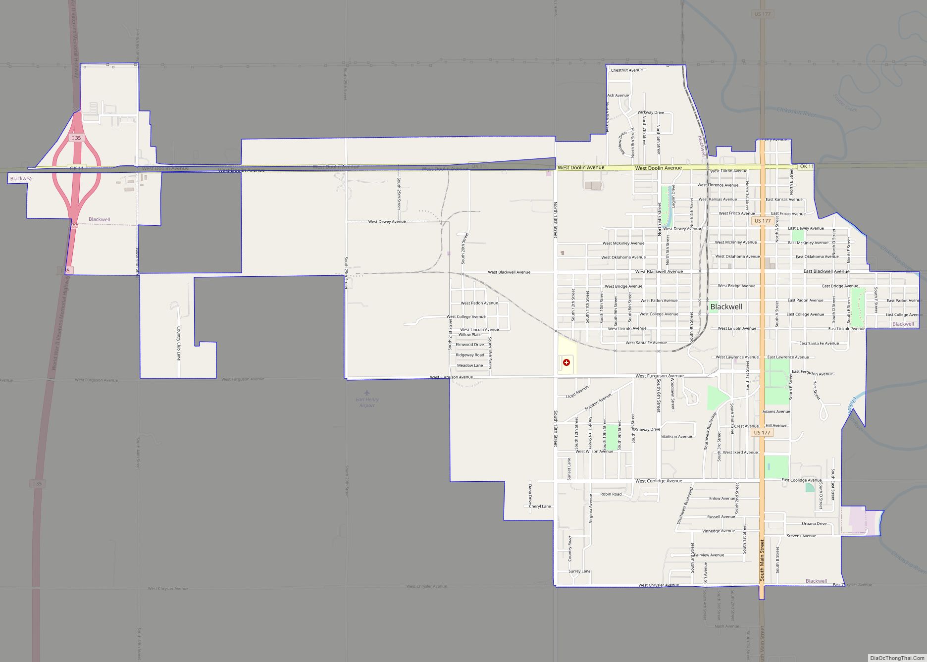
Blackwell is a city in Kay County, Oklahoma, United States, located at the intersection of U.S. Highway 177 and State Highway 11 along Interstate 35 (exit #222). The population was 7,092 at the 2010 census and 6,085 in the 2020 Census. Blackwell was established following the September 16, 1893 Cherokee Outlet land run by A. ... Read more
Braggs is a town in Muskogee County, Oklahoma, United States. The population was 259 as of the 2010 census, with a 14.0 percent decline from the figure of 301 recorded in 2000. The town is best known as the site of Camp Gruber, a World War II military cantonment that was the home base of ... Read more
Bradley is a town in Grady County, Oklahoma, United States. The population was 78 at the 2020 United States census. Bradley town overview: Name: Bradley town LSAD Code: 43 LSAD Description: town (suffix) State: Oklahoma County: Grady County Elevation: 1,079 ft (329 m) Total Area: 0.24 sq mi (0.61 km²) Land Area: 0.24 sq mi (0.61 km²) Water Area: 0.00 sq mi (0.00 km²) Total Population: ... Read more
Boynton is a town in Muskogee County, Oklahoma, United States. The population was 248 at the 2010 census, a 9.5 percent decline from the figure of 274 recorded in 2000. Boynton town overview: Name: Boynton town LSAD Code: 43 LSAD Description: town (suffix) State: Oklahoma County: Muskogee County Elevation: 623 ft (190 m) Total Area: 0.42 sq mi (1.10 km²) ... Read more
Box is an unincorporated community and census-designated place in Sequoyah County, Oklahoma, United States. Its population was 224 as of the 2010 census. Oklahoma State Highway 82 passes through the community. Box was previously known as Roy; its post office changed its name to Box on July 7, 1911, after resident Henry Box. The post ... Read more
Bowlegs is a town in Seminole County, Oklahoma, United States. The population was 405 at the 2010 census. Bowlegs town overview: Name: Bowlegs town LSAD Code: 43 LSAD Description: town (suffix) State: Oklahoma County: Seminole County Elevation: 938 ft (286 m) Total Area: 3.72 sq mi (9.64 km²) Land Area: 3.72 sq mi (9.64 km²) Water Area: 0.00 sq mi (0.00 km²) Total Population: 357 Population ... Read more
Boswell is a town in Choctaw County, Oklahoma, United States. The population was 709 at the 2010 census. Boswell town overview: Name: Boswell town LSAD Code: 43 LSAD Description: town (suffix) State: Oklahoma County: Choctaw County Elevation: 610 ft (186 m) Total Area: 0.77 sq mi (1.99 km²) Land Area: 0.76 sq mi (1.96 km²) Water Area: 0.01 sq mi (0.03 km²) Total Population: 579 Population ... Read more