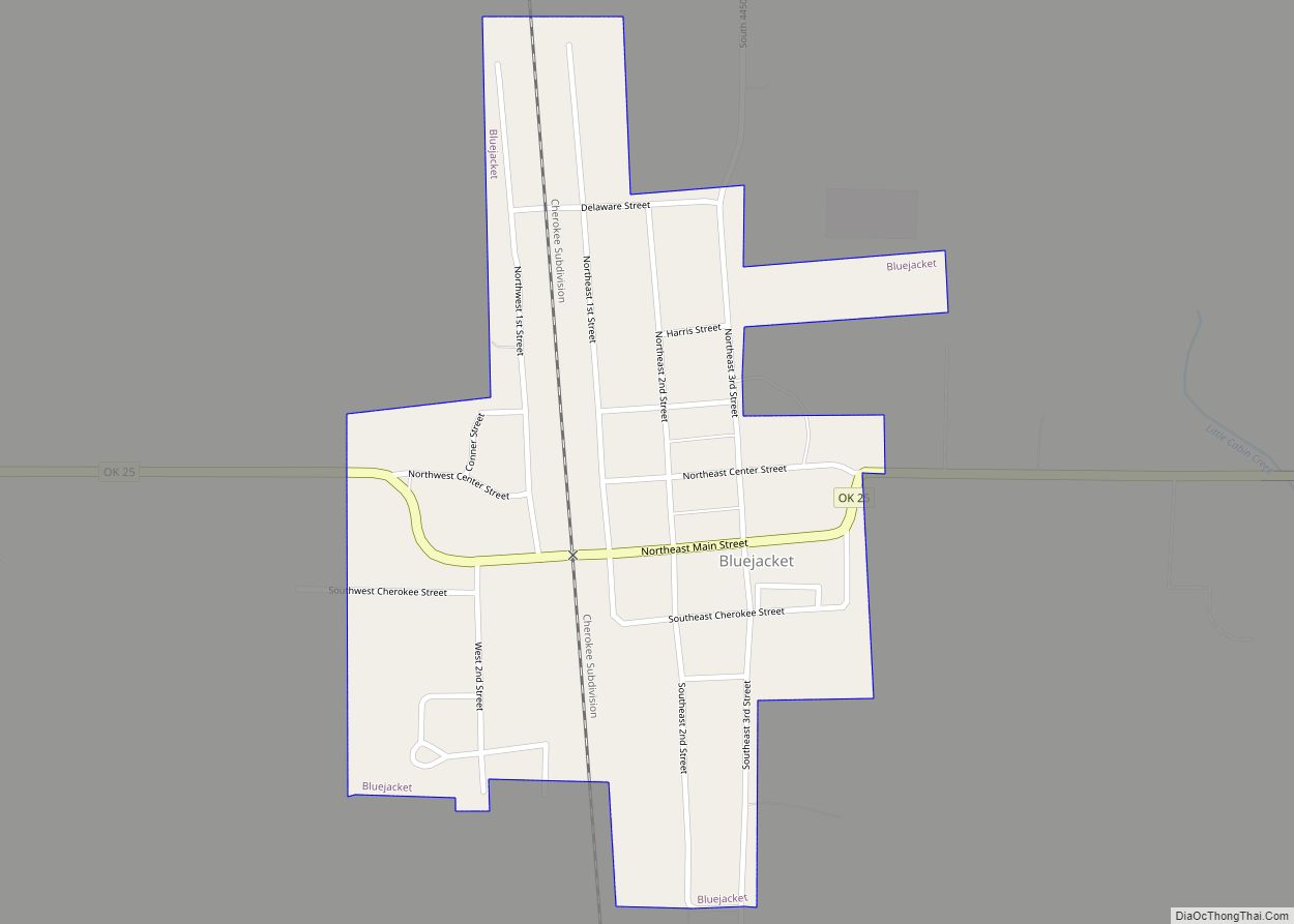
Bluejacket is a town in eastern Craig County, Oklahoma, United States. The population was 339 at the 2010 census, an increase of 23.7 percent over the figure of 274 recorded in 2000. Bluejacket was named for its first postmaster, the Rev. Charles Blue Jacket, one-time chief of the Shawnee and grandson of noted leader Blue Jacket.
| Name: | Bluejacket town |
|---|---|
| LSAD Code: | 43 |
| LSAD Description: | town (suffix) |
| State: | Oklahoma |
| County: | Craig County |
| Elevation: | 787 ft (240 m) |
| Total Area: | 0.43 sq mi (1.13 km²) |
| Land Area: | 0.43 sq mi (1.13 km²) |
| Water Area: | 0.00 sq mi (0.00 km²) |
| Total Population: | 235 |
| Population Density: | 540.23/sq mi (208.59/km²) |
| FIPS code: | 4006950 |
| GNISfeature ID: | 1090300 |
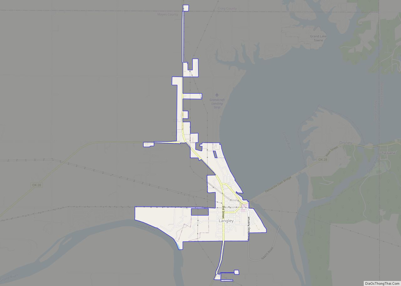
Online Interactive Map
Click on ![]() to view map in "full screen" mode.
to view map in "full screen" mode.
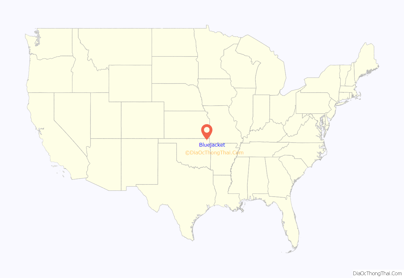
Bluejacket location map. Where is Bluejacket town?

History
Bluejacket was founded as a station designated by the Missouri, Kansas and Texas Railway (KATY) in 1871, as it built a line through Indian Territory from Kansas to Texas. A post office was established in 1882, and Chief Bluejacket was appointed as the first postmaster. The town was incorporated in the Cherokee Nation in 1894.
During the late 1930s, two tornadoes severely damaged Bluejacket. The first, on May 4, 1938, destroyed some barns and killed a farmer and several head of livestock. The second, on August 24, 1939, destroyed much of the business district. This storm killed two young men and caused an estimated half million dollars’ worth of damage in the county.
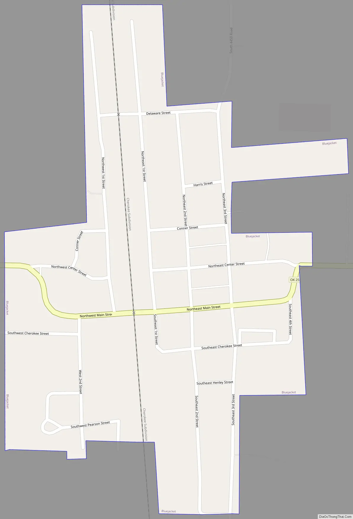
Bluejacket Road Map
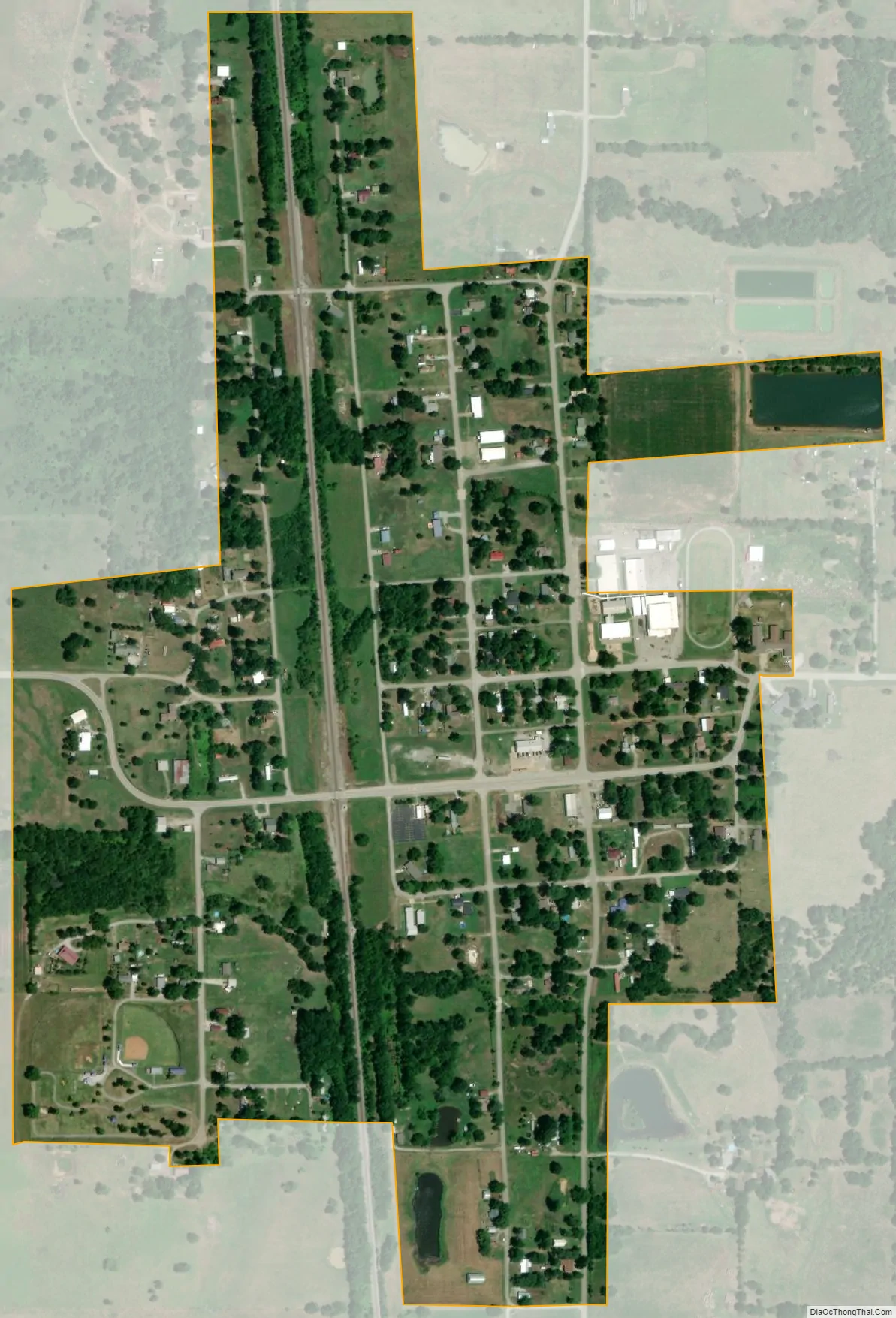
Bluejacket city Satellite Map
Geography
According to the United States Census Bureau, the town has a total area of 0.4 square miles (1.0 km), all land. It is approximately 17 miles (27 km) northeast of Vinita, the county seat.
See also
Map of Oklahoma State and its subdivision:- Adair
- Alfalfa
- Atoka
- Beaver
- Beckham
- Blaine
- Bryan
- Caddo
- Canadian
- Carter
- Cherokee
- Choctaw
- Cimarron
- Cleveland
- Coal
- Comanche
- Cotton
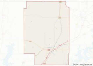
- Craig
- Creek
- Custer
- Delaware
- Dewey
- Ellis
- Garfield
- Garvin
- Grady
- Grant
- Greer
- Harmon
- Harper
- Haskell
- Hughes
- Jackson
- Jefferson
- Johnston
- Kay
- Kingfisher
- Kiowa
- Latimer
- Le Flore
- Lincoln
- Logan
- Love
- Major
- Marshall
- Mayes
- McClain
- McCurtain
- McIntosh
- Murray
- Muskogee
- Noble
- Nowata
- Okfuskee
- Oklahoma
- Okmulgee
- Osage
- Ottawa
- Pawnee
- Payne
- Pittsburg
- Pontotoc
- Pottawatomie
- Pushmataha
- Roger Mills
- Rogers
- Seminole
- Sequoyah
- Stephens
- Texas
- Tillman
- Tulsa
- Wagoner
- Washington
- Washita
- Woods
- Woodward
- Alabama
- Alaska
- Arizona
- Arkansas
- California
- Colorado
- Connecticut
- Delaware
- District of Columbia
- Florida
- Georgia
- Hawaii
- Idaho
- Illinois
- Indiana
- Iowa
- Kansas
- Kentucky
- Louisiana
- Maine
- Maryland
- Massachusetts
- Michigan
- Minnesota
- Mississippi
- Missouri
- Montana
- Nebraska
- Nevada
- New Hampshire
- New Jersey
- New Mexico
- New York
- North Carolina
- North Dakota
- Ohio
- Oklahoma
- Oregon
- Pennsylvania
- Rhode Island
- South Carolina
- South Dakota
- Tennessee
- Texas
- Utah
- Vermont
- Virginia
- Washington
- West Virginia
- Wisconsin
- Wyoming