Map of Highland city, Arkansas
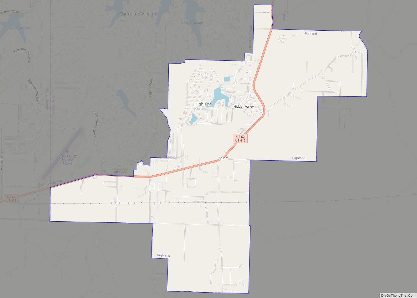
Highland is a city in Sharp County, Arkansas, United States. The city was incorporated in 1998 and is located in Sharp County. It is the fourth largest city in Sharp County with a population of 1,015 in 2021 Highland city overview: Name: Highland city LSAD Code: 25 LSAD Description: city (suffix) State: Arkansas County: Sharp ... Read more
Map of Highland city, Arkansas
Map of Highfill town
Highfill is a town in Benton County, Arkansas, United States. The population was 1,587 as of the 2020 census. It is home to the Northwest Arkansas National Airport, which serves all of the Northwest Arkansas region. Highfill town overview: Name: Highfill town LSAD Code: 43 LSAD Description: town (suffix) State: Arkansas County: Benton County Elevation: ... Read more
Map of Highfill town
Map of Holiday Island CDP
Holiday Island is a 4,500-acre planned retirement and vacation community in Carroll County, Arkansas, United States. Formerly an unincorporated community and census-designated place (CDP), they voted to incorporate in November 2020. As of the 2020 census, the population was 2,533. Holiday Island is located in the Ozark Mountains on Table Rock Lake near Eureka Springs, ... Read more
Map of Holiday Island CDP
Map of Holly Grove city
Holly Grove is a city in Monroe County, Arkansas, United States. As of the 2020 census, the city population was 460, down from 602 in 2010. Holly Grove city overview: Name: Holly Grove city LSAD Code: 25 LSAD Description: city (suffix) State: Arkansas County: Monroe County Elevation: 180 ft (50 m) Total Area: 1.02 sq mi (2.64 km²) Land Area: ... Read more
Map of Holly Grove city
Map of Holland city, Arkansas
Holland is a city in Faulkner County, Arkansas, United States. The population was 557 at the 2010 census. It is part of the Little Rock–North Little Rock–Conway Metropolitan Statistical Area. Holland gained media attention after 13-year-old Kacie Woody was reported missing from her home in this area in 2002; an investigation revealed that she was ... Read more
Map of Holland city, Arkansas
Map of Horseshoe Bend city, Arkansas
Horseshoe Bend is a city in Fulton, Izard, and Sharp counties in the U.S. state of Arkansas. The population was 2,184 at the 2010 census. It is named for the large loop or horseshoe bend in the nearby Strawberry River. Horseshoe Bend city overview: Name: Horseshoe Bend city LSAD Code: 25 LSAD Description: city (suffix) ... Read more
Map of Horseshoe Bend city, Arkansas
Map of Horatio city
Horatio is a city in Sevier County, Arkansas, United States. The population was 1,044 at the 2010 census. Horatio city overview: Name: Horatio city LSAD Code: 25 LSAD Description: city (suffix) State: Arkansas County: Sevier County Elevation: 384 ft (117 m) Total Area: 1.80 sq mi (4.66 km²) Land Area: 1.78 sq mi (4.62 km²) Water Area: 0.01 sq mi (0.04 km²) Total Population: 920 Population ... Read more
Map of Horatio city
Map of Hope city, Arkansas
Hope is a city in Hempstead County in southwestern Arkansas, United States. Hope is the county seat of Hempstead County and the principal city of the Hope Micropolitan Statistical Area, which includes all of Hempstead and Nevada counties. As of the 2010 census the population was 10,095, and in 2019 the population was estimated at ... Read more
Map of Hope city, Arkansas
Map of Hot Springs city, Arkansas
Hot Springs is a resort city in the state of Arkansas and the county seat of Garland County. The city is located in the Ouachita Mountains among the U.S. Interior Highlands, and is set among several natural hot springs for which the city is named. As of the 2020 United States Census, the city had ... Read more
Map of Hot Springs city, Arkansas
Map of Hot Springs Village CDP
Hot Springs Village is a census-designated place (CDP) in Garland and Saline counties in the U.S. state of Arkansas. As it is situated in two counties, it is also part of two metropolitan statistical areas. The portion in Garland County is within the Hot Springs Metropolitan Statistical Area, while the portion extending into Saline County ... Read more
Map of Hot Springs Village CDP
Map of Horseshoe Lake town
Horseshoe Lake is a town in Crittenden County, Arkansas, United States. The population was 264 at the 2020 census. The town is named after Horseshoe Lake, an oxbow lake at the eastern tip of which the town is located. Horseshoe Lake town overview: Name: Horseshoe Lake town LSAD Code: 43 LSAD Description: town (suffix) State: ... Read more
Map of Horseshoe Lake town
Map of Hughes city, Arkansas
Hughes is a city in St. Francis County, Arkansas, United States. As of the 2020 census, it had a population of 1,056. Hughes city overview: Name: Hughes city LSAD Code: 25 LSAD Description: city (suffix) State: Arkansas County: St. Francis County Elevation: 207 ft (63 m) Total Area: 2.28 sq mi (5.92 km²) Land Area: 2.26 sq mi (5.86 km²) Water Area: 0.02 sq mi ... Read more
Map of Hughes city, Arkansas