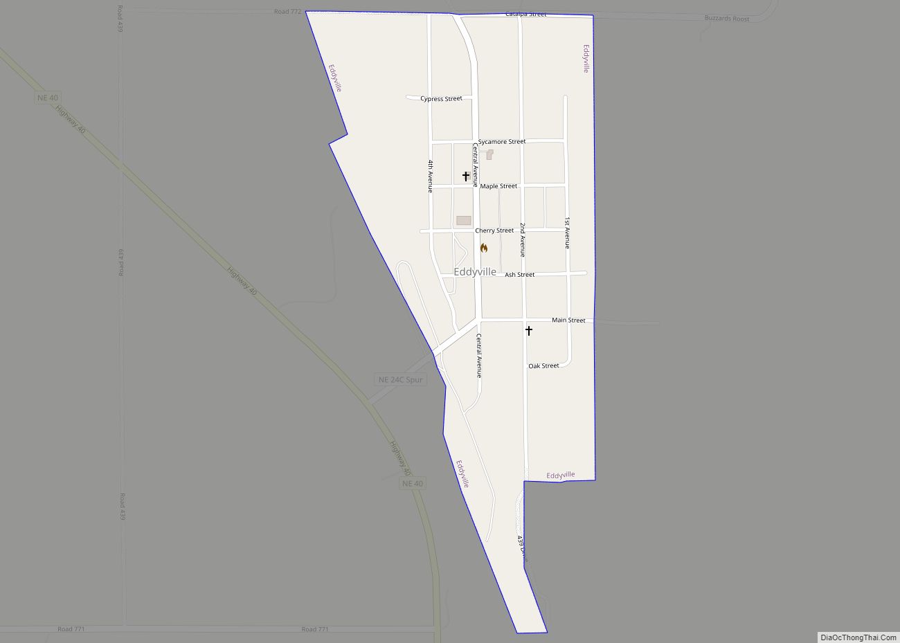
Eddyville is a village in Dawson County, Nebraska, United States. It is part of the Lexington, Nebraska Micropolitan Statistical Area. The population was 97 at the 2010 census. Eddyville village overview: Name: Eddyville village LSAD Code: 47 LSAD Description: village (suffix) State: Nebraska County: Dawson County Elevation: 2,448 ft (746 m) Total Area: 0.28 sq mi (0.71 km²) Land Area: ... Read more
Map of US Cities and Places
Eagle is a village in southwest Cass County, Nebraska, United States. As of the 2020 census, the village population was 1,065. Eagle village overview: Name: Eagle village LSAD Code: 47 LSAD Description: village (suffix) State: Nebraska County: Cass County Elevation: 1,342 ft (409 m) Total Area: 0.41 sq mi (1.07 km²) Land Area: 0.41 sq mi (1.07 km²) Water Area: 0.00 sq mi (0.00 km²) Total ... Read more
Dwight is a village in Butler County, Nebraska, United States. The population was 204 at the 2010 census. Dwight village overview: Name: Dwight village LSAD Code: 47 LSAD Description: village (suffix) State: Nebraska County: Butler County Elevation: 1,624 ft (495 m) Total Area: 0.24 sq mi (0.62 km²) Land Area: 0.24 sq mi (0.62 km²) Water Area: 0.00 sq mi (0.00 km²) Total Population: 229 Population ... Read more
Dunning is the most populous village in Blaine County, Nebraska, United States. The population was 80 at the 2020 census. Dunning village overview: Name: Dunning village LSAD Code: 47 LSAD Description: village (suffix) State: Nebraska County: Blaine County Elevation: 2,618 ft (798 m) Total Area: 0.23 sq mi (0.59 km²) Land Area: 0.23 sq mi (0.59 km²) Water Area: 0.00 sq mi (0.00 km²) Total Population: ... Read more
Duncan is a village in Platte County, Nebraska, United States. The population was 351 at the 2010 census. Duncan village overview: Name: Duncan village LSAD Code: 47 LSAD Description: village (suffix) State: Nebraska County: Platte County Elevation: 1,496 ft (456 m) Total Area: 0.47 sq mi (1.21 km²) Land Area: 0.47 sq mi (1.21 km²) Water Area: 0.00 sq mi (0.00 km²) Total Population: 392 Population ... Read more
Dunbar is a village in Otoe County, Nebraska, United States. The population was 165 at the 2020 census. Dunbar village overview: Name: Dunbar village LSAD Code: 47 LSAD Description: village (suffix) State: Nebraska County: Otoe County Elevation: 1,083 ft (330 m) Total Area: 0.23 sq mi (0.60 km²) Land Area: 0.23 sq mi (0.60 km²) Water Area: 0.00 sq mi (0.00 km²) Total Population: 165 Population ... Read more
Du Bois(/du.ˈbɔɪz/ doo-BOYZ) is a village in the southeast corner of Pawnee County, Nebraska, United States. The population was 124 at the 2020 census. Du Bois village overview: Name: Du Bois village LSAD Code: 47 LSAD Description: village (suffix) State: Nebraska County: Pawnee County Elevation: 1,050 ft (320 m) Total Area: 0.45 sq mi (1.18 km²) Land Area: 0.45 sq mi (1.18 km²) ... Read more
Douglas is a village in southwest Otoe County, Nebraska, United States. The population was 166 at the 2020 census. Douglas village overview: Name: Douglas village LSAD Code: 47 LSAD Description: village (suffix) State: Nebraska County: Otoe County Elevation: 1,250 ft (380 m) Total Area: 0.22 sq mi (0.57 km²) Land Area: 0.22 sq mi (0.57 km²) Water Area: 0.00 sq mi (0.00 km²) Total Population: 166 ... Read more
Dorchester is a village in Saline County, Nebraska, United States. It is thirty-eight miles southwest from the Lincoln, Nebraska metropolitan area. The population was 596 at the 2020 census. Dorchester village overview: Name: Dorchester village LSAD Code: 47 LSAD Description: village (suffix) State: Nebraska County: Saline County Elevation: 1,486 ft (453 m) Total Area: 0.50 sq mi (1.30 km²) Land ... Read more
Doniphan is a village in Hall County, Nebraska, United States. The population was 829 at the 2010 census. It is part of the Grand Island, Nebraska Micropolitan Statistical Area. Doniphan village overview: Name: Doniphan village LSAD Code: 47 LSAD Description: village (suffix) State: Nebraska County: Hall County Elevation: 1,942 ft (592 m) Total Area: 0.49 sq mi (1.28 km²) Land ... Read more
Edgar is a city in Clay County, Nebraska, United States. The population was 498 at the 2010 census. It is part of the Hastings, Nebraska Micropolitan Statistical Area. Edgar city overview: Name: Edgar city LSAD Code: 25 LSAD Description: city (suffix) State: Nebraska County: Clay County Elevation: 1,722 ft (525 m) Total Area: 0.79 sq mi (2.05 km²) Land Area: ... Read more
Elyria is a village in Valley County, Nebraska, United States. The population was 51 at the 2010 census. Elyria village overview: Name: Elyria village LSAD Code: 47 LSAD Description: village (suffix) State: Nebraska County: Valley County Elevation: 2,103 ft (641 m) Total Area: 0.27 sq mi (0.69 km²) Land Area: 0.27 sq mi (0.69 km²) Water Area: 0.00 sq mi (0.00 km²) Total Population: 50 Population ... Read more