Map of Saranac Lake village
Saranac Lake is a village in the state of New York, United States. As of the 2020 census, the population was 4,887, making it the largest community by population in the Adirondack Park. The village is named after Upper, Middle and Lower Saranac lakes, which are nearby. The village of Saranac Lake covers parts of ... Read more
Map of Saranac Lake village
Map of Sandy Creek village, New York
Sandy Creek is a village in Oswego County, New York, United States. The population was 771 at the 2010 census. The Village of Sandy Creek in the central part of the Town of Sandy Creek. The village is located by U.S. Route 11. Sandy Creek village overview: Name: Sandy Creek village LSAD Code: 47 LSAD ... Read more
Map of Sandy Creek village, New York
Map of Sands Point village
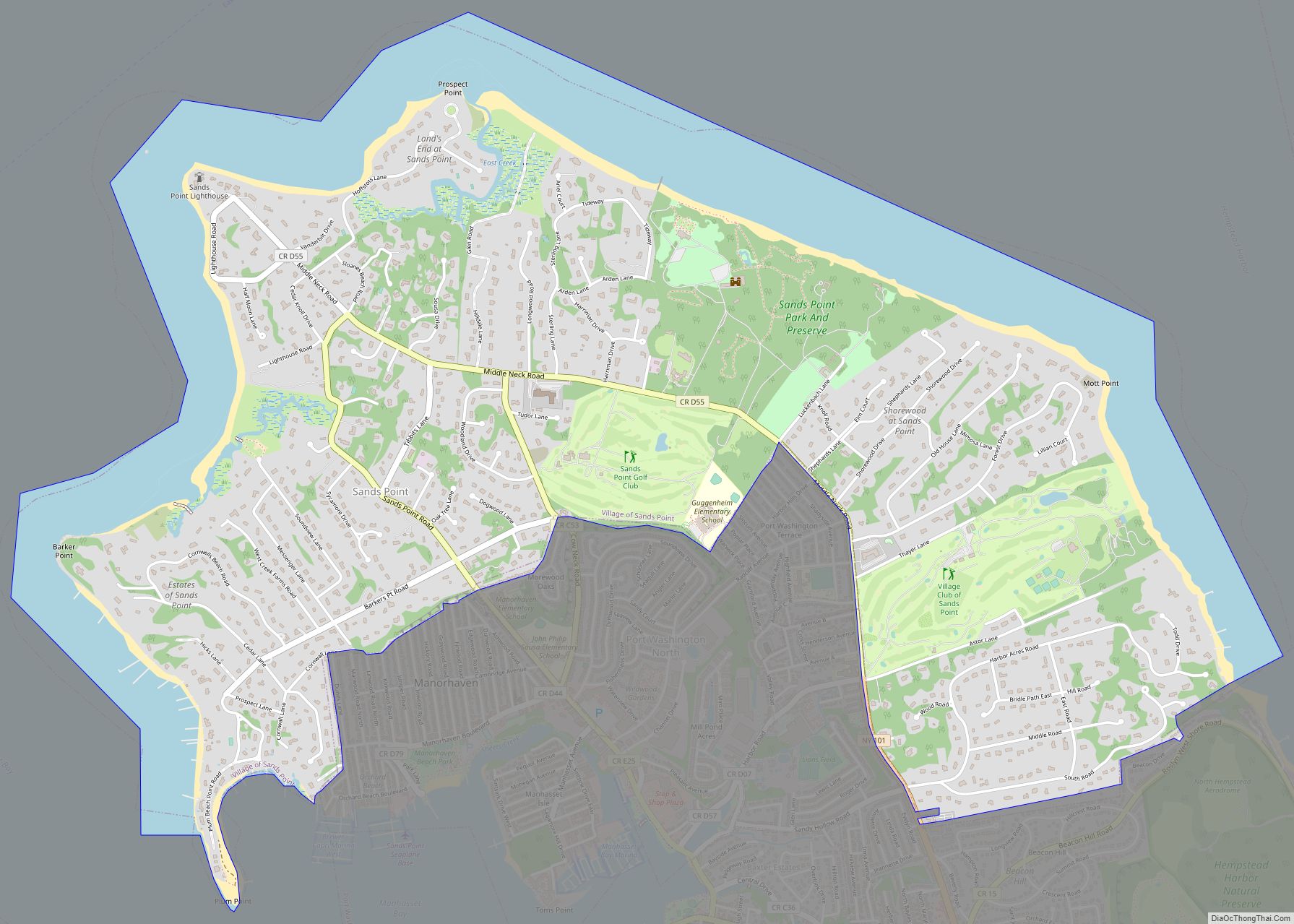
Sands Point is a village located at the tip of the Cow Neck Peninsula in the Town of North Hempstead, in Nassau County, on the North Shore of Long Island, in New York, United States. It is considered part of the Greater Port Washington area, which is anchored by Port Washington. The population was 2,675 ... Read more
Map of Sands Point village
Map of Sand Ridge CDP
Sand Ridge is a hamlet (and census-designated place) in Oswego County, New York, United States. The population was 849 at the 2010 census. Sand Ridge is in the southern section of the Town of Schroeppel. Sand Ridge CDP overview: Name: Sand Ridge CDP LSAD Code: 57 LSAD Description: CDP (suffix) State: New York County: Oswego ... Read more
Map of Sand Ridge CDP
Map of Sanborn CDP, New York
Sanborn is a hamlet (and census-designated place, population: 1,645 in 2010 census) in the Towns of Cambria, Lewiston, and Wheatfield, in Niagara County, New York, United States, on the southern side of the intersection of New York State Route 429 and New York State Route 31. Originally called South Pekin after the formerly thriving hamlet ... Read more
Map of Sanborn CDP, New York
Map of Saltaire village
Saltaire is a village located on Fire Island in Islip, Suffolk County, New York, United States. The year-round population was 37 at the 2010 census, which, as a summer beach community, increases many times over in the summer. Saltaire village overview: Name: Saltaire village LSAD Code: 47 LSAD Description: village (suffix) State: New York County: ... Read more
Map of Saltaire village
Map of Salt Point CDP
Salt Point is a hamlet and census-designated place (CDP) located in the Town of Pleasant Valley, Dutchess County, New York, United States. As of the 2020 census it had a population of 202. It lies northeast of Poughkeepsie following New York Route 115, the Salt Point Turnpike. East of Salt Point, the Taconic State Parkway ... Read more
Map of Salt Point CDP
Map of Salisbury CDP, New York
Salisbury (formerly known as South Westbury) is a hamlet and census-designated place (CDP) in the Town of Hempstead in Nassau County, on Long Island, in New York, United States. The population was 12,093 at the 2010 census. Many Levitt style homes lie adjacent to Eisenhower Park (formerly known as Salisbury Park). It is served by ... Read more
Map of Salisbury CDP, New York
Map of Salisbury Mills CDP
Salisbury Mills is a hamlet and census-designated place (CDP) in the towns of Blooming Grove and Cornwall in Orange County, New York, United States. As of the 2020 census, it had a population of 580. The CDP is in eastern Orange County and is bordered to the north by Beaver Dam Lake. Salisbury Mills is ... Read more
Map of Salisbury Mills CDP
Map of Salem CDP, New York
Salem is a hamlet (and census-designated place) located in the town of Salem in Washington County, New York, United States. It is part of the Glens Falls Metropolitan Statistical Area. The population was 946 at the 2010 census. The hamlet is located in the north central part of Town of Salem, at the junction of ... Read more
Map of Salem CDP, New York
Map of Saugerties village
Saugerties (/ˈsɔːɡərtiːz/) is a village in Ulster County, New York, United States. The population was 3,899 at the 2020 census, showing a slight decline from the 3,971 counted at the 2010 census. The Village of Saugerties is located on the west bank of the Hudson River, at the mouth of the Esopus Creek. It is ... Read more
Map of Saugerties village
Map of Saugerties South CDP
Saugerties South is a hamlet (and census-designated place) in Ulster County, New York, United States. The population was 2,442 at the 2020 census. Saugerties South is a community south of the Village of Saugerties and Esopus Creek in the Town of Saugerties. U.S. Route 9W passes through the community. Saugerties South CDP overview: Name: Saugerties ... Read more
Map of Saugerties South CDP