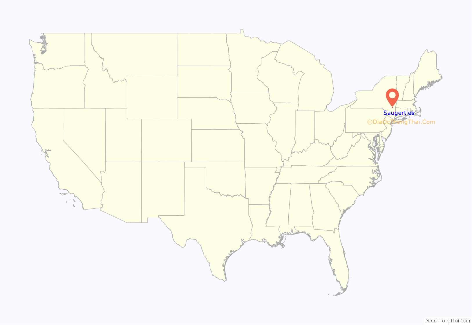
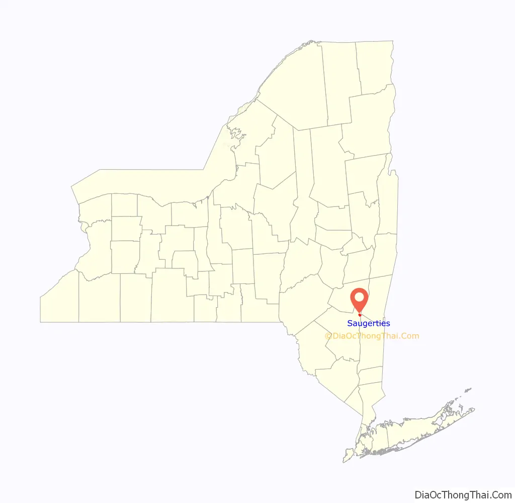
Saugerties (/ˈsɔːɡərtiːz/) is a village in Ulster County, New York, United States. The population was 3,899 at the 2020 census, showing a slight decline from the 3,971 counted at the 2010 census.
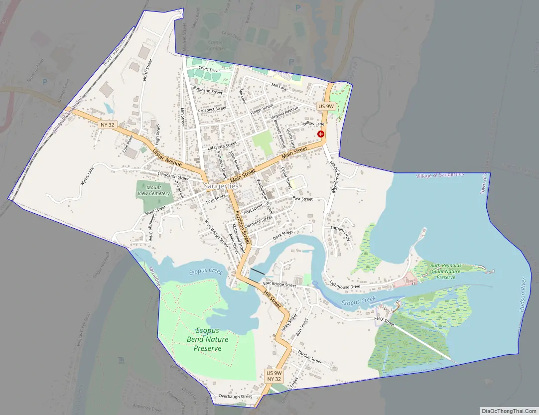
The Village of Saugerties is located on the west bank of the Hudson River, at the mouth of the Esopus Creek. It is in the eastern part of the Town of Saugerties. U.S. Route 9W and New York State Route 32 pass through the village, converging at its center and overlapping to the south. These routes parallel the New York State Thruway (Interstate 87), which passes through the town a mile west of the village.
| Name: | Saugerties village |
|---|---|
| LSAD Code: | 47 |
| LSAD Description: | village (suffix) |
| State: | New York |
| County: | Ulster County |
| Incorporated: | 1831 |
| Elevation: | 154 ft (47 m) |
| Total Area: | 2.26 sq mi (5.85 km²) |
| Land Area: | 1.78 sq mi (4.62 km²) |
| Water Area: | 0.48 sq mi (1.23 km²) |
| Total Population: | 3,899 |
| Population Density: | 2,185.54/sq mi (844.07/km²) |
| ZIP code: | 12477 |
| Area code: | 845 |
| FIPS code: | 3665288 |
| GNISfeature ID: | 0964502 |
| Website: | village.saugerties.ny.us/content |
Online Interactive Map
Click on ![]() to view map in "full screen" mode.
to view map in "full screen" mode.
Saugerties location map. Where is Saugerties village?
History
In the 1650s, Barent Cornelis Volge operated a sawmill on the Sawyer’s Kill, supplying lumber for the manor of Rensselaerswick. He had secured a title from the Esopus Sachem to this land sometime before 1663. The name Saugerties derives from “Zagertje”, which means “Little Sawyer” in Dutch.
Circa 1685, George Meals and Richard Hayes purchased land on both sides of the Esopus Creek where it enters the Hudson River. Within two years, they sold the riverfront land to Barent Burhans, a miller whose granddaughter’s husband, John Brink Jr., established a ferry across the river to Clermont, the seat of the Lower Livingston Manor.
John Persen was an early mill owner. He had both a sawmill and a gristmill; he also operated a ferry crossing the river to the east shore. He built the Mynderse House around 1685.
During the American Revolution, a British naval squadron lay at anchor at Saugerties from October 18–22, 1777, while raiding parties burned the Livingston estates of Clermont and Belvedere, across the Hudson River. Some of Benjamin Snyder’s sloops were burned in Saugerties harbor as well.
The village was incorporated in 1831 as “Ulster,” but it changed its name to “Saugerties” in 1855.
Saugerties Road Map
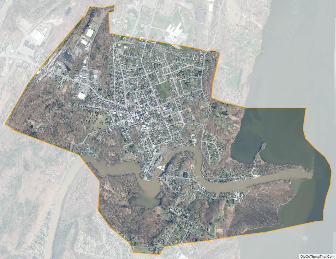
Saugerties city Satellite Map
Geography
Saugerties is located at 42°4′34″N 73°57′0″W / 42.07611°N 73.95000°W / 42.07611; -73.95000 (42.076282, -73.950219).
According to the United States Census Bureau, the village has a total area of 2.3 square miles (6.0 km), of which 1.8 square miles (4.7 km) is land and 0.4 square miles (1.0 km) (19.30%) is water.
The village is on the west bank of the Hudson River, where the Esopus Creek enters the Hudson.
See also
Map of New York State and its subdivision:- Albany
- Allegany
- Bronx
- Broome
- Cattaraugus
- Cayuga
- Chautauqua
- Chemung
- Chenango
- Clinton
- Columbia
- Cortland
- Delaware
- Dutchess
- Erie
- Essex
- Franklin
- Fulton
- Genesee
- Greene
- Hamilton
- Herkimer
- Jefferson
- Kings
- Lake Ontario
- Lewis
- Livingston
- Madison
- Monroe
- Montgomery
- Nassau
- New York
- Niagara
- Oneida
- Onondaga
- Ontario
- Orange
- Orleans
- Oswego
- Otsego
- Putnam
- Queens
- Rensselaer
- Richmond
- Rockland
- Saint Lawrence
- Saratoga
- Schenectady
- Schoharie
- Schuyler
- Seneca
- Steuben
- Suffolk
- Sullivan
- Tioga
- Tompkins
- Ulster
- Warren
- Washington
- Wayne
- Westchester
- Wyoming
- Yates
- Alabama
- Alaska
- Arizona
- Arkansas
- California
- Colorado
- Connecticut
- Delaware
- District of Columbia
- Florida
- Georgia
- Hawaii
- Idaho
- Illinois
- Indiana
- Iowa
- Kansas
- Kentucky
- Louisiana
- Maine
- Maryland
- Massachusetts
- Michigan
- Minnesota
- Mississippi
- Missouri
- Montana
- Nebraska
- Nevada
- New Hampshire
- New Jersey
- New Mexico
- New York
- North Carolina
- North Dakota
- Ohio
- Oklahoma
- Oregon
- Pennsylvania
- Rhode Island
- South Carolina
- South Dakota
- Tennessee
- Texas
- Utah
- Vermont
- Virginia
- Washington
- West Virginia
- Wisconsin
- Wyoming


