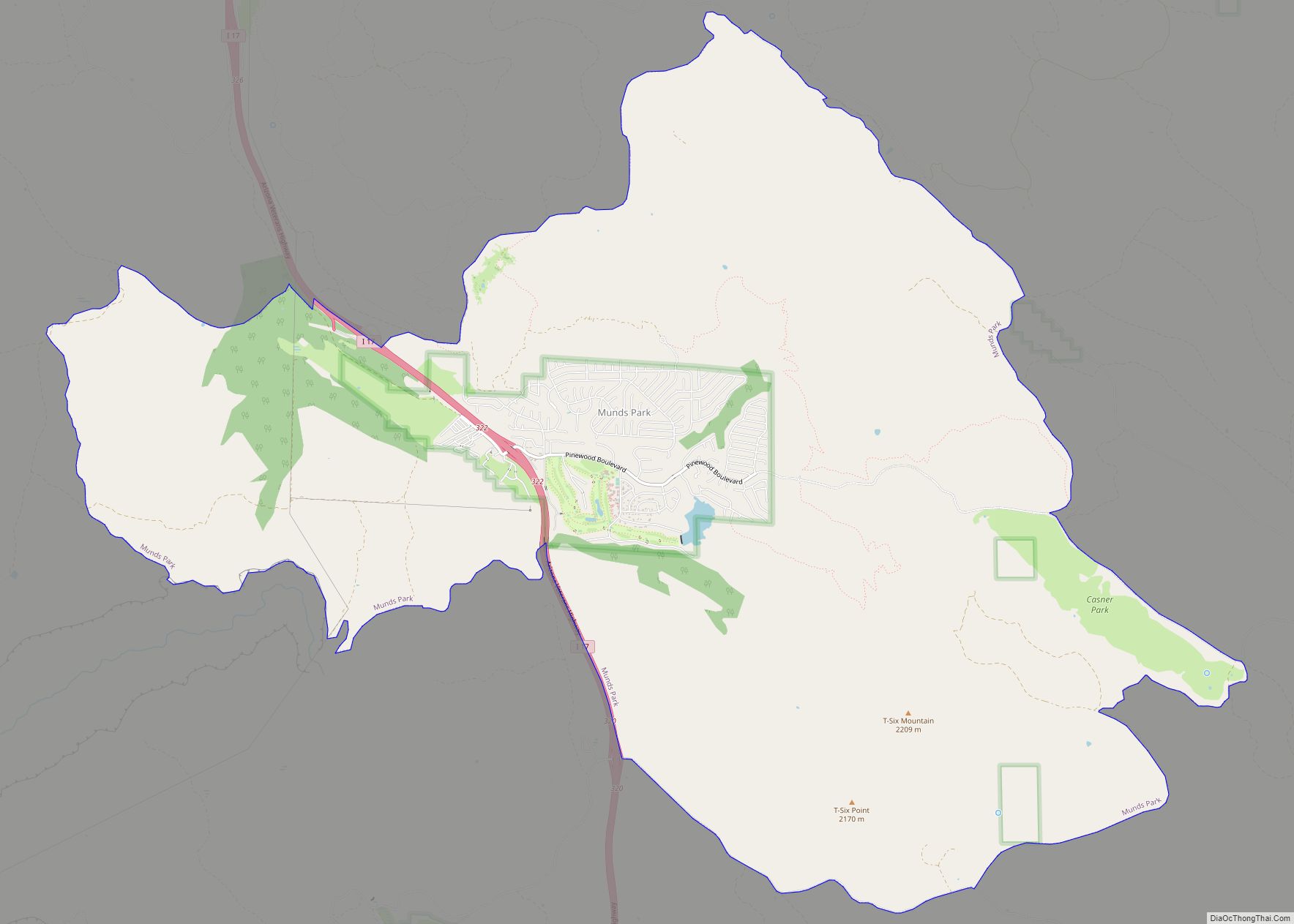
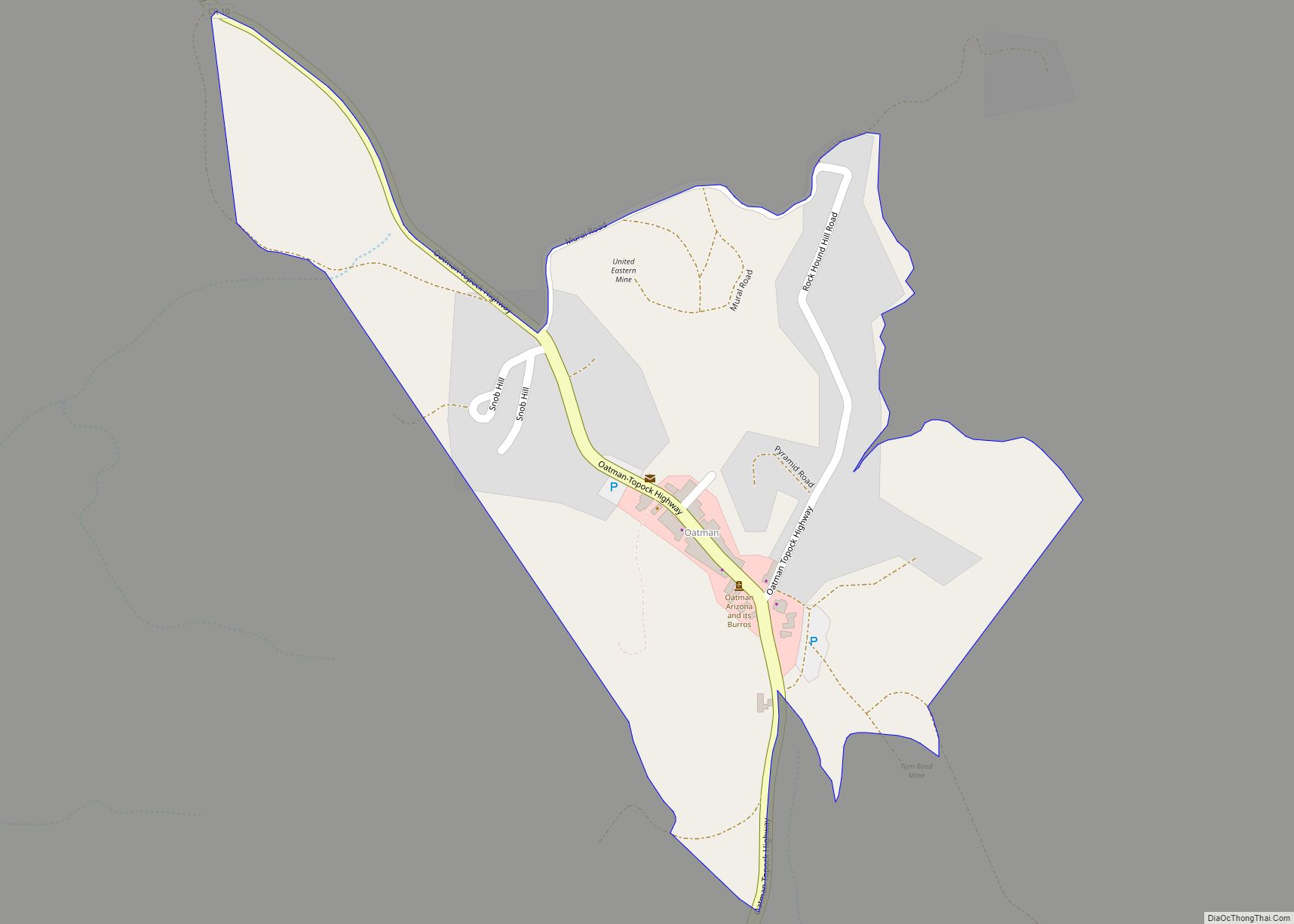
Munds Park is an unincorporated census-designated place (CDP) in Coconino County, Arizona, United States. The year round population was 631 at the 2010 census. Munds Park CDP overview: Name: Munds Park CDP LSAD Code: 57 LSAD Description: CDP (suffix) State: Arizona County: Coconino County Elevation: 6,590 ft (2,009 m) Total Area: 22.29 sq mi (57.72 km²) Land Area: 22.25 sq mi (57.62 km²) ... Read more
Map of US Cities and Places
Mountainaire is a census-designated place (CDP) in Coconino County, Arizona, United States. The population was 1,119 at the 2010 census. Mountainaire CDP overview: Name: Mountainaire CDP LSAD Code: 57 LSAD Description: CDP (suffix) State: Arizona County: Coconino County Elevation: 6,800 ft (2,073 m) Total Area: 10.21 sq mi (26.43 km²) Land Area: 10.20 sq mi (26.43 km²) Water Area: 0.00 sq mi (0.01 km²) Total Population: ... Read more
New Kingman-Butler is an unincorporated community and census-designated place (CDP) in Mohave County, Arizona, United States, directly north of and bordering the city of Kingman. The population was 12,907 as of the 2020 census. New Kingman-Butler CDP overview: Name: New Kingman-Butler CDP LSAD Code: 57 LSAD Description: CDP (suffix) State: Arizona County: Mohave County Elevation: ... Read more
Nelson is a census-designated place (CDP) in Pima County, Arizona, United States. The population was 259 at the 2010 census. Nelson CDP overview: Name: Nelson CDP LSAD Code: 57 LSAD Description: CDP (suffix) State: Arizona County: Pima County Elevation: 1,975 ft (602 m) Total Area: 0.47 sq mi (1.23 km²) Land Area: 0.47 sq mi (1.23 km²) Water Area: 0.00 sq mi (0.00 km²) Total Population: ... Read more
Nazlini (Navajo: Názlíní) is a census-designated place (CDP) in Apache County, Arizona, United States. The population was 489 at the 2010 census. Nearby are Nazlini Creek and Nazlini Canyon. Nazlini Canyon is the site of many Native American ruins and campsites that were abandoned when erosion made them unusable. Nazlini CDP overview: Name: Nazlini CDP ... Read more
North Fork is a census-designated place (CDP) in Navajo County, Arizona, United States, on the Fort Apache Indian Reservation. The population was 1,417 at the 2010 census. North Fork CDP overview: Name: North Fork CDP LSAD Code: 57 LSAD Description: CDP (suffix) State: Arizona County: Navajo County Elevation: 6,768 ft (2,063 m) Total Area: 61.62 sq mi (159.60 km²) Land ... Read more
Nolic is a census-designated place (CDP) located on the Tohono O’odham Indian Reservation in Pima County, Arizona, United States. The population was 37 at the 2010 census. Nolic CDP overview: Name: Nolic CDP LSAD Code: 57 LSAD Description: CDP (suffix) State: Arizona County: Pima County Elevation: 2,379 ft (725 m) Total Area: 0.52 sq mi (1.35 km²) Land Area: 0.52 sq mi ... Read more
New River is an unincorporated community and census-designated place (CDP) in Maricopa County, Arizona, United States. The population was 17,290 as of the 2020 census, up from 14,952 at the 2010 census. New River CDP overview: Name: New River CDP LSAD Code: 57 LSAD Description: CDP (suffix) State: Arizona County: Maricopa County Elevation: 2,014 ft (614 m) ... Read more
Oatman is a census-designated place (CDP) in the Black Mountains of Mohave County, Arizona, United States, located at an elevation of 2,710 feet (830 m). It began as a small mining camp when two prospectors struck a $10 million gold find in 1915, though the vicinity had already been settled for a number of years. Oatman’s ... Read more
Oak Springs is a census-designated place (CDP) in Apache County, Arizona, United States. The population was 63 at the 2010 census. Oak Springs CDP overview: Name: Oak Springs CDP LSAD Code: 57 LSAD Description: CDP (suffix) State: Arizona County: Apache County Elevation: 6,542 ft (1,994 m) Total Area: 0.18 sq mi (0.48 km²) Land Area: 0.18 sq mi (0.48 km²) Water Area: 0.00 sq mi ... Read more
Nutrioso is an unincorporated community and census-designated place (CDP) in Apache County, Arizona, United States. Nutrioso is located on U.S. Route 180 and U.S. Route 191, 12 miles (19 km) south-southeast of Eagar. Nutrioso has a post office with ZIP code 85932. As of the 2010 census, the population was 26. Nutrioso CDP overview: Name: Nutrioso ... Read more
Oljato-Monument Valley (Navajo: Ooljééʼtó) is a census-designated place (CDP) in Navajo County, Arizona, United States. The population was 154 at the 2010 census. Oljato-Monument Valley CDP overview: Name: Oljato-Monument Valley CDP LSAD Code: 57 LSAD Description: CDP (suffix) State: Arizona County: Navajo County Elevation: 4,838 ft (1,475 m) Total Area: 12.32 sq mi (31.91 km²) Land Area: 12.32 sq mi (31.91 km²) Water ... Read more