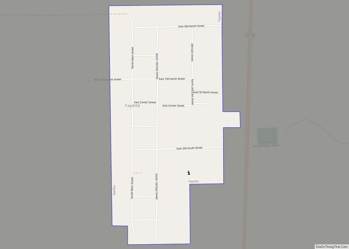
Fayette is a town in Sanpete County, Utah, United States. The population was 204 at the 2000 census. Fayette town overview: Name: Fayette town LSAD Code: 43 LSAD Description: town (suffix) State: Utah County: Sanpete County Incorporated: 1948 Elevation: 5,052 ft (1,540 m) Total Area: 0.40 sq mi (1.02 km²) Land Area: 0.40 sq mi (1.02 km²) Water Area: 0.00 sq mi (0.00 km²) Total Population: ... Read more
Map of US Cities and Places
Fairview is a city in northern Sanpete County, Utah, United States. The population was 1,247 at the 2010 census. Fairview city overview: Name: Fairview city LSAD Code: 25 LSAD Description: city (suffix) State: Utah County: Sanpete County Founded: 1859 Elevation: 5,948 ft (1,813 m) Total Area: 1.26 sq mi (3.26 km²) Land Area: 1.26 sq mi (3.26 km²) Water Area: 0.00 sq mi (0.00 km²) Total ... Read more
Fairfield is a town in Utah County, Utah, United States. It is part of the Provo–Orem, Utah Metropolitan Statistical Area. It is located in the southwest corner of Cedar Valley about 50 miles (80 km) southwest of Salt Lake City and 5 miles (8.0 km) south of Cedar Fort on Utah State Route 73, west of Utah ... Read more
Fountain Green is a city in Sanpete County, Utah, United States. The population was 1,071 at the 2010 census. Fountain Green city overview: Name: Fountain Green city LSAD Code: 25 LSAD Description: city (suffix) State: Utah County: Sanpete County Elevation: 5,899 ft (1,798 m) Total Area: 1.25 sq mi (3.24 km²) Land Area: 1.25 sq mi (3.24 km²) Water Area: 0.00 sq mi (0.00 km²) Total ... Read more
Glenwood is a town in Sevier County, Utah, United States. The population was 464 at the 2010 census. Glenwood town overview: Name: Glenwood town LSAD Code: 43 LSAD Description: town (suffix) State: Utah County: Sevier County Founded: 1863 Elevation: 5,272 ft (1,607 m) Total Area: 0.52 sq mi (1.35 km²) Land Area: 0.52 sq mi (1.35 km²) Water Area: 0.00 sq mi (0.00 km²) Total Population: ... Read more
Glendale is a town in Kane County, Utah, United States. The population was 381 at the 2010 census. Glendale town overview: Name: Glendale town LSAD Code: 43 LSAD Description: town (suffix) State: Utah County: Kane County Founded: 1862 Incorporated: March 29, 1935 Elevation: 5,778 ft (1,761 m) Total Area: 7.00 sq mi (18.12 km²) Land Area: 7.00 sq mi (18.12 km²) Water Area: ... Read more
Genola (/dʒəˈnoʊlə/ jə-NOH-lə) is a town in Utah County, Utah, United States. It is part of the Provo–Orem Metropolitan Statistical Area. The population was 1,370 at the 2010 census. Genola town overview: Name: Genola town LSAD Code: 43 LSAD Description: town (suffix) State: Utah County: Utah County Incorporated: December 29, 1935 Elevation: 4,600 ft (1,402 m) Total ... Read more
Garden is a census-designated place (CDP) in Rich County, Utah, United States. It includes the southernmost subdivision of Garden City at its northeast and the hamlet of Meadowville at its southeast; otherwise it is farmland. The population was 181 at the 2010 census. Garden CDP overview: Name: Garden CDP LSAD Code: 57 LSAD Description: CDP ... Read more
Garden City is a town in northwestern Rich County, Utah, United States. The population was 562 at the 2010 census. Garden City sits on the shores of Bear Lake and is a popular summer resort destination town, thus nicknamed the “Caribbean of the Rockies”. Garden City town overview: Name: Garden City town LSAD Code: 43 ... Read more
Francis is a town in on the western edge of Summit County, Utah, United States. It is part of the Salt Lake City, Utah Metropolitan Statistical Area. The population was 1,077 at the 2010 census. Francis town overview: Name: Francis town LSAD Code: 43 LSAD Description: town (suffix) State: Utah County: Summit County Incorporated: 1939 ... Read more
Halls Crossing is a census-designated place (CDP) on the western edge of San Juan County, Utah, United States. The population was six at the 2010 Census. State Route 276 crosses the Colorado River at Halls Crossing using the Charles Hall Ferry. Halls Crossing CDP overview: Name: Halls Crossing CDP LSAD Code: 57 LSAD Description: CDP ... Read more
Halchita is a census-designated place (CDP) in San Juan County, Utah, United States. The population was 270 at the 2000 census. Halchita CDP overview: Name: Halchita CDP LSAD Code: 57 LSAD Description: CDP (suffix) State: Utah County: San Juan County Elevation: 4,380 ft (1,335 m) Total Area: 17.1 sq mi (44.3 km²) Land Area: 17.1 sq mi (44.3 km²) Water Area: 0.0 sq mi (0.0 km²) ... Read more