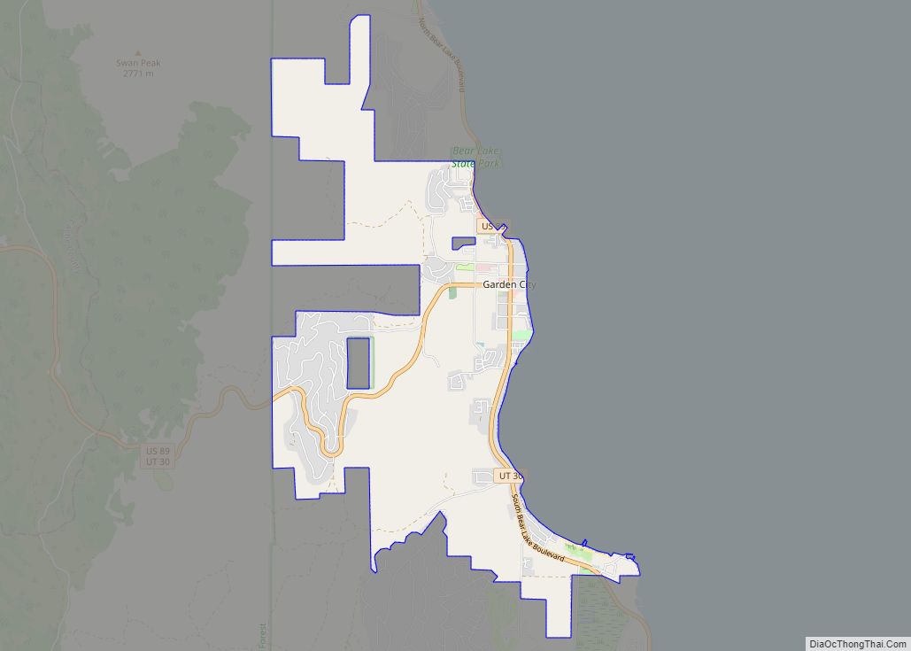
Garden City is a town in northwestern Rich County, Utah, United States. The population was 562 at the 2010 census. Garden City sits on the shores of Bear Lake and is a popular summer resort destination town, thus nicknamed the “Caribbean of the Rockies”.
| Name: | Garden City town |
|---|---|
| LSAD Code: | 43 |
| LSAD Description: | town (suffix) |
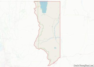
| State: | Utah |
| County: | Rich County |
| Incorporated: | 1934 |
| Elevation: | 5,968 ft (1,819 m) |
| Total Area: | 8.78 sq mi (22.74 km²) |
| Land Area: | 8.78 sq mi (22.74 km²) |
| Water Area: | 0.00 sq mi (0.00 km²) |
| Total Population: | 562 |
| Population Density: | 70.29/sq mi (27.14/km²) |
| ZIP code: | 84028 |
| Area code: | 435 |
| FIPS code: | 4927930 |
| GNISfeature ID: | 1428133 |
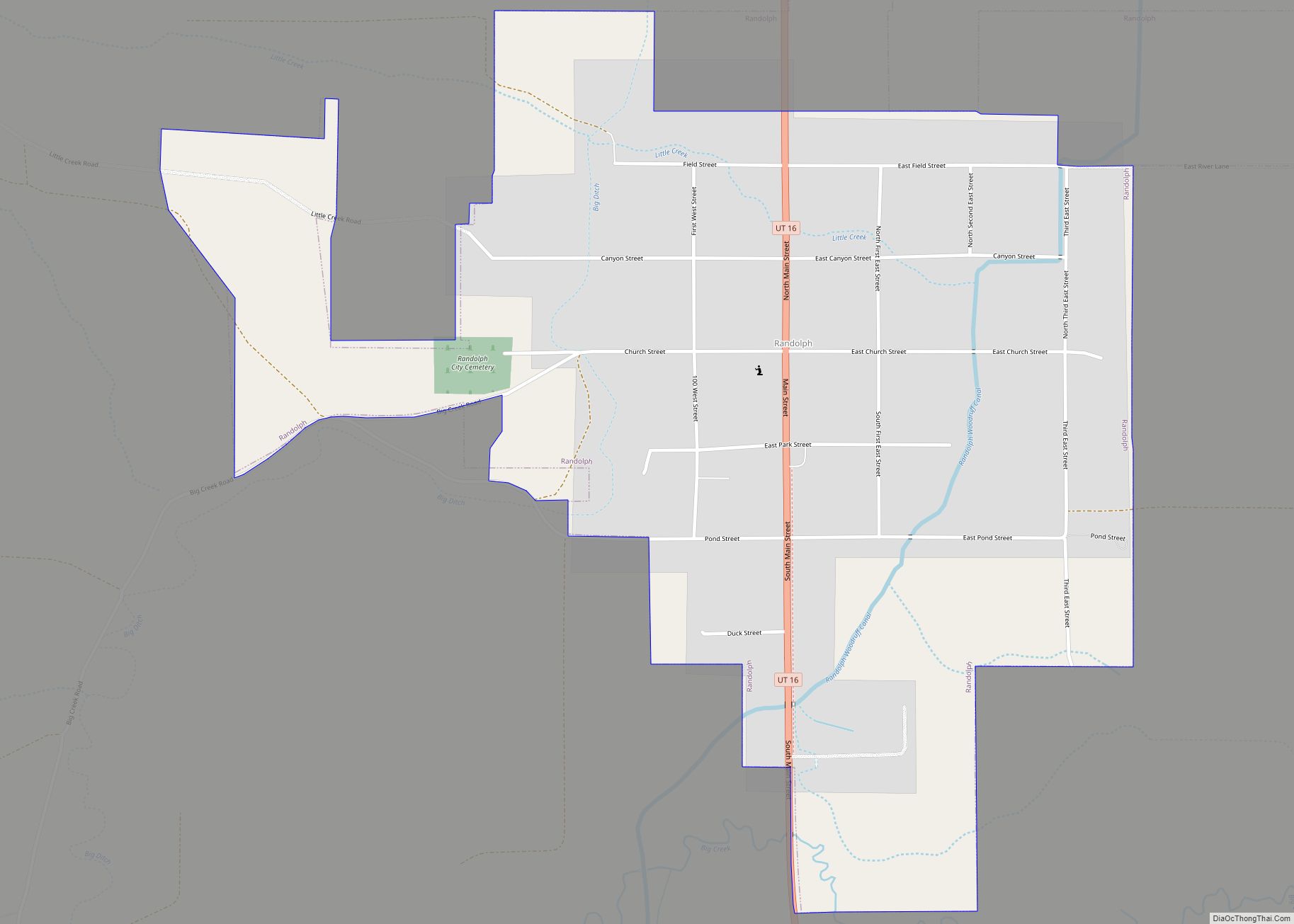
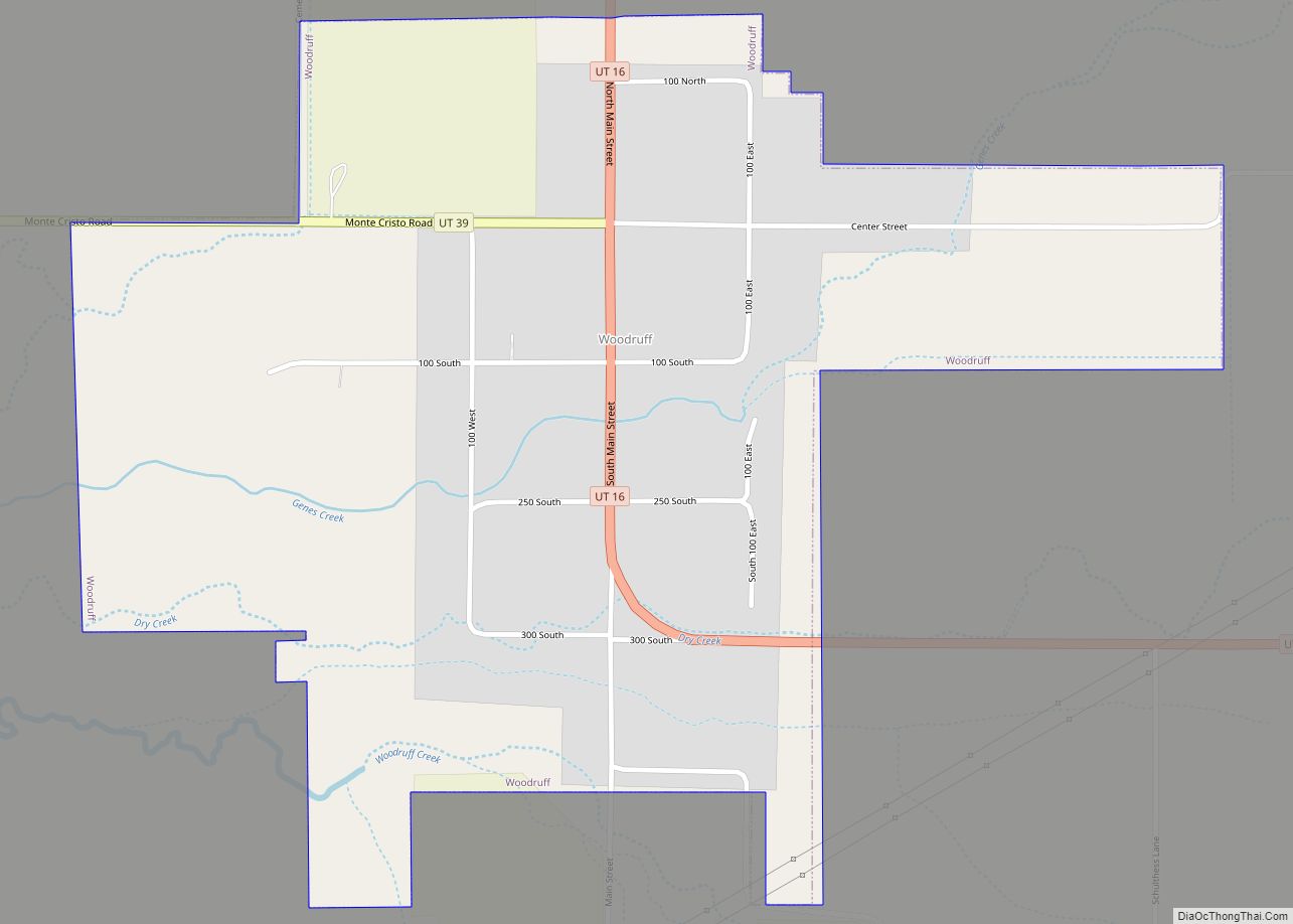
Online Interactive Map
Click on ![]() to view map in "full screen" mode.
to view map in "full screen" mode.
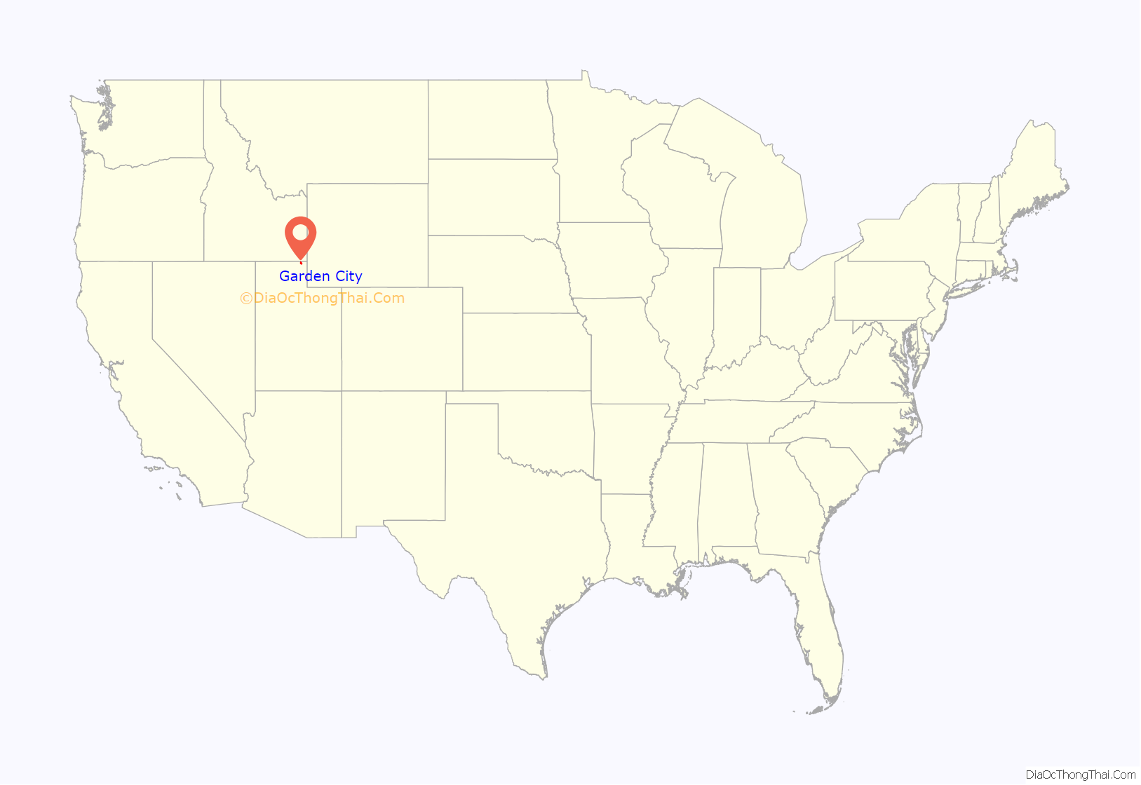
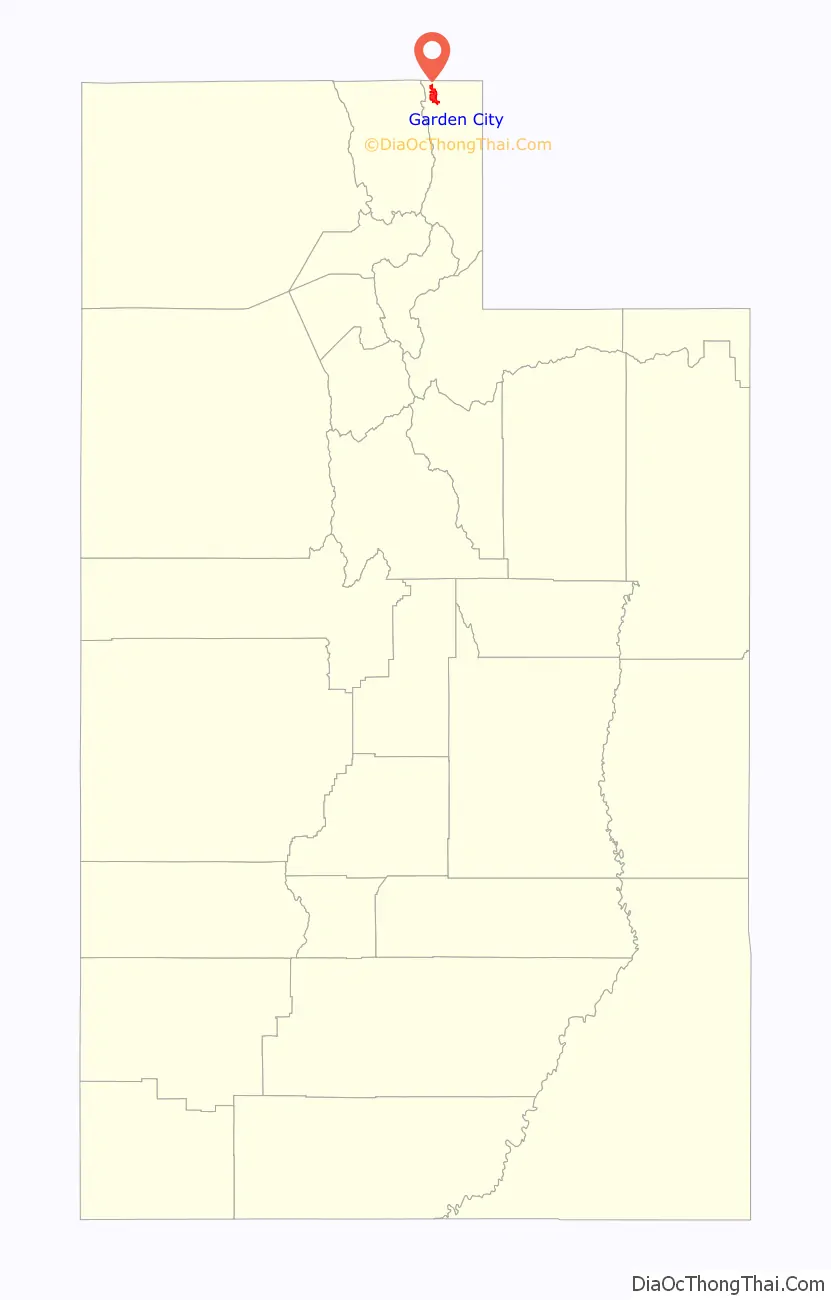
Garden City location map. Where is Garden City town?
History
Garden City was first settled in 1877, and an LDS branch was formed there. Two years later the town had grown into a ward. In 1979, it merged with the neighboring town of Pickelville.
in 1903, Horatio Nelson Jackson and Sewall Crocker stopped in Garden City on the first automobile journey across the United States.
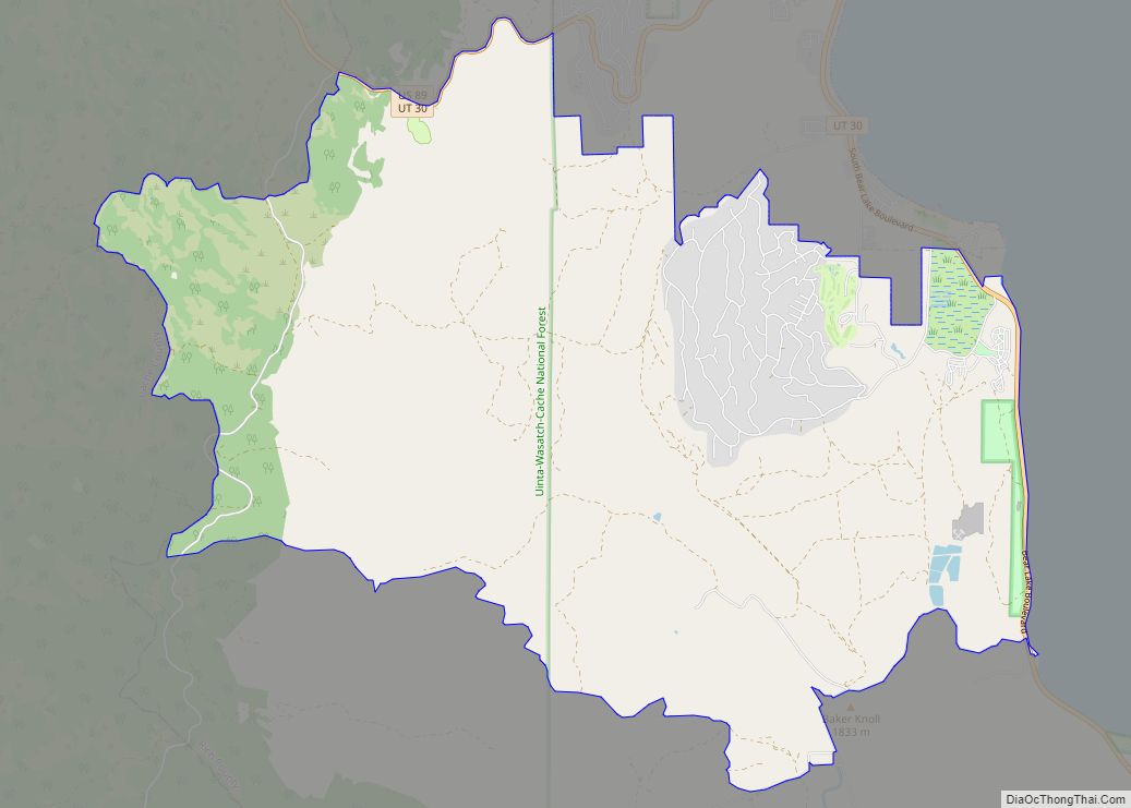
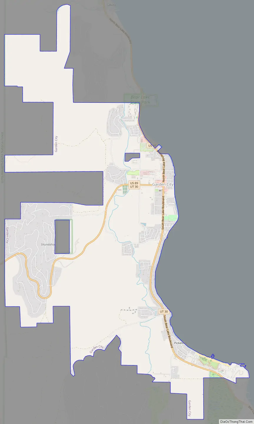
Garden City Road Map
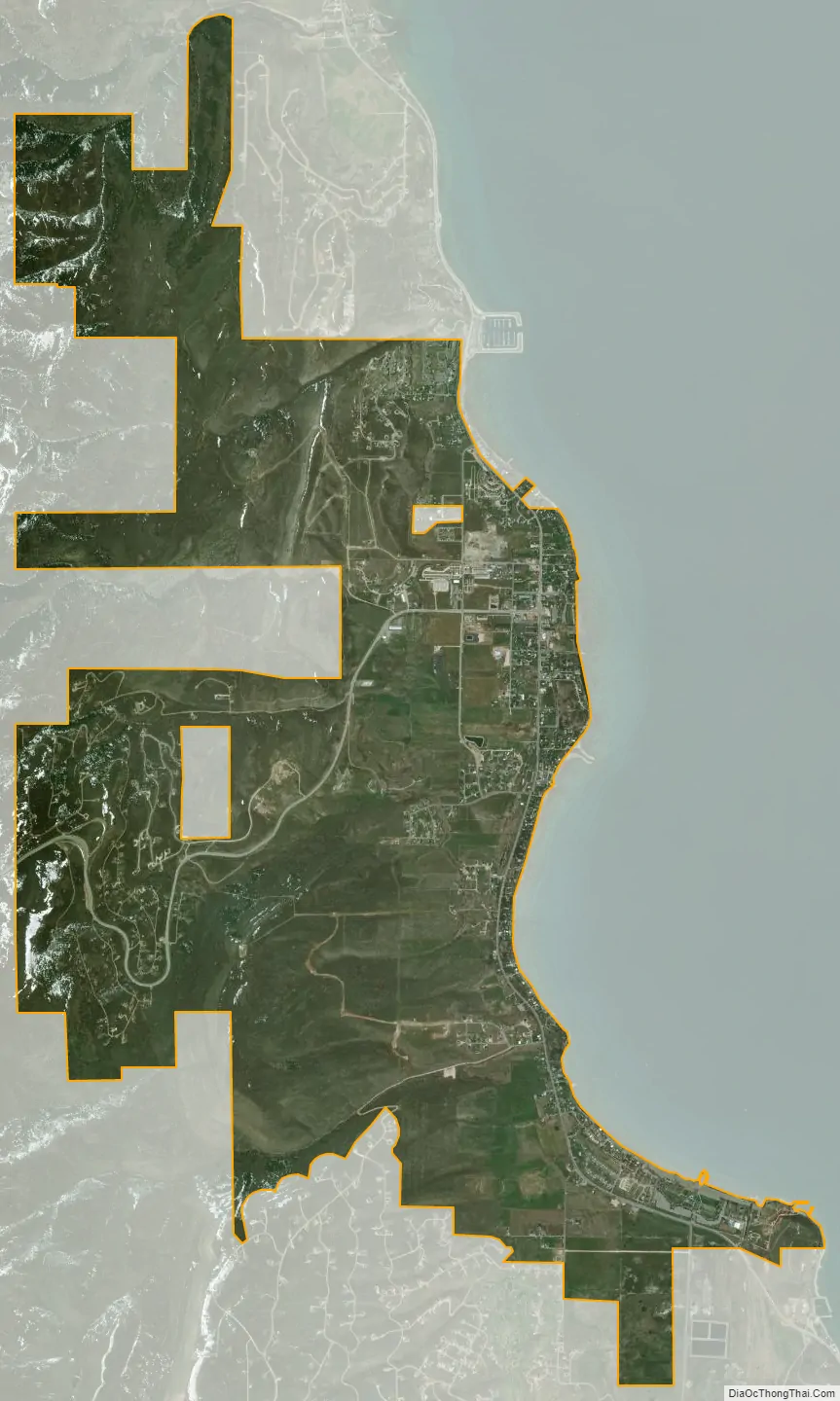
Garden City city Satellite Map
Geography
According to the United States Census Bureau, the town has a total area of 4.5 square miles (11.7 km), all land.
Climate
Garden City has a humid continental climate with warm summers (Köppen Dfb).
See also
Map of Utah State and its subdivision: Map of other states:- Alabama
- Alaska
- Arizona
- Arkansas
- California
- Colorado
- Connecticut
- Delaware
- District of Columbia
- Florida
- Georgia
- Hawaii
- Idaho
- Illinois
- Indiana
- Iowa
- Kansas
- Kentucky
- Louisiana
- Maine
- Maryland
- Massachusetts
- Michigan
- Minnesota
- Mississippi
- Missouri
- Montana
- Nebraska
- Nevada
- New Hampshire
- New Jersey
- New Mexico
- New York
- North Carolina
- North Dakota
- Ohio
- Oklahoma
- Oregon
- Pennsylvania
- Rhode Island
- South Carolina
- South Dakota
- Tennessee
- Texas
- Utah
- Vermont
- Virginia
- Washington
- West Virginia
- Wisconsin
- Wyoming