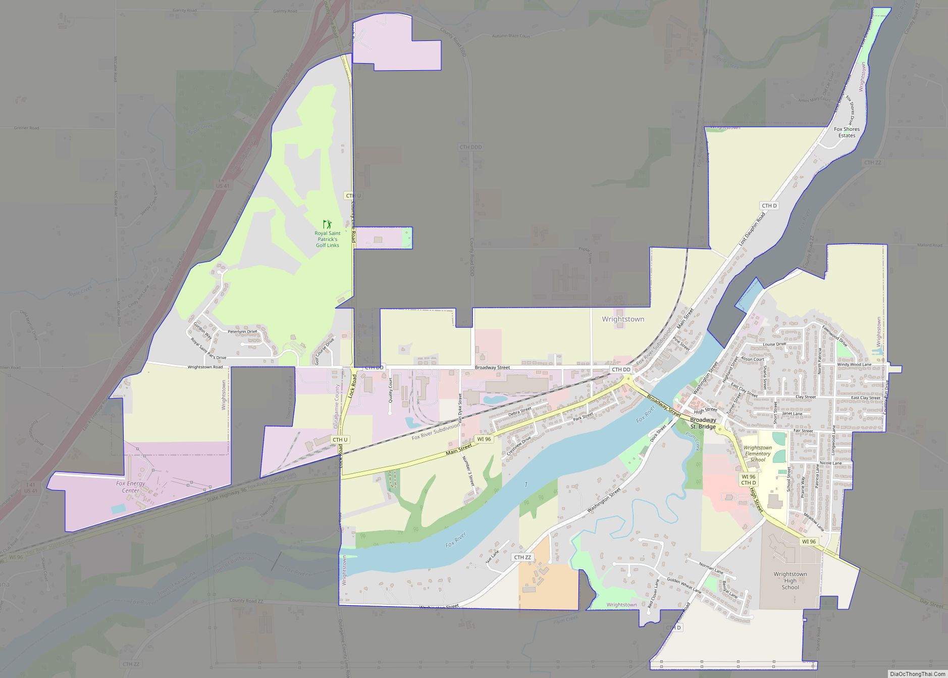
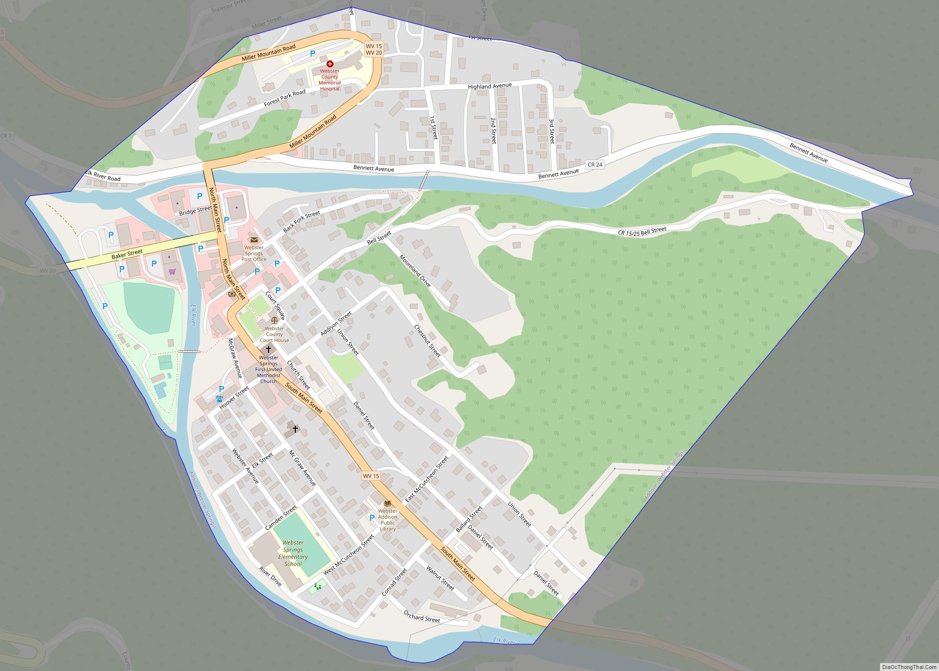
Wrightstown is a village in Brown and Outagamie counties in the U.S. state of Wisconsin. The population was 2,827 at the 2010 census. Of this, 2,676 were in Brown County, and 151 were in Outagamie County. The village is surrounded mostly by the westernmost part of the Town of Wrightstown in Brown County. On February ... Read more
Map of US Cities and Places
Winchester is an unincorporated census-designated place in the town of Winchester in Winnebago County, Wisconsin, United States. The community is located less than 1 mile (1 kilometer) from the southern intersection of U.S. Route 10 and U.S. Route 45. Wisconsin Highway 150 passed east–west through the community until the road was decommissioned by the state ... Read more
Woodville is a village in St. Croix County, Wisconsin, United States. The population was 1,344 at the 2010 census. Woodville village overview: Name: Woodville village LSAD Code: 47 LSAD Description: village (suffix) State: Wisconsin County: St. Croix County Elevation: 1,142 ft (348 m) Total Area: 1.80 sq mi (4.65 km²) Land Area: 1.80 sq mi (4.65 km²) Water Area: 0.00 sq mi (0.00 km²) Total Population: ... Read more
Wilton is a town in Monroe County, Wisconsin, United States. The population was 925 at the 2000 census. The Village of Wilton is located partially within the town. Wilton village overview: Name: Wilton village LSAD Code: 47 LSAD Description: village (suffix) State: Wisconsin County: Monroe County FIPS code: 5587525 Online Interactive Map Wilton online map. ... Read more
Woodruff is a census-designated place in the Town of Woodruff in Oneida County, Wisconsin, United States. Woodruff CDP overview: Name: Woodruff CDP LSAD Code: 57 LSAD Description: CDP (suffix) State: Wisconsin County: Oneida County Elevation: 1,608 ft (490 m) Total Area: 1.434 sq mi (3.71 km²) Land Area: 1.409 sq mi (3.65 km²) Water Area: 0.025 sq mi (0.06 km²) Total Population: 966 Population Density: 670/sq mi ... Read more
Wilson is a village in St. Croix County, Wisconsin, United States. The population was 184 at the 2010 census. Wilson village overview: Name: Wilson village LSAD Code: 47 LSAD Description: village (suffix) State: Wisconsin County: St. Croix County Total Area: 1.71 sq mi (4.42 km²) Land Area: 1.71 sq mi (4.42 km²) Water Area: 0.00 sq mi (0.00 km²) Total Population: 184 Population Density: ... Read more
Woodman is a town in Grant County in the U.S. state of Wisconsin. The population was 195 at the 2000 census. The Village of Woodman is located within the town. Woodman village overview: Name: Woodman village LSAD Code: 47 LSAD Description: village (suffix) State: Wisconsin County: Grant County FIPS code: 5588825 Online Interactive Map Woodman ... Read more
Williams Bay is a village in Walworth County, Wisconsin, United States. It is one of three municipalities on Geneva Lake. The population was 2,953 at the 2020 census. Williams Bay village overview: Name: Williams Bay village LSAD Code: 47 LSAD Description: village (suffix) State: Wisconsin County: Walworth County Elevation: 879 ft (268 m) Total Area: 2.78 sq mi (7.20 km²) ... Read more
Addison (Webster Springs) town overview: Name: Addison (Webster Springs) town LSAD Code: 43 LSAD Description: town (suffix) State: West Virginia County: Webster County FIPS code: 5400364 Online Interactive Map Addison (Webster Springs) online map. Source: Basemap layers from Google Map, Open Street Map (OSM), Arcgisonline, Wmflabs. Boundary Data from Database of Global Administrative Areas. Addison ... Read more
Bancroft is a town in Putnam County, West Virginia, United States, along the Kanawha River. The population was 389 at the 2020 census. It is part of the Huntington–Ashland metropolitan area. Bancroft town overview: Name: Bancroft town LSAD Code: 43 LSAD Description: town (suffix) State: West Virginia County: Putnam County Elevation: 591 ft (180 m) Total Area: ... Read more
Arbovale CDP overview: Name: Arbovale CDP LSAD Code: 57 LSAD Description: CDP (suffix) State: West Virginia FIPS code: 5402260 Online Interactive Map Arbovale online map. Source: Basemap layers from Google Map, Open Street Map (OSM), Arcgisonline, Wmflabs. Boundary Data from Database of Global Administrative Areas. Arbovale location map. Where is Arbovale CDP? Arbovale Road Map ... Read more
Zoar (Menominee: Saqnawæpaniw) is a census-designated place (CDP) and unincorporated community in Menominee County, Wisconsin, United States. The population was 107 at the 2020 census. Zoar is located along Wisconsin Highway 47, approximately 3 miles (4.8 km) northwest of Neopit. Situated within traditional Menominee territory, it is known in the Menominee language as Saqnawehnaen, a name ... Read more