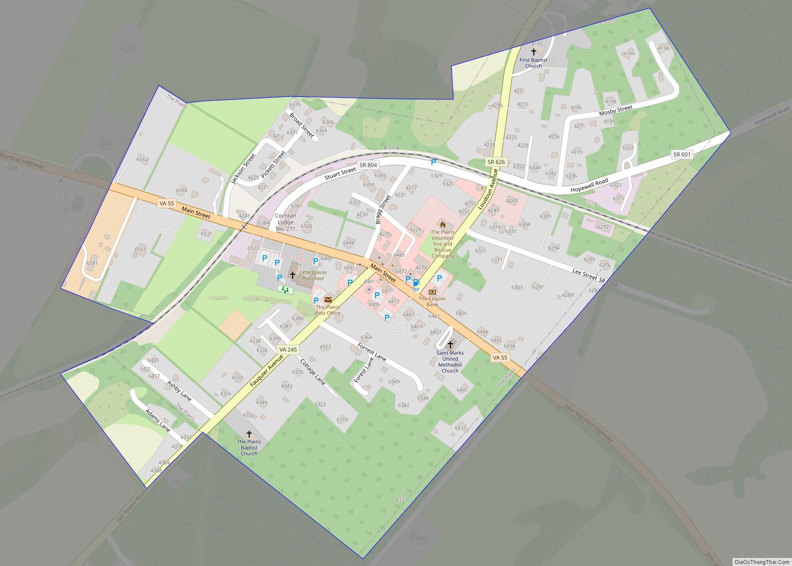
Map of Cavendish CDP
Cavendish is a census-designated place, the central village of the town of Cavendish, Windsor County, Vermont, United States. Until the mid–nineteenth century it was known as Duttonsville. As of the 2010 census, the population of the CDP was 179, compared to 1,367 for the entire town of Cavendish. Cavendish is the site of the 1848 ... Read more
Map of Cavendish CDP
Map of Cambridge village, Vermont
Cambridge is a town in Lamoille County, Vermont, United States. The population was 3,839 at the 2020 United States Census. Cambridge includes the villages of Jeffersonville and Cambridge. Cambridge village overview: Name: Cambridge village LSAD Code: 47 LSAD Description: village (suffix) State: Vermont County: Lamoille County Elevation: 758 ft (231 m) Total Area: 63.69 sq mi (164.95 km²) Land Area: ... Read more
Map of Cambridge village, Vermont
Map of Cabot CDP, Vermont
Cabot is a New England town located in the northeast corner of Washington County, Vermont, United States. The population was 1,443 at the 2020 census. It contains the unincorporated villages of Cabot Village, Cabot Plains, South Cabot, East Cabot, Molly’s Pond (named after Molly, the wife of Indian Joe), and Lower Cabot. Cabot contains several ... Read more
Map of Cabot CDP, Vermont
Map of Bristol CDP, Vermont
Bristol is the main settlement in the town of Bristol in Addison County, Vermont, United States, and a census-designated place (CDP). The population was 1,936 at the 2020 census, out of a total population of 3,782 in the town of Bristol. Bristol CDP overview: Name: Bristol CDP LSAD Code: 57 LSAD Description: CDP (suffix) State: ... Read more
Map of Bristol CDP, Vermont
Map of Coventry CDP
Coventry /ˈkɒvəntri/ is a town in Orleans County, Vermont, United States. The population was 1,100 at the 2020 census. Coventry CDP overview: Name: Coventry CDP LSAD Code: 57 LSAD Description: CDP (suffix) State: Vermont County: Orleans County Elevation: 218 ft (276 m) Total Area: 27.7 sq mi (71.7 km²) Land Area: 27.5 sq mi (71.1 km²) Water Area: 0.2 sq mi (0.6 km²) Total Population: 1,100 ... Read more
Map of Coventry CDP
Map of East Montpelier CDP
East Montpelier is a census-designated place (CDP) comprising the central village of the town of East Montpelier, Washington County, Vermont, United States. The population of the CDP was 80 at the 2010 census. East Montpelier CDP overview: Name: East Montpelier CDP LSAD Code: 57 LSAD Description: CDP (suffix) State: Vermont County: Washington County Elevation: 728 ft ... Read more
Map of East Montpelier CDP
Map of East Barre CDP
East Barre is a census-designated place (CDP) in the town of Barre, Washington County, Vermont, United States. The population of the CDP was 826 at the 2010 census. Prior to 2010, East Barre was part of the Graniteville-East Barre CDP, which consisted of three unincorporated villages in the town: Graniteville, East Barre, and Websterville. East ... Read more
Map of East Barre CDP
Map of Derby Center village
Derby Center village overview: Name: Derby Center village LSAD Code: 47 LSAD Description: village (suffix) State: Vermont County: Orleans County FIPS code: 5017425 Online Interactive Map Derby Center online map. Source: Basemap layers from Google Map, Open Street Map (OSM), Arcgisonline, Wmflabs. Boundary Data from Database of Global Administrative Areas. Derby Center location map. Where ... Read more
Map of Derby Center village
Map of Graniteville CDP, Vermont
Graniteville is a census-designated place (CDP) in the town of Barre, Washington County, Vermont, United States. The population of the CDP was 784 at the 2010 census. Prior to 2010, it was part of the Graniteville-East Barre CDP, which consisted of three unincorporated villages in the town: Graniteville, East Barre, and Websterville. Graniteville is home ... Read more
Map of Graniteville CDP, Vermont
Map of Fair Haven CDP, Vermont
Fair Haven is a census-designated place (CDP) in the town of Fair Haven, Vermont in Rutland County, Vermont, United States. The population was 2,269 at the 2010 census. Fair Haven CDP overview: Name: Fair Haven CDP LSAD Code: 57 LSAD Description: CDP (suffix) State: Vermont County: Rutland County Elevation: 384 ft (117 m) Total Area: 2.8 sq mi (7.2 km²) ... Read more
Map of Fair Haven CDP, Vermont
Map of Jacksonville village, Vermont
Jacksonville village overview: Name: Jacksonville village LSAD Code: 47 LSAD Description: village (suffix) State: Vermont County: Windham County FIPS code: 5036025 Online Interactive Map Jacksonville online map. Source: Basemap layers from Google Map, Open Street Map (OSM), Arcgisonline, Wmflabs. Boundary Data from Database of Global Administrative Areas. Jacksonville location map. Where is Jacksonville village? Jacksonville ... Read more
Map of Jacksonville village, Vermont
Map of Hartland CDP, Vermont
Hartland is a census-designated place (CDP) that comprises the central village of the town of Hartland, Windsor County, Vermont, United States. As of the 2010 census, the population of the CDP was 380, compared to 3,393 for the entire town of Hartland. Hartland CDP overview: Name: Hartland CDP LSAD Code: 57 LSAD Description: CDP (suffix) ... Read more
Map of Hartland CDP, Vermont