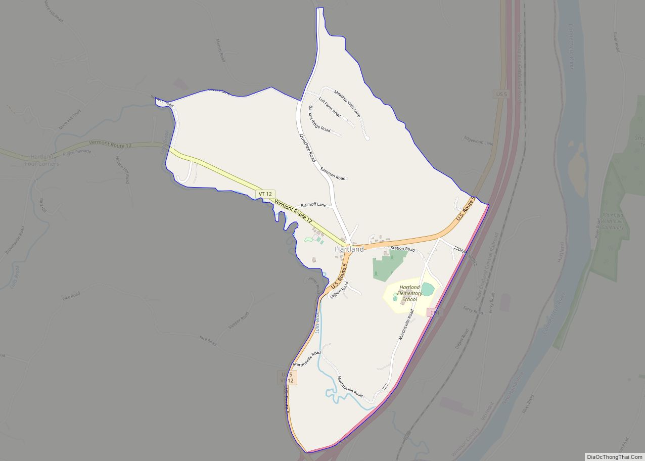
Map of Montpelier city, Vermont
Montpelier city overview: Name: Montpelier city LSAD Code: 25 LSAD Description: city (suffix) State: Vermont County: Washington County FIPS code: 5046000 Online Interactive Map Montpelier online map. Source: Basemap layers from Google Map, Open Street Map (OSM), Arcgisonline, Wmflabs. Boundary Data from Database of Global Administrative Areas. Montpelier location map. Where is Montpelier city? Montpelier ... Read more
Map of Montpelier city, Vermont
Map of Marshfield village, Vermont
Marshfield is a town in Washington County, Vermont, United States. The population was 1,583 at the 2020 census. Marshfield village overview: Name: Marshfield village LSAD Code: 47 LSAD Description: village (suffix) State: Vermont County: Washington County Total Area: 43.4 sq mi (112.4 km²) Land Area: 43.4 sq mi (112.4 km²) Water Area: 0.1 sq mi (0.3 km²) Total Population: 1,583 Population Density: 37/sq mi (14.1/km²) ... Read more
Map of Marshfield village, Vermont
Map of Putney CDP, Vermont
Putney is the primary village and a census-designated place (CDP) in the town of Putney, Windham County, Vermont, United States. As of the 2020 census, it had a population of 571, compared to 2,617 in the entire town. The Putney Village Historic District occupies the center of the CDP. The CDP is in eastern Windham ... Read more
Map of Putney CDP, Vermont
Map of Saxtons River village
Saxtons River village overview: Name: Saxtons River village LSAD Code: 47 LSAD Description: village (suffix) State: Vermont County: Windham County FIPS code: 5062950 Online Interactive Map Saxtons River online map. Source: Basemap layers from Google Map, Open Street Map (OSM), Arcgisonline, Wmflabs. Boundary Data from Database of Global Administrative Areas. Saxtons River location map. Where ... Read more
Map of Saxtons River village
Map of Stowe CDP, Vermont
Stowe is a census-designated place (CDP) comprising the central community in the town of Stowe, Lamoille County, Vermont, United States. As of the 2010 census the population of the CDP was 495, out of 4,314 in the entire town. Stowe CDP overview: Name: Stowe CDP LSAD Code: 57 LSAD Description: CDP (suffix) State: Vermont County: ... Read more
Map of Stowe CDP, Vermont
Map of St. Johnsbury CDP
St. Johnsbury is a census-designated place (CDP) corresponding to the main settled areas in the town of St. Johnsbury, Caledonia County, Vermont, United States. As of the 2020 census it had a population of 5,994, out of 7,364 in the entire town. The CDP is in eastern Caledonia County, occupying the southern one-third of the ... Read more
Map of St. Johnsbury CDP
Map of Acme CDP
Acme is a rural village in Whatcom County, Washington, United States. There is a general store, post office, gas station, diner, elementary school and two churches located there. Acme is also included in, and the source-name for, a larger census-designated place (CDP). The Census Bureau no longer tracks the population for the village itself, but ... Read more
Map of Acme CDP
Map of Aberdeen city, Washington
Aberdeen (/ˈæbərdiːn/) is a city in Grays Harbor County, Washington, United States. The population was 17,013 at the 2020 census. The city is the economic center of Grays Harbor County, bordering the cities of Hoquiam and Cosmopolis. Aberdeen is occasionally referred to as the “Gateway to the Olympic Peninsula”. Aberdeen city overview: Name: Aberdeen city ... Read more
Map of Aberdeen city, Washington
Map of Allyn CDP
Allyn is a census-designated place (CDP) in Mason County, Washington, United States. The population was 1,963 at the 2010 census. It was part of the former Allyn-Grapeview CDP that was broken up into Allyn and Grapeview in 2010. Allyn is located on the western shore of North Bay region of the Case Inlet of the ... Read more
Map of Allyn CDP
Map of Algona city, Washington
Algona (/ælˈɡoʊnə/) is a city in King County, Washington, United States, and the Seattle metropolitan area, surrounded by the suburbs of Auburn to the north and east, Pacific to the south, and unincorporated King County to the west. The population was 3,290 as of the 2020 census. Due to Algona’s adjacency to the city of ... Read more
Map of Algona city, Washington
Map of Alger CDP, Washington
Alger is a census-designated place (CDP) in Skagit County, Washington, United States. The population was 403 at the 2010 census. It is included in the Mount Vernon–Anacortes, Washington Metropolitan Statistical Area. Alger is located along Old Highway 99 North Road. It is near the midway point of the route between Seattle and Vancouver, 76 miles ... Read more
Map of Alger CDP, Washington
Map of Alderwood Manor CDP
Alderwood Manor is a census-designated place (CDP) in Snohomish County, Washington, United States. The population was 10,198 at the 2020 census. Prior to the 2000 census, Alderwood Manor was counted as part of the Alderwood Manor-Bothell North CDP. Alderwood Manor CDP overview: Name: Alderwood Manor CDP LSAD Code: 57 LSAD Description: CDP (suffix) State: Washington ... Read more
Map of Alderwood Manor CDP