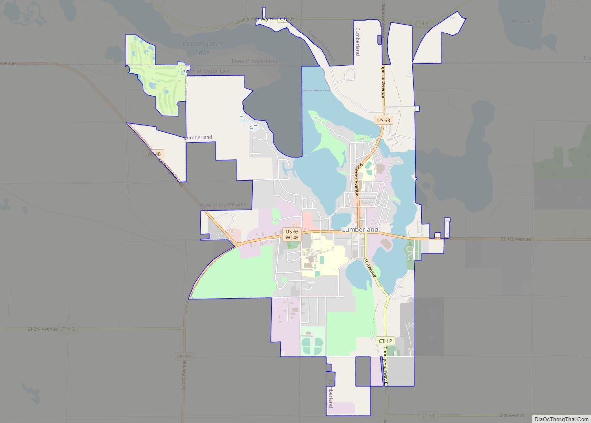
Map of Oceana town

Map of Oceana town

Oceana is a town in Wyoming County, West Virginia. The population was 1,462 at the time of the 2020 census. Oceana is the oldest city in Wyoming County and was the county seat until 1907. Oceana was the eponym of the film Oxyana. The town has a town hall and a local police department. It … Read more

Map of Oakvale town

Map of Oakvale town

Oakvale is a town in Mercer County, West Virginia, United States, along the East River. The population was 137 at the 2020 census. It is part of the Bluefield, WV-VA micropolitan area which has a population of 107,578. Oakvale town overview: Name: Oakvale town LSAD Code: 43 LSAD Description: town (suffix) State: West Virginia County: … Read more

Map of Oak Hill city, West Virginia

Map of Oak Hill city, West Virginia

Oak Hill is a city in Fayette County, West Virginia, United States. The population was 8,179 at the 2020 census. It is part of the Beckley metropolitan area. The city is also home to the historic Oak Hill Railroad Depot which still stands today as an artisan shop. Country singer Hank Williams died in Oak … Read more

Map of Nutter Fort town

Map of Nutter Fort town

Nutter Fort is a town in Harrison County, West Virginia, United States, incorporated in 1923. The town is a southeastern suburb of Clarksburg. Since 1996, Nutter Fort has held the West Virginia Blackberry Festival during the first weekend of August. The population was 1,497 at the 2020 census. The town is also home to the … Read more

Map of Northfork town

Map of Northfork town

Northfork is a town in McDowell County, West Virginia, United States, located on U.S. Route 52 between Welch and Bluefield. The population was 231 at the 2020 census. Northfork was incorporated in 1901, so named because of its location on the north fork of the Elkhorn Creek at its junction with the south fork. It … Read more

Map of North Hills town, West Virginia

Map of North Hills town, West Virginia

North Hills is a town in Wood County, West Virginia, United States. It is a suburb of Parkersburg. The population was 837 at the 2020 census. North Hills was incorporated on February 15, 1979. North Hills town overview: Name: North Hills town LSAD Code: 43 LSAD Description: town (suffix) State: West Virginia County: Wood County … Read more

Map of Nitro city

Map of Nitro city

Nitro is a city in Kanawha and Putnam counties in the U.S. state of West Virginia. It takes its name from a World War I era nitrocellulose plant. The population was 6,618 according to the 2020 census. It is part of the Charleston metropolitan area. Nitro city overview: Name: Nitro city LSAD Code: 25 LSAD … Read more

Map of Newell CDP, West Virginia

Map of Newell CDP, West Virginia

Newell is an unincorporated community and census-designated place in northern Hancock County, West Virginia, United States, situated along the Ohio River. The population was 1,203 at the 2020 census. It is a part of the Weirton–Steubenville metropolitan area. Newell is home to the Fiesta Tableware Company and the Mountaineer Casino, Racetrack and Resort. Newell CDP … Read more

Map of Newburg town, West Virginia

Map of Newburg town, West Virginia

Newburg is a town in western Preston County, West Virginia, United States. The population was 275 at the 2020 census. It is part of the Morgantown metropolitan area. The town was so named on account of it being the newest town on the railroad, according to local history. Newburg town overview: Name: Newburg town LSAD … Read more

Map of New Richmond CDP, West Virginia

Map of New Richmond CDP, West Virginia

New Richmond is a census-designated place (CDP) in Wyoming County, West Virginia, United States. As of the 2010 census, its population was 238. The community is the site of Wyoming East High School. New Richmond CDP overview: Name: New Richmond CDP LSAD Code: 57 LSAD Description: CDP (suffix) State: West Virginia County: Wyoming County Total … Read more

Map of Parsons city, West Virginia

Map of Parsons city, West Virginia

Parsons is the largest city in and county seat of Tucker County, West Virginia, United States. The population was 1,322 at the 2020 census. Parsons is located at the confluence of the Shavers Fork and the Black Fork, forming the head of the Cheat River. Parsons city overview: Name: Parsons city LSAD Code: 25 LSAD … Read more

Map of New Martinsville city

Map of New Martinsville city

New Martinsville is a city in and the county seat of Wetzel County, West Virginia, United States, along the Ohio River. The population was 5,186 at the 2020 census. New Martinsville city overview: Name: New Martinsville city LSAD Code: 25 LSAD Description: city (suffix) State: West Virginia County: Wetzel County Elevation: 623 ft (190 m) Total Area: … Read more