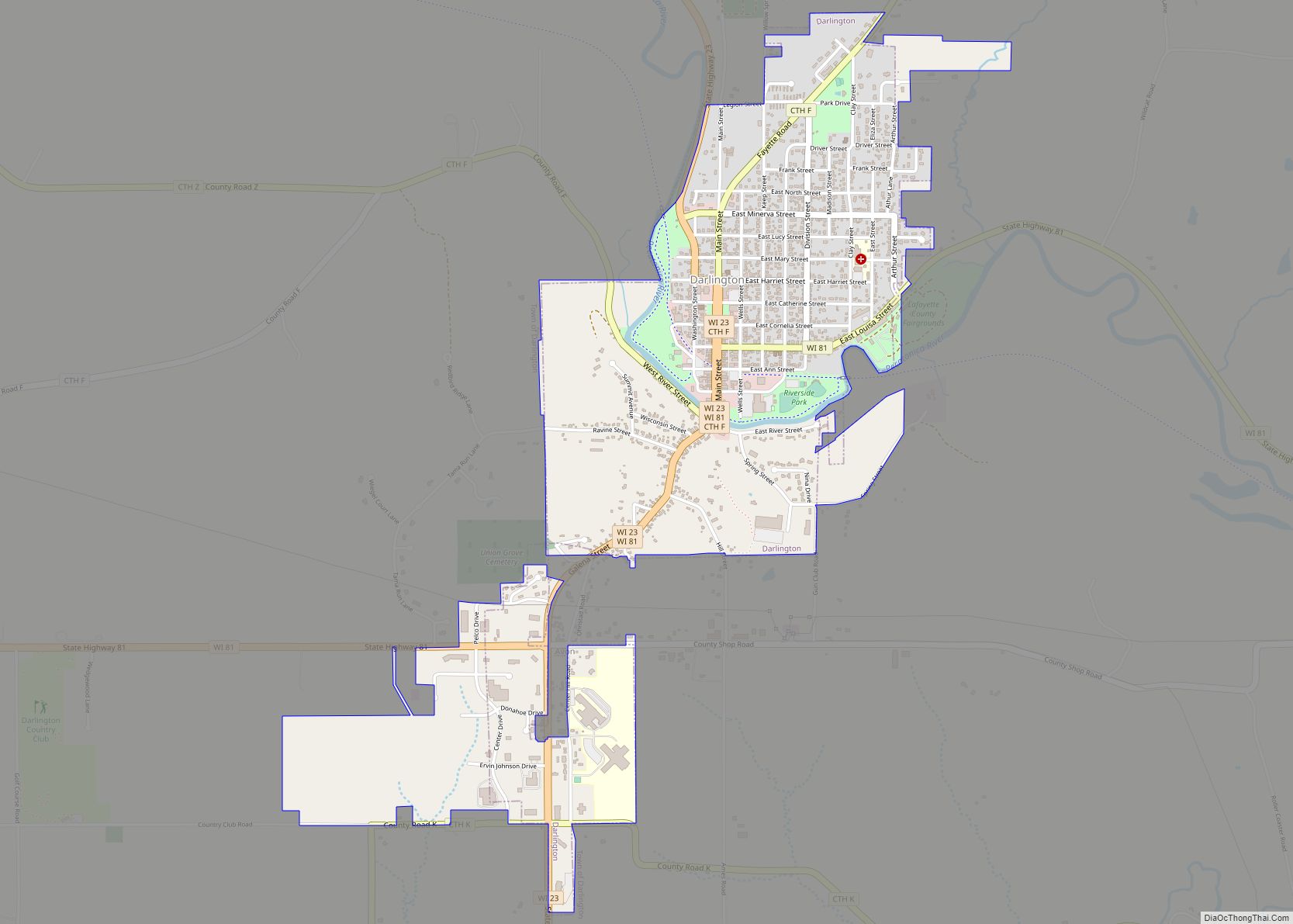
Map of Deerfield village, Wisconsin
Deerfield is a town in Dane County, Wisconsin, United States. The population was 1,470 at the 2000 census. The Village of Deerfield is located within the town. The unincorporated communities of London and Old Deerfield are located in the town. Deerfield village overview: Name: Deerfield village LSAD Code: 47 LSAD Description: village (suffix) State: Wisconsin ... Read more
Map of Deerfield village, Wisconsin
Map of Dousman village
Dousman is a village in Waukesha County, Wisconsin, United States. The population was 2,419 at the 2020 census. Dousman village overview: Name: Dousman village LSAD Code: 47 LSAD Description: village (suffix) State: Wisconsin County: Waukesha County Elevation: 866 ft (264 m) Total Area: 2.77 sq mi (7.17 km²) Land Area: 2.63 sq mi (6.82 km²) Water Area: 0.14 sq mi (0.35 km²) Total Population: 2,419 Population ... Read more
Map of Dousman village
Map of Edgar village, Wisconsin
Edgar is a village in Marathon County, Wisconsin, United States. It is part of the Wausau, Wisconsin Metropolitan Statistical Area. The population was 1,479 at the 2010 census. Edgar has maintained Tree City USA standing since 1995. Edgar village overview: Name: Edgar village LSAD Code: 47 LSAD Description: village (suffix) State: Wisconsin County: Marathon County ... Read more
Map of Edgar village, Wisconsin
Map of Dorchester village, Wisconsin
Dorchester is a village in Clark and Marathon counties in the U.S. state of Wisconsin, along the 45th parallel. It is part of the Wausau, Wisconsin Metropolitan Statistical Area. The population was 876 at the 2010 census. Of this, 871 were in Clark County, and only 5 were in Marathon County. Dorchester village overview: Name: ... Read more
Map of Dorchester village, Wisconsin
Map of Eden village, Wisconsin
Eden is a village in Fond du Lac County, Wisconsin, United States. The population was 875 at the 2010 census. The village is located within the Town of Eden. Eden village overview: Name: Eden village LSAD Code: 47 LSAD Description: village (suffix) State: Wisconsin County: Fond du Lac County Total Area: 0.62 sq mi (1.60 km²) Land Area: ... Read more
Map of Eden village, Wisconsin
Map of Dodgeville city
Dodgeville is a city in and the county seat of Iowa County, Wisconsin, United States. The population was 4,984 at the 2020 census, making it the county’s most populous city. Dodgeville is part of the Madison Metropolitan Statistical Area. Dodgeville city overview: Name: Dodgeville city LSAD Code: 25 LSAD Description: city (suffix) State: Wisconsin County: ... Read more
Map of Dodgeville city
Map of Dodge CDP, Wisconsin
Dodge is an unincorporated census-designated place located in the town of Dodge, Trempealeau County, Wisconsin, United States. Dodge is 8.5 miles (13.7 km) south-southwest of Arcadia. Dodge has a post office with ZIP code 54625. As of the 2010 census, its population was 121. Dodge CDP overview: Name: Dodge CDP LSAD Code: 57 LSAD Description: CDP ... Read more
Map of Dodge CDP, Wisconsin
Map of East Troy village
East Troy is a town in Walworth County, Wisconsin, United States. The population was 3,392 as of the 2020 census. The unincorporated communities of Hilburn, Lake Beulah, and Potter Lake are located in the town, as was the ghost town of Army Lake. East Troy is also home to several summer camps. East Troy village ... Read more
Map of East Troy village
Map of Dickeyville village
Dickeyville is a village in Grant County, Wisconsin, United States. The population was 1,061 at the 2010 census. The Dickeyville Grotto is located in the heart of the village. Dickeyville village overview: Name: Dickeyville village LSAD Code: 47 LSAD Description: village (suffix) State: Wisconsin County: Grant County Elevation: 958 ft (292 m) Total Area: 1.01 sq mi (2.62 km²) Land ... Read more
Map of Dickeyville village
Map of Eagle village, Wisconsin
Eagle is a town in Waukesha County, Wisconsin, United States. The population was 3,478 at the 2020 census. The Village of Eagle is located within the town. The unincorporated community of Eagleville is also located in the town. Eagle village overview: Name: Eagle village LSAD Code: 47 LSAD Description: village (suffix) State: Wisconsin County: Waukesha ... Read more
Map of Eagle village, Wisconsin
Map of Eagle Lake CDP, Wisconsin
Eagle Lake is a census-designated place (CDP) in the town of Dover, Racine County, Wisconsin, United States. The population was 1,251 at the 2020 census. Eagle Lake CDP overview: Name: Eagle Lake CDP LSAD Code: 57 LSAD Description: CDP (suffix) State: Wisconsin County: Racine County Elevation: 801 ft (244 m) Total Area: 3.0 sq mi (7.8 km²) Land Area: 2.2 sq mi ... Read more
Map of Eagle Lake CDP, Wisconsin
Map of Dyckesville CDP
Dyckesville is an unincorporated census-designated place in Brown and Kewaunee counties in the U.S. state of Wisconsin located in the towns of Green Bay and Red River. As of the 2010 census its population was 538. Dyckesville is bypassed by Wisconsin Highway 57, which ran through the community until 2006. Dyckesville is part of the ... Read more
Map of Dyckesville CDP