Map of Coal City CDP, West Virginia
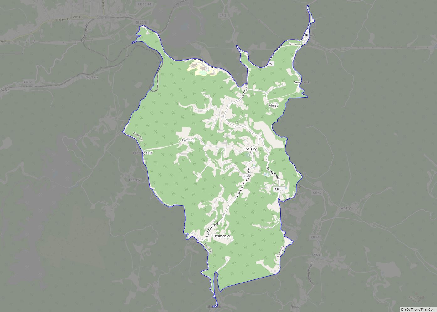
Coal City is a census-designated place (CDP) in Raleigh County, West Virginia, United States. The population was 1,815 at the 2010 census. Coal City’s population is composed of other surrounding unincorporated communities (Whitby, Jonben, and Fireco). Coal City CDP overview: Name: Coal City CDP LSAD Code: 57 LSAD Description: CDP (suffix) State: West Virginia County: ... Read more
Map of Coal City CDP, West Virginia
Map of Clendenin town
Clendenin is a town in Kanawha County, West Virginia, United States, situated along the Elk River. The population was 850 at the 2020 census. Clendenin town overview: Name: Clendenin town LSAD Code: 43 LSAD Description: town (suffix) State: West Virginia County: Kanawha County Elevation: 623 ft (190 m) Total Area: 1.52 sq mi (3.94 km²) Land Area: 1.44 sq mi (3.73 km²) Water ... Read more
Map of Clendenin town
Map of Clarksburg city, West Virginia
Clarksburg is a city in and the county seat of Harrison County, West Virginia, United States, in the north-central region of the state. The population of the city was 16,039 at the 2020 census, making it the tenth-largest city in West Virginia. It is the principal city of the Clarksburg micropolitan area, which had a ... Read more
Map of Clarksburg city, West Virginia
Map of Chesapeake town, West Virginia
Chesapeake is a town in Kanawha County, West Virginia, United States. The population was 1,336 at the 2020 census. The town is situated on the Kanawha River. Chesapeake was incorporated on November 1, 1948 as recorded in Book 67 Page 123-124, and named for the Chesapeake and Ohio Railway, which has served the community since ... Read more
Map of Chesapeake town, West Virginia
Map of East Dailey CDP
East Dailey is a census-designated place (CDP) in Randolph County, West Virginia, United States. As of the 2010 census, its population was 557. It is located within the Monongahela National Forest adjacent to the Tygart Valley River. East Dailey and its Old Timer’s Camp are host to the Elkhenge Music Festival. East Dailey CDP overview: ... Read more
Map of East Dailey CDP
Map of Durbin town
Durbin is a town in Pocahontas County, West Virginia, United States. The population was 235 at the 2020 census. The town has the name of Charles R. Durbin, a local bank official. Durbin town overview: Name: Durbin town LSAD Code: 43 LSAD Description: town (suffix) State: West Virginia County: Pocahontas County Elevation: 2,738 ft (835 m) Total ... Read more
Map of Durbin town
Map of Craigsville CDP, West Virginia
Craigsville is a census-designated place (CDP) in Nicholas County, West Virginia, United States. The population was 2,213 at the 2010 census. Craigsville CDP overview: Name: Craigsville CDP LSAD Code: 57 LSAD Description: CDP (suffix) State: West Virginia County: Nicholas County Elevation: 2,313 ft (705 m) Total Area: 6.1 sq mi (15.7 km²) Land Area: 6.1 sq mi (15.7 km²) Water Area: 0.0 sq mi (0.0 km²) ... Read more
Map of Craigsville CDP, West Virginia
Map of Dixie CDP, West Virginia
Dixie is a census-designated place (CDP) in Fayette and Nicholas counties, West Virginia, United States. Dixie is located on West Virginia Route 16, 5.5 miles (8.9 km) north of Gauley Bridge. Dixie has a post office with ZIP code 25059. As of the 2010 census, its population was 291, with 202 residents in Nicholas County and ... Read more
Map of Dixie CDP, West Virginia
Map of Despard CDP
Despard is a census-designated place (CDP) in Harrison County, West Virginia, United States. The population was 1,004 at the 2010 census. Despard was home to the largest manufacturing enterprise in north central West Virginia in the early 1900s, the Jackson Sheet and Tin Plate Company, after 1905 known as the Phillips Sheet and Tin Plate ... Read more
Map of Despard CDP
Map of Delbarton town
Delbarton is a town in Mingo County, West Virginia, United States. The population was 522 at the 2020 census. Delbarton town overview: Name: Delbarton town LSAD Code: 43 LSAD Description: town (suffix) State: West Virginia County: Mingo County Elevation: 764 ft (233 m) Total Area: 1.99 sq mi (5.15 km²) Land Area: 1.99 sq mi (5.15 km²) Water Area: 0.00 sq mi (0.00 km²) Total Population: ... Read more
Map of Delbarton town
Map of Davy town
Davy is a town in McDowell County, West Virginia, United States. The population was 420 at the 2010 census. Founded in 1873, the town was originally called Hallsville but the name would change to Davy by 1901. Davy was officially incorporated in 1948. It is a mostly residential community in a coal mining district along ... Read more
Map of Davy town
Map of Danville town, West Virginia
Danville is a town in Boone County, West Virginia, United States. The population was 660 at the 2020 census. Danville was incorporated in 1911 and named for Dan Rock, the town’s first postmaster. Danville was formerly known as Newport and Red House. Danville town overview: Name: Danville town LSAD Code: 43 LSAD Description: town (suffix) ... Read more
Map of Danville town, West Virginia