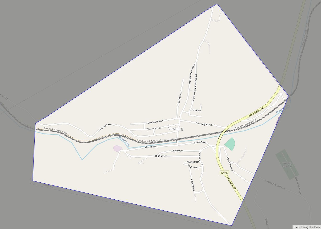
Map of Parkman CDP, Wyoming

Map of Parkman CDP, Wyoming

Parkman is a census-designated place (CDP) in Sheridan County, Wyoming, United States. The population was 180 at the 2020 census. Parkman CDP overview: Name: Parkman CDP LSAD Code: 57 LSAD Description: CDP (suffix) State: Wyoming County: Sheridan County Elevation: 4,305 ft (1,312 m) Total Area: 9.6 sq mi (25 km²) Land Area: 9.6 sq mi (25 km²) Water Area: 0.02 sq mi (0.05 km²) Total Population: … Read more

Map of Reliance CDP, Wyoming

Map of Reliance CDP, Wyoming

Reliance is a census-designated place (CDP) in Sweetwater County, Wyoming, United States. The population was 714 at the 2010 census. Reliance CDP overview: Name: Reliance CDP LSAD Code: 57 LSAD Description: CDP (suffix) State: Wyoming County: Sweetwater County Elevation: 6,529 ft (1,990 m) Total Area: 4.1 sq mi (11 km²) Land Area: 4.1 sq mi (11 km²) Water Area: 0.0 sq mi (0 km²) Total Population: … Read more

Map of Owl Creek CDP

Map of Owl Creek CDP

Owl Creek is a (CDP) in Hot Springs County, Wyoming, United States. The population was five at the 2010 Census. Owl Creek CDP overview: Name: Owl Creek CDP LSAD Code: 57 LSAD Description: CDP (suffix) State: Wyoming County: Hot Springs County Elevation: 5,647 ft (1,721 m) Total Area: 6.5 sq mi (16.8 km²) Land Area: 6.5 sq mi (16.8 km²) Water Area: 0.0 sq mi … Read more

Map of Red Butte CDP

Map of Red Butte CDP

Red Butte is a census-designated place (CDP) in Natrona County, Wyoming, United States. It is part of the Casper, Wyoming Metropolitan Statistical Area. The population was 1,430 at the 2020 census. Red Butte CDP overview: Name: Red Butte CDP LSAD Code: 57 LSAD Description: CDP (suffix) State: Wyoming County: Natrona County Elevation: 5,167 ft (1,575 m) Total … Read more

Map of Rawlins city

Map of Rawlins city

Rawlins is a city in Carbon County, Wyoming, United States. The population was 8,221 at the 2020 census. It is the county seat of Carbon County. It was named for Union General John Aaron Rawlins, who camped in the locality in 1867. Rawlins city overview: Name: Rawlins city LSAD Code: 25 LSAD Description: city (suffix) … Read more

Map of Ranchettes CDP

Map of Ranchettes CDP

Ranchettes is a census-designated place (CDP) in Laramie County, Wyoming, United States. It is part of the Cheyenne, Wyoming Metropolitan Statistical Area. The population was 5,798 at the 2010 census. Ranchettes CDP overview: Name: Ranchettes CDP LSAD Code: 57 LSAD Description: CDP (suffix) State: Wyoming County: Laramie County Elevation: 6,201 ft (1,890 m) Total Area: 49.2 sq mi (127.4 km²) … Read more

Map of Ranchester town

Map of Ranchester town

Ranchester is a town in Sheridan County, Wyoming, United States. The population was 1,064 at the 2020 census. Ranchester town overview: Name: Ranchester town LSAD Code: 43 LSAD Description: town (suffix) State: Wyoming County: Sheridan County Incorporated: 1911 Elevation: 3,763 ft (1,147 m) Total Area: 0.71 sq mi (1.84 km²) Land Area: 0.71 sq mi (1.84 km²) Water Area: 0.00 sq mi (0.00 km²) Total Population: … Read more

Map of Ralston CDP, Wyoming

Map of Ralston CDP, Wyoming

Ralston is a census-designated place (CDP) in Park County, Wyoming, United States. The population was 280 at the 2010 census. Ralston CDP overview: Name: Ralston CDP LSAD Code: 57 LSAD Description: CDP (suffix) State: Wyoming County: Park County Elevation: 4,554 ft (1,388 m) Total Area: 5.6 sq mi (14.6 km²) Land Area: 5.6 sq mi (14.6 km²) Water Area: 0.0 sq mi (0.0 km²) Total Population: … Read more

Map of Rafter J Ranch CDP

Map of Rafter J Ranch CDP

Rafter J Ranch is a census-designated place (CDP) in Teton County, Wyoming, United States. The population was 1,075 at the 2010 census. It is part of the Jackson, WY–ID Micropolitan Statistical Area. Rafter J Ranch CDP overview: Name: Rafter J Ranch CDP LSAD Code: 57 LSAD Description: CDP (suffix) State: Wyoming County: Teton County Elevation: … Read more

Map of Sheridan city, Wyoming

Map of Sheridan city, Wyoming

Sheridan is a town in the U.S. state of Wyoming and the county seat of Sheridan County. The town is located halfway between Yellowstone Park and Mount Rushmore by U.S. Route 14 and 16. It is the principal town of the Sheridan, Wyoming, Micropolitan Statistical Area which encompasses all of Sheridan County. The 2010 census … Read more

Map of Shell CDP

Map of Shell CDP

Shell is a census-designated place (CDP) in Big Horn County, Wyoming, United States. The population was 83 at the 2010 Census. The community is named for the abundance of fossil shells located in the area. Nearby exposed formations such as the Cloverly Formation and the Morrison Formation have yielded numerous fossils of dinosaurs and other … Read more

Map of Ten Sleep town

Map of Ten Sleep town

Ten Sleep is a town in Washakie County, Wyoming, United States. It is located in the Bighorn Basin in the western foothills of the Bighorn Mountains, approximately 26 miles (42 km) east of Worland and 59 miles (95 km) west of Buffalo. The population was 206 at the 2020 census. Ten Sleep town overview: Name: Ten Sleep … Read more