Point Pleasant is a city in and the county seat of Mason County, West Virginia, United States, at the confluence of the Ohio and Kanawha Rivers. The population was 4,101 at the 2020 census. It is the principal city of the Point Pleasant micropolitan area extending into Ohio. The town is known for the Mothman, a purported humanoid creature reportedly sighted in the area that has become a part of West Virginia folklore.
| Name: | Point Pleasant city |
|---|---|
| LSAD Code: | 25 |
| LSAD Description: | city (suffix) |
| State: | West Virginia |
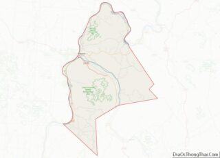
| County: | Mason County |
| Elevation: | 568 ft (173 m) |
| Total Area: | 3.09 sq mi (8.02 km²) |
| Land Area: | 2.42 sq mi (6.26 km²) |
| Water Area: | 0.68 sq mi (1.76 km²) |
| Total Population: | 4,101 |
| Population Density: | 1,681.29/sq mi (649.10/km²) |
| ZIP code: | 25550 |
| Area code: | 304 |
| FIPS code: | 5464708 |
| GNISfeature ID: | 1555381 |
| Website: | www.ptpleasantwv.org |
Online Interactive Map
Click on ![]() to view map in "full screen" mode.
to view map in "full screen" mode.
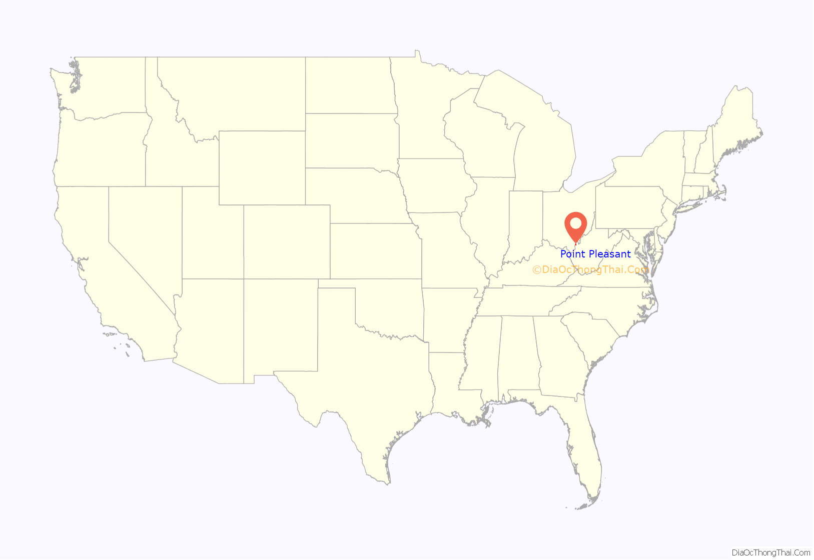
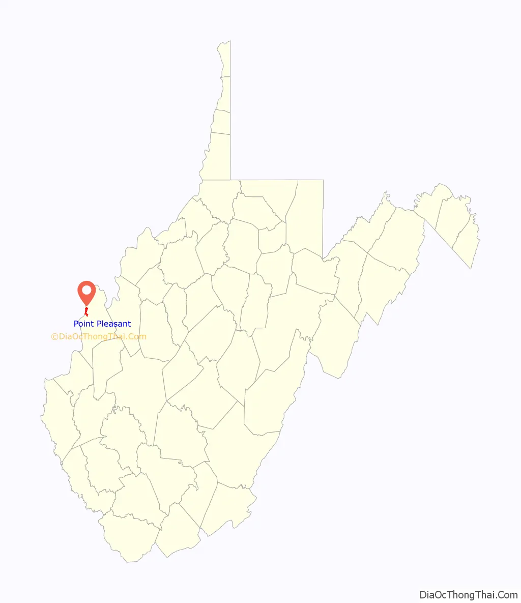
Point Pleasant location map. Where is Point Pleasant city?
History
A Shawnee village known as Upper Shawneetown was established in this area before 1749, which the Shawnees called “Chinoudaista” or “Chinodahichetha.”
The Céloron Expedition (1749)
In the second half of 1749, the French explorer Pierre Joseph Céloron de Blainville (1693-1759) claimed French sovereignty over the Ohio Valley, burying a lead plaque at the meeting point of the Ohio and Kanawha Rivers.
The text on the plaque is as follows:
Céloron’s expedition was a diplomatic failure since the local tribes remained pro-British, and British representatives in the region refused to leave. This incident was the prelude to conflicts between the French and British in North America that would lead to the outbreak of the French and Indian War in 1754 (as part of the Seven Years’ War) that would lead to the cessation of New France to the British and the ultimate expulsion of France from most of its possessions in North America.
The expedition can nevertheless be seen in more positive terms as a geographical project, since the Céloron expedition was the starting point for the first map of the Ohio Valley. The map was the work of the Jesuit Joseph Pierre de Bonnecamps.
In 1770, Colonel George Washington visited the confluence that would become Point Pleasant, then proceeded 14 miles up the “Great Kanawha” and later reported that “This Country abounds in Buffalo and Wild game of all kinds as also in all kinds of wild fowl, there being in the Bottoms a great many small grassy Ponds or Lakes which are full of Swans, Geese, and Ducks of different kinds.”
The Battle of Point Pleasant (1774)
In the Battle of Point Pleasant (October 10, 1774), fought on the future site of the town, over one thousand Virginia militiamen, led by Colonel Andrew Lewis (1720–1781), defeated a roughly equal force of an Algonquin confederation of Shawnee and Mingo warriors led by Shawnee Chief Cornstalk (c. 1720–1777). The event is celebrated locally as the “First Battle of the American Revolutionary War” and in 1908 the U.S. Senate authorized erection of a local monument to commemorate it as such. Most historians, however, regard it not as a battle of the Revolution (1775–1783), but as a part of Lord Dunmore’s War (1774).
Statue of Lord Dunmore at Point Pleasant, in front of the flood wall mural.
Mural with a quotation from Documentary History of Dunmore’s War, 1774, edited by Reuben Thwaites (here misspelled “Thwaits”) and Louise Kellogg.
Settlement
“Camp Point Pleasant” was established by Col. Lewis at the time of the Battle and the settlement that followed also took that name. Although not certain, Point Pleasant may have been permanently settled by whites as early as 1774. A permanent stockade known as Fort Blair was erected there at about that time. Prior to that, hostilities between whites and Indians all along the Ohio River Valley probably precluded the possibility of settlement in the absence of a substantial stockade. In 1776, a new fort was built on the site of the earlier fort and named for the recently deceased Virginia official Peyton Randolph (1721–1775). Fort Randolph is best remembered as the place where Chief Cornstalk was murdered in 1777. It withstood attack by Indians the following year, but was abandoned in 1779.
George Washington’s 1770 journey to the Ohio River Valley had been occasioned by military grants that had been awarded by proclamation in 1754 by Governor Dinwiddie to officers and soldiers who had served in the French and Indian War. The resulting survey encompassed 52,302 acres (or 80 square miles) and was subdivided in the 1780s as follows: 9,876 acres — including the present side of Point Pleasant — to Andrew Lewis, 5,000 acres for George Muse, 5,000 acres for Peter Hogg, 8,000 acres for Andrew Stephens, another 3,000 acres for Peter Hogg, another 5,026 acres for George Muse, 3,400 acres for Andrew Waggener, 6,000 acres for John Poulson, 6,000 acres for John West. On the lower side of the Kanawha River, 13,532 acres for Hugh Mercer (see Mercers Bottom) and, finally, 10,990 acres for Washington himself.
Fort Randolph was rebuilt nearby in 1785 after the renewal of hostilities between the United States government and the Indians, but saw little action and was eventually abandoned once again. The settlement at Point Pleasant did not receive an official charter until 1794.
19th century
Mason County was carved out of Kanawha County in 1804 and Point Pleasant was designated the county seat at that time. According to historian Virgil A. Lewis, “Point Pleasant did not flourish for many years [after the turn of the century]. There was no church for more than fifty years and society was at a low ebb. There was a popular superstition that because of the fiendish murder of Cornstalk there in 1777, the place was laid under a curse for a hundred years”. Lewis also relates that a visitor to Point Pleasant in 1810 observed that …
Point Pleasant was incorporated in 1833.
During the American Civil War, the Virginia Secession Convention of 1861, Mason County’s delegate, lawyer James H. Couch (1821-1899), although a slaveholder, voted against secession. Mason County then sent no delegates to the Virginia House of Delegates until West Virginia’s statehood, which Virginia’s House of Delegates refused to recognize, thus seating James Hutcheson who had been elected by Confederate soldiers in their camp. Meanwhile, William W. Newman claimed to represent Mason as well as nearby Jackson, Cabell, Wayne and Wirt counties throughout the war. Mason County sent more than 1000 men to the Union army and one company of 61 men to the Confederate Army (the 37th Virginia Infantry). In March 1863, in the only wartime skirmish in Point Pleasant, during the Jones-Imboden Raid, the 6th Virginia Cavalry and 8th Virginia Cavalry attacked the Mason County Courthouse, where they believed munitions stored, leaving bullet holes in the walls until a replacement was built in 1954.
20th century
Point Pleasant was widely noted for the 1967 collapse of the Silver Bridge, which killed 46 people.
On October 10, 1974, Point Pleasant celebrated the 200th anniversary of the Battle of Point Pleasant. A replica of Fort Randolph was built in 1973-74 and dedicated as part of the festivities. The town of Point Pleasant was situated over the site of the fort and so the replica is located at Krodel Park, about one mile away.
National Register of Historic Places
The Eastham House, Lewis-Capehart-Roseberry House, and Point Pleasant Battleground are listed on the National Register of Historic Places. The central business district and surrounding residential areas are included in the Point Pleasant Historic District.
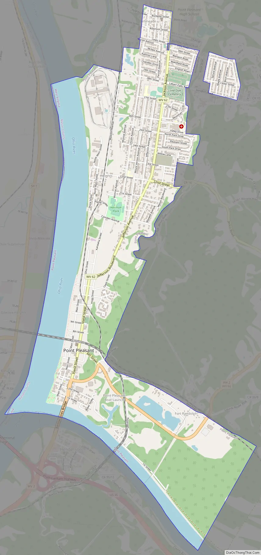
Point Pleasant Road Map
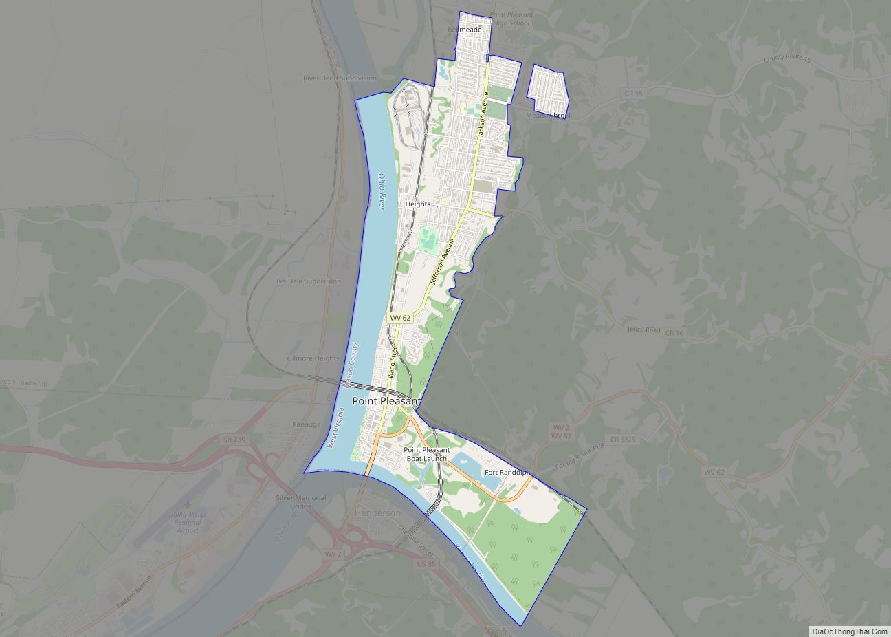
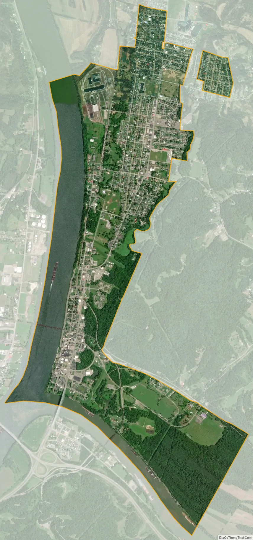
Point Pleasant city Satellite Map
Geography
According to the United States Census Bureau, the city has a total area of 3.10 square miles (8.03 km), of which 2.40 square miles (6.22 km) is land and 0.70 square miles (1.81 km) is water.
Point Pleasant is located at 38°51′27″N 82°7′43″W / 38.85750°N 82.12861°W / 38.85750; -82.12861 (38.857527, -82.128571).
Point Pleasant is home to Tu-Endie-Wei State Park and Krodel Park.
Climate
The climate in this area is characterized by evenly distributed precipitation throughout the year. According to the Köppen Climate Classification system, Point Pleasant has a humid subtropical climate, abbreviated “Cfa” on climate maps.
See also
Map of West Virginia State and its subdivision:- Barbour
- Berkeley
- Boone
- Braxton
- Brooke
- Cabell
- Calhoun
- Clay
- Doddridge
- Fayette
- Gilmer
- Grant
- Greenbrier
- Hampshire
- Hancock
- Hardy
- Harrison
- Jackson
- Jefferson
- Kanawha
- Lewis
- Lincoln
- Logan
- Marion
- Marshall
- Mason
- McDowell
- Mercer
- Mineral
- Mingo
- Monongalia
- Monroe
- Morgan
- Nicholas
- Ohio
- Pendleton
- Pleasants
- Pocahontas
- Preston
- Putnam
- Raleigh
- Randolph
- Ritchie
- Roane
- Summers
- Taylor
- Tucker
- Tyler
- Upshur
- Wayne
- Webster
- Wetzel
- Wirt
- Wood
- Wyoming
- Alabama
- Alaska
- Arizona
- Arkansas
- California
- Colorado
- Connecticut
- Delaware
- District of Columbia
- Florida
- Georgia
- Hawaii
- Idaho
- Illinois
- Indiana
- Iowa
- Kansas
- Kentucky
- Louisiana
- Maine
- Maryland
- Massachusetts
- Michigan
- Minnesota
- Mississippi
- Missouri
- Montana
- Nebraska
- Nevada
- New Hampshire
- New Jersey
- New Mexico
- New York
- North Carolina
- North Dakota
- Ohio
- Oklahoma
- Oregon
- Pennsylvania
- Rhode Island
- South Carolina
- South Dakota
- Tennessee
- Texas
- Utah
- Vermont
- Virginia
- Washington
- West Virginia
- Wisconsin
- Wyoming