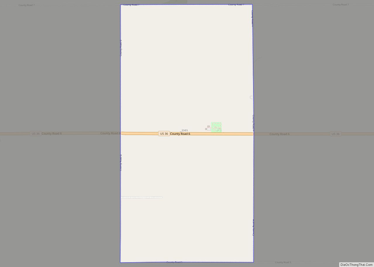
Map of Jansen CDP, Colorado
Jansen is an unincorporated community and a census-designated place (CDP) located in and governed by Las Animas County, Colorado, United States. The population of the Jansen CDP was 101 at the United States Census 2020. The Trinidad post office (Zip Code 81082) serves the Jansen postal addresses. Jansen CDP overview: Name: Jansen CDP LSAD Code: ... Read more
Map of Jansen CDP, Colorado
Map of Johnson Village CDP
Johnson Village is an unincorporated community and a census-designated place (CDP) located in and governed by Chaffee County, Colorado, United States. The population of the Johnson Village CDP was 299 at the United States Census 2020. The Buena Vista post office (Zip Code 81211) serves the area. Johnson Village CDP overview: Name: Johnson Village CDP ... Read more
Map of Johnson Village CDP
Map of Keenesburg town
The Town of Keenesburg is a Statutory Town in Weld County, Colorado, United States. The population was 1,250 at the 2020 United States Census. Keenesburg town overview: Name: Keenesburg town LSAD Code: 43 LSAD Description: town (suffix) State: Colorado County: Weld County Elevation: 4,944 ft (1,507 m) Total Area: 3.46 sq mi (8.96 km²) Land Area: 3.43 sq mi (8.89 km²) Water Area: ... Read more
Map of Keenesburg town
Map of Julesburg town
Julesburg is the statutory town that is the county seat and the most populous municipality of Sedgwick County, Colorado, United States. The population was 1,307 at the 2020 United States Census. Julesburg town overview: Name: Julesburg town LSAD Code: 43 LSAD Description: town (suffix) State: Colorado County: Sedgwick County Incorporated: November 18, 1886 Elevation: 3,478 ft ... Read more
Map of Julesburg town
Map of Johnstown town, Colorado
Johnstown is a home rule municipality in Weld and Larimer counties in the U.S. state of Colorado. The population was 17,303 at the 2020 United States Census. Johnstown town overview: Name: Johnstown town LSAD Code: 43 LSAD Description: town (suffix) State: Colorado County: Larimer County, Weld County Elevation: 4,852 ft (1,479 m) Total Area: 13.84 sq mi (35.84 km²) Land ... Read more
Map of Johnstown town, Colorado
Map of Keystone CDP, Colorado
Keystone is an unincorporated community and a census-designated place (CDP) located in and governed by Summit County, Colorado, United States. The CDP is a part of the Breckenridge, CO Micropolitan Statistical Area. The population of the Keystone CDP was 1,369 at the United States Census 2020. The Dillon post office (Zip Code 80435) serves Keystone ... Read more
Map of Keystone CDP, Colorado
Map of Kersey town, Colorado
The Town of Kersey is a Statutory Town in Weld County, Colorado, United States. The population was 1,495 at the 2020 United States Census. Kersey town overview: Name: Kersey town LSAD Code: 43 LSAD Description: town (suffix) State: Colorado County: Weld County Elevation: 4,619 ft (1,408 m) Total Area: 2.03 sq mi (5.25 km²) Land Area: 2.02 sq mi (5.24 km²) Water Area: ... Read more
Map of Kersey town, Colorado
Map of Ken Caryl CDP
Ken Caryl, commonly known as Ken Caryl Ranch, is an unincorporated community and a census-designated place (CDP) located in and governed by Jefferson County, Colorado, United States. The CDP is a part of the Denver–Aurora–Lakewood, CO Metropolitan Statistical Area. The population of the Ken Caryl CDP was 33,811 at the United States Census 2020. The ... Read more
Map of Ken Caryl CDP
Map of Kirk CDP
Kirk is an unincorporated town, a post office, and a census-designated place (CDP) located in and governed by Yuma County, Colorado, United States. The Kirk post office has the ZIP Code 80824. At the United States Census 2020, the population of the Kirk CDP was 61. Kirk CDP overview: Name: Kirk CDP LSAD Code: 57 ... Read more
Map of Kirk CDP
Map of Kiowa town, Colorado
Kiowa is a home rule municipality town and the county seat of Elbert County, Colorado, United States. The town population was 725 at the 2020 United States Census. Kiowa town overview: Name: Kiowa town LSAD Code: 43 LSAD Description: town (suffix) State: Colorado County: Elbert County Incorporated: December 30, 1912 Elevation: 6,378 ft (1,944 m) Total Area: ... Read more
Map of Kiowa town, Colorado
Map of Kim town
The Town of Kim is a Statutory Town in Las Animas County, Colorado, United States. The population was 63 at the time of the 2020 United States Census. As of 2014, the town included a complete school system (grades K-12), a post office, and a general store. A post office called Kim has been in ... Read more
Map of Kim town
Map of Kremmling town
The Town of Kremmling is a Statutory Town in Grand County, Colorado, United States. The town population was 1,509 at the 2020 United States Census. The town sits along the upper Colorado River in the lower arid section of Middle Park between Byers Canyon and Gore Canyon. The town was founded in 1881 during the ... Read more
Map of Kremmling town