Map of San Acacio CDP
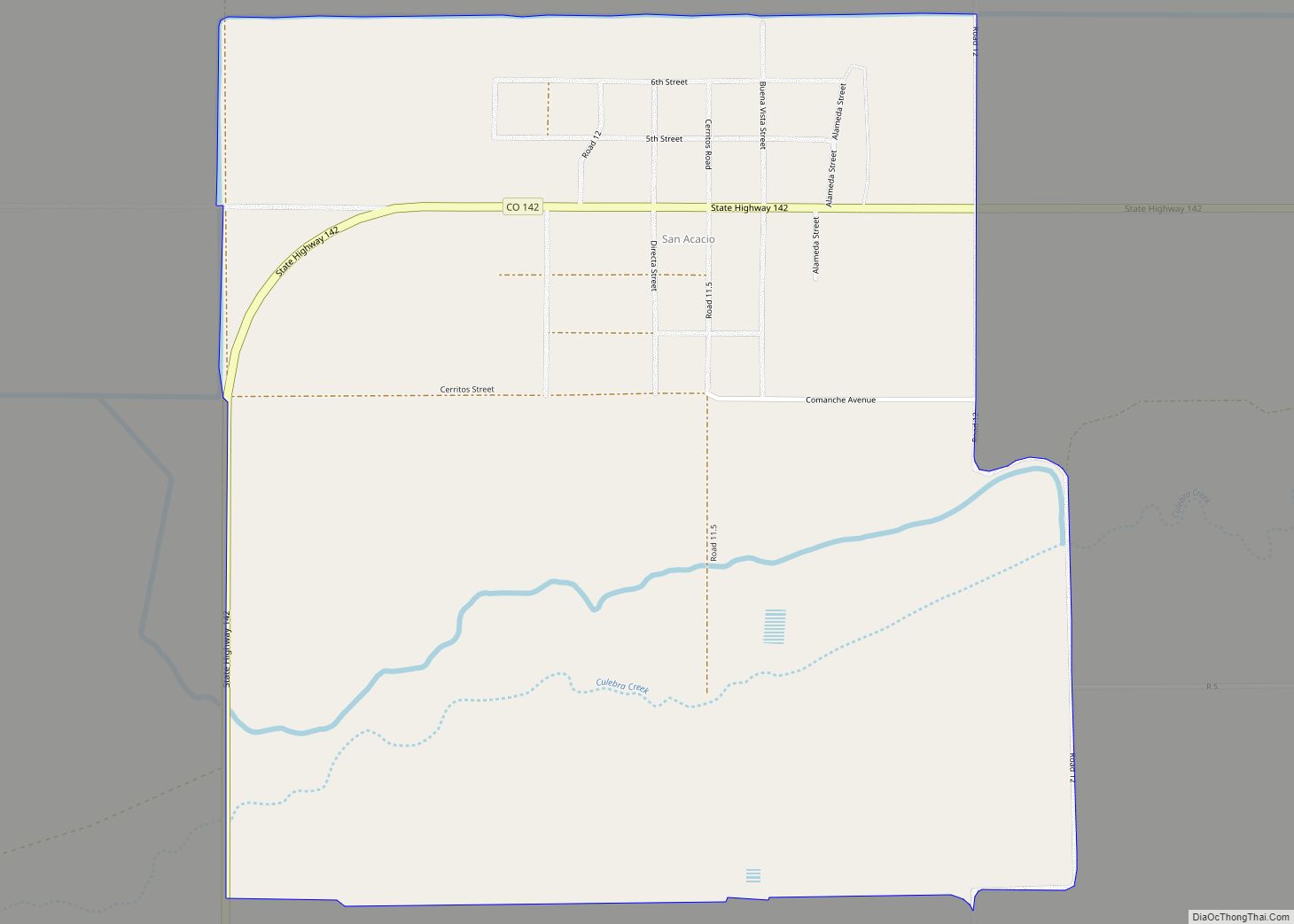
San Acacio is an unincorporated community and a census-designated place (CDP) located in and governed by Costilla County, Colorado, United States. The population of the San Acacio CDP was 56 at the 2020 United States census. The Sanford post office (Zip Code 81151) serves San Acacio postal addresses. San Acacio CDP overview: Name: San Acacio ... Read more
Map of San Acacio CDP
Map of Salt Creek CDP
Salt Creek is an unincorporated community and a census-designated place (CDP) located in and governed by Pueblo County, Colorado, United States. The CDP is a part of the Pueblo, CO Metropolitan Statistical Area. The population of the Salt Creek CDP was 507 at the United States Census 2020. The Pueblo post office (Zip Code 81006) ... Read more
Map of Salt Creek CDP
Map of Sawpit town
The Town of Sawpit is a Statutory Town in San Miguel County, Colorado, United States. The town population was 38 at the 2020 census, making Sawpit the fifth least populous incorporated town in the state of Colorado. The Telluride Post Office (ZIP Code 81435) serves Sawpit. Sawpit town overview: Name: Sawpit town LSAD Code: 43 ... Read more
Map of Sawpit town
Map of Sanford town, Colorado
Sanford is a statutory town in Conejos County, Colorado, United States. The population was 879 at the 2020 census. A post office called Sanford has been in operation since 1888. The town was named after Silas Sanford Smith, a Mormon pioneer. Sanford town overview: Name: Sanford town LSAD Code: 43 LSAD Description: town (suffix) State: ... Read more
Map of Sanford town, Colorado
Map of Security-Widefield CDP
Security-Widefield is a census-designated place (CDP) comprising the unincorporated communities of Security and Widefield located in and governed by El Paso County, Colorado, United States. The CDP is a part of the Colorado Springs, CO Metropolitan Statistical Area. The population of the Security-Widefield CDP was 38,639 at the United States Census 2020. El Paso County ... Read more
Map of Security-Widefield CDP
Map of Segundo CDP
Segundo is an unincorporated community and a census-designated place (CDP) located in and governed by Las Animas County, Colorado, United States. The population of the Segundo CDP was 100 at the United States Census 2020. The Trinidad post office (Zip Code 81082) serves the area. Segundo CDP overview: Name: Segundo CDP LSAD Code: 57 LSAD ... Read more
Map of Segundo CDP
Map of Sedgwick town, Colorado
Sedgwick is a statutory town in Sedgwick County, Colorado, United States. The population was 172 at the 2020 census. Sedgwick town overview: Name: Sedgwick town LSAD Code: 43 LSAD Description: town (suffix) State: Colorado County: Sedgwick County Incorporated: January 28, 1918 Elevation: 3,586 ft (1,093 m) Total Area: 0.35 sq mi (0.90 km²) Land Area: 0.35 sq mi (0.90 km²) Water Area: 0.00 sq mi ... Read more
Map of Sedgwick town, Colorado
Map of Sedalia CDP, Colorado
Sedalia is an unincorporated town, a post office, and a census-designated place (CDP) located in and governed by Douglas County, Colorado, United States. The CDP is a part of the Denver–Aurora–Lakewood, CO Metropolitan Statistical Area. The Sedalia post office has the ZIP Code 80135. At the United States Census 2020, the population of the Sedalia ... Read more
Map of Sedalia CDP, Colorado
Map of Severance town, Colorado
Severance is a Statutory Town in Weld County, Colorado, United States. The population was 7683 at the 2020 census. The town is located on the Colorado Eastern Plains, northwest of Greeley, a crossroads of county roads. A post office in Severance has been in operation since 1894. The community was named after David Severance, a ... Read more
Map of Severance town, Colorado
Map of Seven Hills CDP, Colorado
Seven Hills is an unincorporated community and a census-designated place (CDP) located in and governed by Boulder County, Colorado, United States. The CDP is a part of the Boulder, CO Metropolitan Statistical Area. The population of the Seven Hills CDP was 129 at the United States Census 2020. The Boulder post office (Zip Code 80302) ... Read more
Map of Seven Hills CDP, Colorado
Map of Seibert town
Seibert is a statutory town in Kit Carson County, Colorado, United States. The population was 172 at the 2020 census. A post office called Seibert has been in operation since 1888. The community was named after Henry Seibert, a railroad agent. Seibert town overview: Name: Seibert town LSAD Code: 43 LSAD Description: town (suffix) State: ... Read more
Map of Seibert town
Map of Sheridan city, Colorado
The City of Sheridan is a home rule municipality located in Arapahoe County, Colorado, United States. Sheridan is a part of the Denver–Aurora–Lakewood, CO Metropolitan Statistical Area. The population was 6,105 at the 2020 census. Sheridan city overview: Name: Sheridan city LSAD Code: 25 LSAD Description: city (suffix) State: Colorado County: Arapahoe County Incorporated: April, ... Read more
Map of Sheridan city, Colorado