Map of Sheridan Lake town
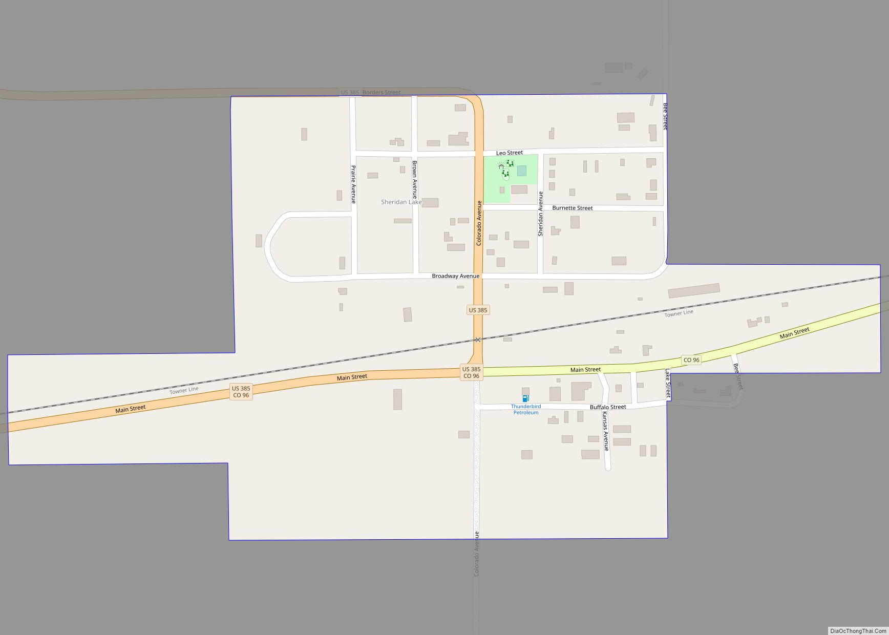
The Town of Sheridan Lake is a Statutory Town located in Kiowa County, Colorado, United States. The population was 55 at the 2020 census. A post office called “Sheridan Lake” has been in operation since 1887. The community was named after Phil Sheridan, a pioneer hunter. Sheridan Lake town overview: Name: Sheridan Lake town LSAD ... Read more
Map of Sheridan Lake town
Map of Shaw Heights CDP
Shaw Heights is an unincorporated community and a census-designated place (CDP) located in and governed by Adams County, Colorado, United States. The CDP is part of the Denver–Aurora–Lakewood, CO Metropolitan Statistical Area. The population of the Shaw Heights CDP was 5,185 at the United States Census 2020. The Westminster post office (Zip code 80031) serves ... Read more
Map of Shaw Heights CDP
Map of Sherrelwood CDP
Sherrelwood is an unincorporated community and a census-designated place (CDP) located in and governed by Adams County, Colorado, United States. The CDP is a part of the Denver–Aurora–Lakewood, CO Metropolitan Statistical Area. The population of the Sherrelwood CDP was 19,228 at the United States Census 2020. Sherrelwood CDP overview: Name: Sherrelwood CDP LSAD Code: 57 ... Read more
Map of Sherrelwood CDP
Map of Silver Cliff town
The Town of Silver Cliff is the Statutory Town that is the most populous municipality in Custer County, Colorado, United States. The population was 609 at the 2020 census, up from 587 in 2010. Silver Cliff town overview: Name: Silver Cliff town LSAD Code: 43 LSAD Description: town (suffix) State: Colorado County: Custer County Incorporated: ... Read more
Map of Silver Cliff town
Map of Silt town
Silt is a Statutory Town in Garfield County, Colorado, United States. The population was 3,536 at the 2020 census, up from 2,930 at the 2010 census. Silt town overview: Name: Silt town LSAD Code: 43 LSAD Description: town (suffix) State: Colorado County: Garfield County Incorporated: May, 1915 Elevation: 5,456 ft (1,663 m) Total Area: 1.73 sq mi (4.47 km²) Land ... Read more
Map of Silt town
Map of Silverton town, Colorado
Silverton is a statutory town that is the county seat, the most populous community, and the only incorporated municipality in San Juan County, Colorado, United States. The town is located in a remote part of the western San Juan Mountains, a range of the Rocky Mountains. The first mining claims were made in mountains above ... Read more
Map of Silverton town, Colorado
Map of Silverthorne town
The Town of Silverthorne is a home rule municipality in Summit County, Colorado. According to the 2020 Census, the population of the city is 4,402. Silverthorne town overview: Name: Silverthorne town LSAD Code: 43 LSAD Description: town (suffix) State: Colorado County: Summit County Incorporated: September 5, 1967 Elevation: 9,035 ft (2,754 m) Total Area: 4.07 sq mi (10.54 km²) Land ... Read more
Map of Silverthorne town
Map of Silver Plume town
Silver Plume is a Statutory Town located in Clear Creek County, Colorado, United States. Silver Plume is a former silver mining camp along Clear Creek in the Front Range of the Rocky Mountains. The federally designated Georgetown-Silver Plume Historic District comprises Silver Plume, the neighboring town of Georgetown, and the Georgetown Loop Historic Mining & ... Read more
Map of Silver Plume town
Map of Snowmass Village town
Snowmass Village is a home rule municipality in Pitkin County, Colorado, United States. The population was 3,096 at the 2020 census. A popular winter resort location for skiing and snowboarding, the town is well known as the location of the Snowmass ski area, the largest of the four nearby ski areas operated collectively as Aspen/Snowmass. ... Read more
Map of Snowmass Village town
Map of Smeltertown CDP
Smeltertown is an unincorporated community and a census-designated place (CDP) located in and governed by Chaffee County, Colorado, United States. The population of the Smeltertown CDP was 88 at the United States Census 2020. The Salida post office (Zip Code 81201) serves the area. Smeltertown CDP overview: Name: Smeltertown CDP LSAD Code: 57 LSAD Description: ... Read more
Map of Smeltertown CDP
Map of Simla town
Simla is a statutory town in Elbert County, Colorado, United States. It is 48 miles (77 km) northeast of Colorado Springs. The population was 601 at the time of the 2020 United States Census. Simla town overview: Name: Simla town LSAD Code: 43 LSAD Description: town (suffix) State: Colorado County: Elbert County Incorporated: January 15, 1912 ... Read more
Map of Simla town
Map of Southern Ute CDP
Southern Ute is a census-designated place (CDP) on the Southern Ute Indian Reservation in southern La Plata County, Colorado, United States. The CDP is a part of the Durango, CO Micropolitan Statistical Area. The population of the Southern Ute CDP was 158 at the United States Census 2020. The Ignacio post office (Zip Code 81137) ... Read more
Map of Southern Ute CDP