Map of Chena Ridge CDP

Map of Chena Ridge CDP

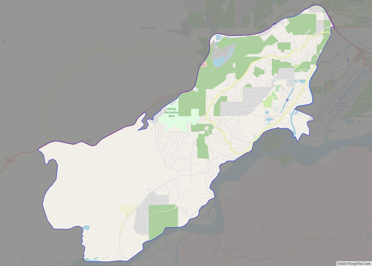
Chena Ridge (Lower Tanana: Khotughee’oden) is a census-designated place (CDP) in Fairbanks North Star Borough, Alaska, United States. It is the location of the former city (1903-73) of Chena, now a ghost town that once rivaled nearby Fairbanks in importance. One of the new CDPs created in 2010 in Alaska, Chena Ridge is now a … Read more

Map of Chefornak city

Map of Chefornak city

Chefornak (Central Yupik: Cevvʼarneq) is a city in Bethel Census Area, Alaska, United States. At the 2010 census its population was 418, up from 394 in 2000. Chefornak city overview: Name: Chefornak city LSAD Code: 25 LSAD Description: city (suffix) State: Alaska County: Bethel Census Area Incorporated: 1974 Elevation: 0 ft (0 m) Total Area: 5.99 sq mi (15.51 km²) … Read more

Map of Chicken CDP

Map of Chicken CDP

Chicken is a tiny unincorporated village in Southeast Fairbanks Census Area, Alaska. It is a community founded on gold mining, and is one of the few surviving gold rush towns in Alaska. The population was 12 at the time of the 2020 census, up from 7 in 2010. However, usually year round, there are 17 … Read more

Map of Chickaloon CDP

Map of Chickaloon CDP

Chickaloon (Nay’dini’aa Na’ in Ahtna Athabascan; Nuk’din’itnu in Dena’ina) is a census-designated place (CDP) in Matanuska-Susitna Borough, Alaska, United States. It is part of the Anchorage, Alaska Metropolitan Statistical Area. The population was 254 at the 2020 census, down from 272 in 2010. The Alaska Native people of Chickaloon are a mixture of Ahtna and … Read more

Map of Chevak city

Map of Chevak city

Chevak (Cevʼaq , which means “cut-through channel” in Chevak Cup’ik) is a city in Kusilvak Census Area, Alaska, United States. At the 2010 census the population was 938, up from 765 in 2000. There is a tri-language system in Chevak; English, Cup’ik, and a mixture of the two languages. The people in Chevak speak a … Read more

Map of Chignik city

Map of Chignik city

Chignik (Alutiiq: Cirniq) is a city in Lake and Peninsula Borough, Alaska, United States. It is two hundred and fifty miles southwest of Kodiak. At the 2020 census the population was 97, up from 91 in 2010. Chignik city overview: Name: Chignik city LSAD Code: 25 LSAD Description: city (suffix) State: Alaska County: Lake and … Read more

Map of Chignik Lake CDP

Map of Chignik Lake CDP

Chignik Lake (Alutiiq: Igyaraq; Russian: Чигник-Лейк) is a census-designated place (CDP) in Lake and Peninsula Borough, Alaska, United States. It is 475 miles (764 km) southwest of Anchorage. At the 2020 census, the population was 61. Chignik Lake CDP overview: Name: Chignik Lake CDP LSAD Code: 57 LSAD Description: CDP (suffix) State: Alaska County: Lake and … Read more

Map of Chignik Lagoon CDP

Map of Chignik Lagoon CDP

Chignik Lagoon (Alutiiq: Nanwarnaq) is a census-designated place (CDP) in Lake and Peninsula Borough, Alaska, United States. At the 2020 census, the population was 72. Chignik Lagoon CDP overview: Name: Chignik Lagoon CDP LSAD Code: 57 LSAD Description: CDP (suffix) State: Alaska County: Lake and Peninsula Borough Total Area: 13.25 sq mi (34.32 km²) Land Area: 13.25 sq mi (34.32 km²) … Read more

Map of Chistochina CDP

Map of Chistochina CDP

Chistochina (Tsiis Tl’edze’ Caegge in Ahtna Athabascan) is a census-designated place (CDP) in Copper River Census Area, Alaska, United States. At the 2020 census the population was 60, down from 93 in 2010. Chistochina CDP overview: Name: Chistochina CDP LSAD Code: 57 LSAD Description: CDP (suffix) State: Alaska County: Valdez-Cordova Census Area Total Area: 368.79 sq mi … Read more

Map of Chisana CDP

Map of Chisana CDP

Chisana (also Shushanna) (Tsetsaan’ Na in Ahtna) is a census-designated place (CDP) in the Copper River Census Area in the U.S. state of Alaska. As of the 2010 Census, the population of the CDP was 0. The English name Chisana derives from the Ahtna Athabascan name Tsetsaan’ Na, meaning literally ‘copper river’ (not to be … Read more

Map of Chiniak CDP

Map of Chiniak CDP

Chiniak (Cing’iyak in Alutiiq) is a census-designated place (CDP) in Kodiak Island Borough, Alaska, United States. The population was 47 at the 2010 census, down from 50 in 2000. Chiniak CDP overview: Name: Chiniak CDP LSAD Code: 57 LSAD Description: CDP (suffix) State: Alaska County: Kodiak Island Borough Elevation: 0 ft (0 m) Total Area: 38.80 sq mi (100.48 km²) … Read more

Map of Circle CDP

Map of Circle CDP, Alaska

Circle (also called Circle City; Gwichʼin: Danzhit Khànląįį) is a census-designated place (CDP) in Yukon-Koyukuk Census Area, Alaska, United States. At the 2010 census the population was 104, up from 100 in 2000. Circle is 160 mi (260 km) northeast of Fairbanks at the end of the Steese Highway. Circle was named by miners in the late … Read more