Map of East Milton CDP
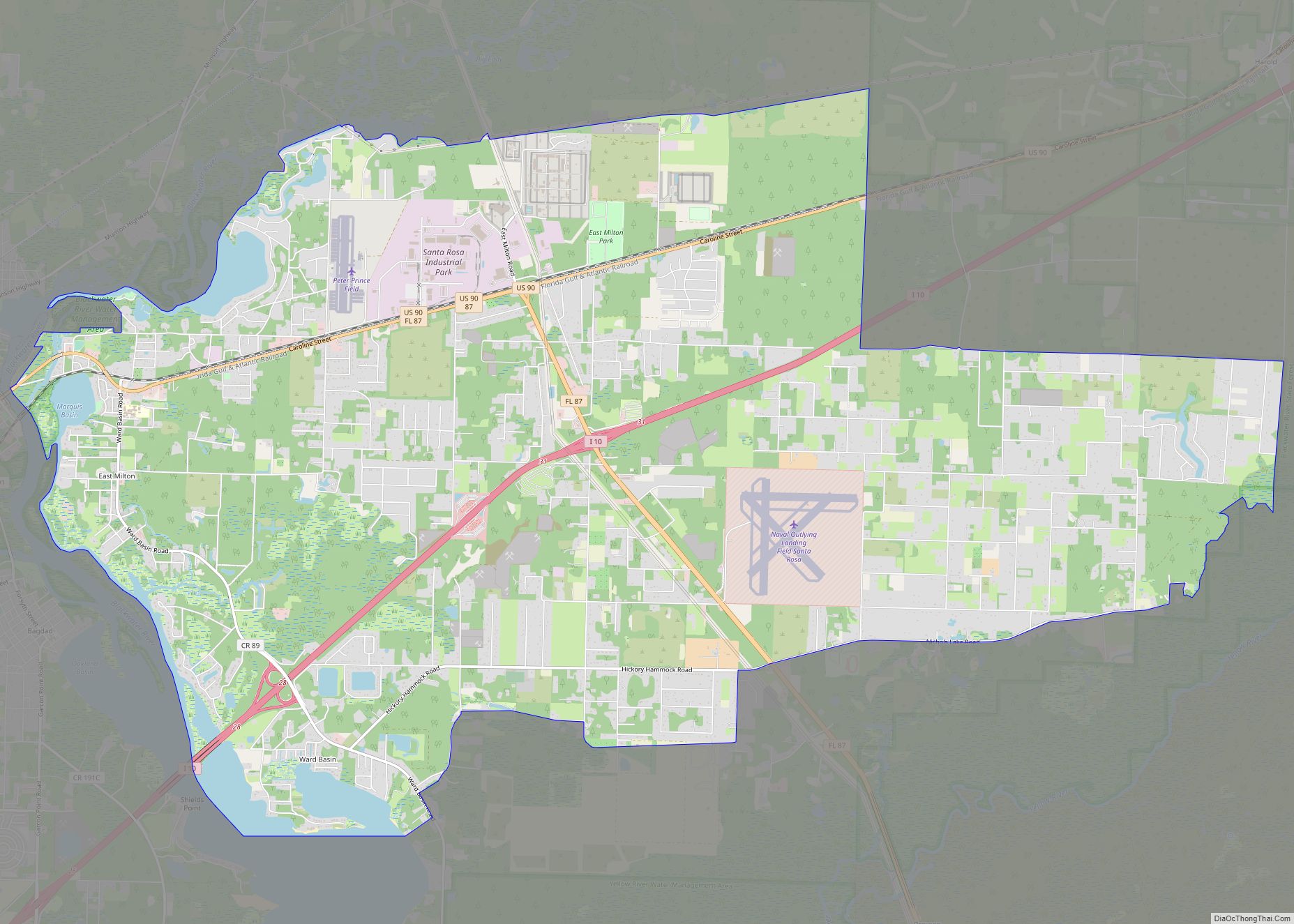
East Milton is an unincorporated community and census-designated place in Santa Rosa County, Florida, United States. Its population was 11,074 as of the 2010 census. As its name indicates, the community is located on the east bank of the Blackwater River opposite Milton, and to the north of Navarre. East Milton CDP overview: Name: East ... Read more
Map of East Milton CDP
Map of East Lake CDP
East Lake is a census-designated place (CDP) in Pinellas County, Florida, United States. The population was 30,962 at the 2010 census. It was one of the last areas in the densely populated county to develop. It is often confused with East Lake in neighboring Hillsborough County. East Lake CDP overview: Name: East Lake CDP LSAD ... Read more
Map of East Lake CDP
Map of Eatonville town, Florida
Eatonville is a town in Orange County, Florida, United States, six miles north of Orlando. It is part of Greater Orlando. Incorporated on August 15, 1887, it was one of the first self-governing all-black municipalities in the United States. The Eatonville Historic District and Moseley House Museum are in Eatonville. Author Zora Neale Hurston grew ... Read more
Map of Eatonville town, Florida
Map of Eastpoint CDP
Eastpoint is a census-designated place (CDP) in Franklin County, Florida, United States. The population was 2,337 at the 2010 census. Eastpoint CDP overview: Name: Eastpoint CDP LSAD Code: 57 LSAD Description: CDP (suffix) State: Florida County: Franklin County Elevation: 7 ft (2 m) Total Area: 7.47 sq mi (19.34 km²) Land Area: 7.44 sq mi (19.28 km²) Water Area: 0.02 sq mi (0.06 km²) Total Population: ... Read more
Map of Eastpoint CDP
Map of East Williston CDP, Florida
East Williston is a census-designated place (CDP) in Levy County, Florida, United States. The population was 694 at the 2010 census. East Williston CDP overview: Name: East Williston CDP LSAD Code: 57 LSAD Description: CDP (suffix) State: Florida County: Levy County Total Area: 3.01 sq mi (7.79 km²) Land Area: 3.01 sq mi (7.79 km²) Water Area: 0.00 sq mi (0.00 km²) Total Population: ... Read more
Map of East Williston CDP, Florida
Map of Edgewood city, Florida
Edgewood is a city in Orange County, Florida, United States. The population was 2,503 at the 2010 census. It is part of the Orlando–Kissimmee–Sanford Metropolitan Statistical Area. Edgewood city overview: Name: Edgewood city LSAD Code: 25 LSAD Description: city (suffix) State: Florida County: Orange County Elevation: 89 ft (27 m) Total Area: 1.54 sq mi (3.98 km²) Land Area: 1.24 sq mi ... Read more
Map of Edgewood city, Florida
Map of Edgewater city, Florida
Edgewater is a city in Volusia County, Florida, United States, situated along the Indian River, adjacent to the Mosquito Lagoon. As of the 2020 United States Census, the city had a population of 23,097. It is a part of the Deltona–Daytona Beach–Ormond Beach, FL metropolitan statistical area, which was home to 590,289 people in 2010. ... Read more
Map of Edgewater city, Florida
Map of Ebro town, Florida
Ebro is a town in Washington County, Florida, United States. The population was 270 at the 2010 census. As of 2018, the population recorded by the U.S. Census Bureau is 275. It is believed that the Spanish named the town, as there is an Ebro River in Spain. Ebro town overview: Name: Ebro town LSAD ... Read more
Map of Ebro town, Florida
Map of El Portal village, Florida
El Portal is a village in Miami-Dade County, Florida, United States. The name is derived from the Spanish term for “the gate”, after two wooden gates that once stood as a gateway to the village. El Portal was originally annexed into the city of Miami in 1925. With the arrival of the Great Depression, Miami ... Read more
Map of El Portal village, Florida
Map of Egypt Lake-Leto CDP
Egypt Lake-Leto is a census-designated place in an unincorporated part of Hillsborough County, Florida, United States. The population was 35,282 at the 2010 census. The area is located just north of Tampa International Airport. The ZIP code for Egypt Lake-Leto is 33614. Egypt Lake-Leto CDP overview: Name: Egypt Lake-Leto CDP LSAD Code: 57 LSAD Description: ... Read more
Map of Egypt Lake-Leto CDP
Map of Eglin AFB CDP
Eglin Air Force Base (IATA: VPS, ICAO: KVPS, FAA LID: VPS) is a United States Air Force (USAF) base in the western Florida Panhandle, located about three miles (5 km) southwest of Valparaiso in Okaloosa County. The host unit at Eglin is the 96th Test Wing (formerly the 96th Air Base Wing). The 96 TW is ... Read more
Map of Eglin AFB CDP
Map of Englewood CDP, Florida
Englewood is a census-designated place (CDP) in Charlotte and Sarasota counties in the U.S. state of Florida. As of the 2020 census, it had a population of 20,800. It is part of the Sarasota-Bradenton-Punta Gorda Combined Statistical Area. Englewood CDP overview: Name: Englewood CDP LSAD Code: 57 LSAD Description: CDP (suffix) State: Florida County: Charlotte ... Read more
Map of Englewood CDP, Florida